


For decades, the São Francisco River has been a source of food, work, transport and life for those living on its banks, such as the Kariri-Xocó indigenous people. Today, reduced water flows and changes to the river’s course are having a negative impact and threatening a relationship built up over generations in the largest river basin situated entirely within Brazilian territory.
Anderson Santana | Instituto Nordeste Rural Conectado (Ineruc)
It was not yet midday when the bridge over the São Francisco River began to recede into the distance. To the right lay the state of Sergipe. To the left, Alagoas. Beneath the concrete lay a river that had already travelled more than 2,800 kilometres from Minas Gerais, traversed the Cerrado biome, crossed the Caatinga, received dozens of tributaries, supplied towns, irrigated crops, sustained traditional communities and fuelled part of the Brazilian economy before reaching its final kilometres. From there on, there was little left before it reached the Atlantic Ocean. For millions of Brazilians, it is simply the Velho Chico. For the indigenous peoples who have lived on its banks since long before the arrival of the Portuguese colonisers, it remains Opará – the ‘river-sea’ or ‘great river’ in the Tupi language.


The journey between Propriá, in Sergipe, and Porto Real do Colégio, in Alagoas, takes just a few minutes. Known as the Lower São Francisco, this 208-kilometre stretch between the Xingó Hydroelectric Power Station and the river’s mouth divides the two states before flowing into the Atlantic. It was here that indigenous communities, small-scale fishermen, riverside dwellers, family farmers and researchers began to report, often independently, changes to the landscape and the river’s behaviour.
Viewed from the top of the bridge, the river landscape is striking in its scale. The water’s surface reflects the sky of the sertão (semi-arid interior). On the banks, small boats still cross the river slowly. In the distance lies Porto Real do Colégio, a small riverside town like so many others scattered across the Brazilian hinterland.
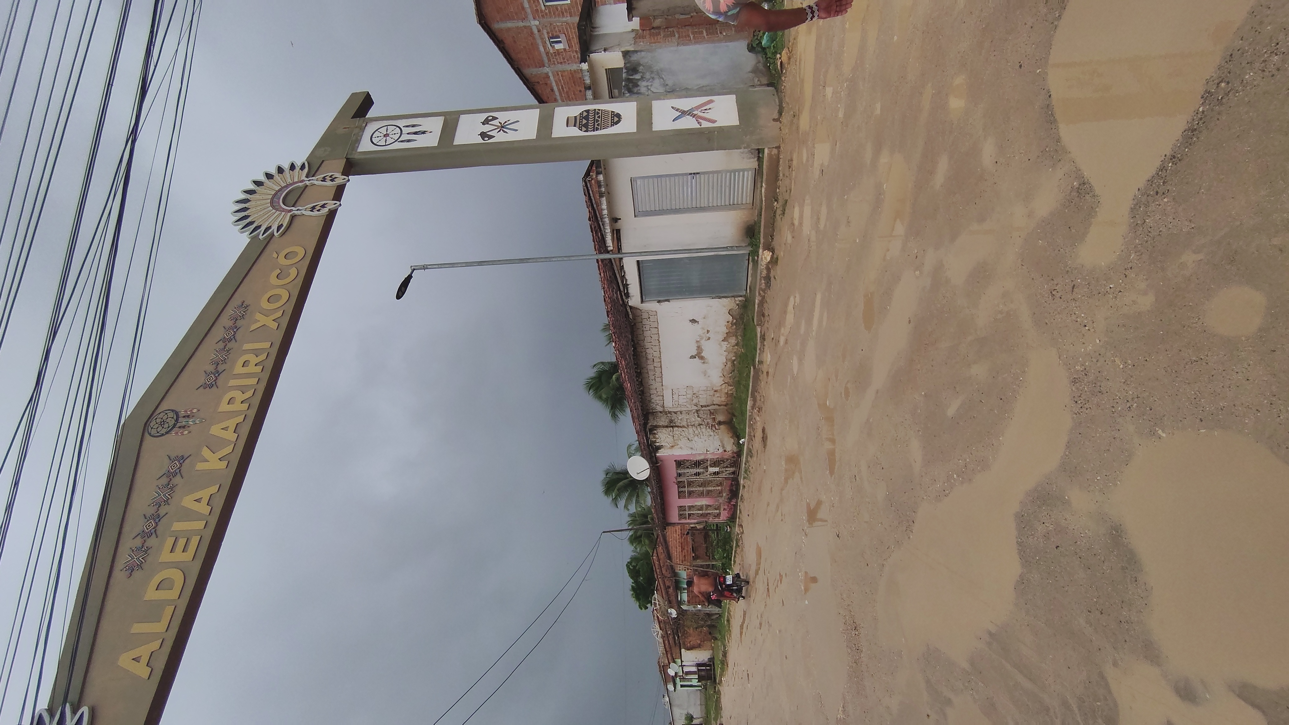
It is at this point that Pawanã Crody, aged 42, begins to speak. As village chief, shaman and leader of the Sabuká group of the Kariri-Xocó people, he knows that understanding that territory requires more than just data or maps. “We are now a community of 1,200 families. This city has ended up swallowing us up,” he laments.
It was no coincidence that this investigation began amongst the Kariri-Xocó. The community occupies a unique position in the Lower São Francisco region. Having lived on the banks of the Opará for generations, its residents have witnessed profound changes in the river’s dynamics and have developed initiatives aimed at the recovery of degraded areas, becoming a benchmark for environmental restoration efforts in the region.
Long before Porto Real do Colégio existed, long before the creation of the states of Alagoas and Sergipe, and long before the river was named after Saint Francis, various indigenous peoples occupied vast areas of the Lower São Francisco region. They lived on the banks of the Opará, travelled along the river, shared territories, knowledge of fishing, agriculture, vegetation management and spiritual practices deeply connected to the waters. The arrival of the Portuguese colonisers changed everything.
Colonial occupation spread along the riverbanks. This was followed by religious missions, the establishment of settlements, the expansion of plantations, the appropriation of land, violence against the indigenous peoples, and successive policies aimed at cultural assimilation. Throughout this process, various indigenous groups were expelled from their territories, dispersed, or incorporated into settlements organised by the Portuguese Crown.
“The Kariri-Xocó are more than just one people. It’s not just the Kariri and the Xocó. We are a people made up of several other peoples. As well as the Kariri and the Xocó, we also have the Natú, Karapotó, Carapoti, Pankararu and other groups. Today we are strong because we had to come together. The establishment of the Kariri-Xocó territory arose from these struggles to ensure our people were not wiped out,” emphasises Pawanã.
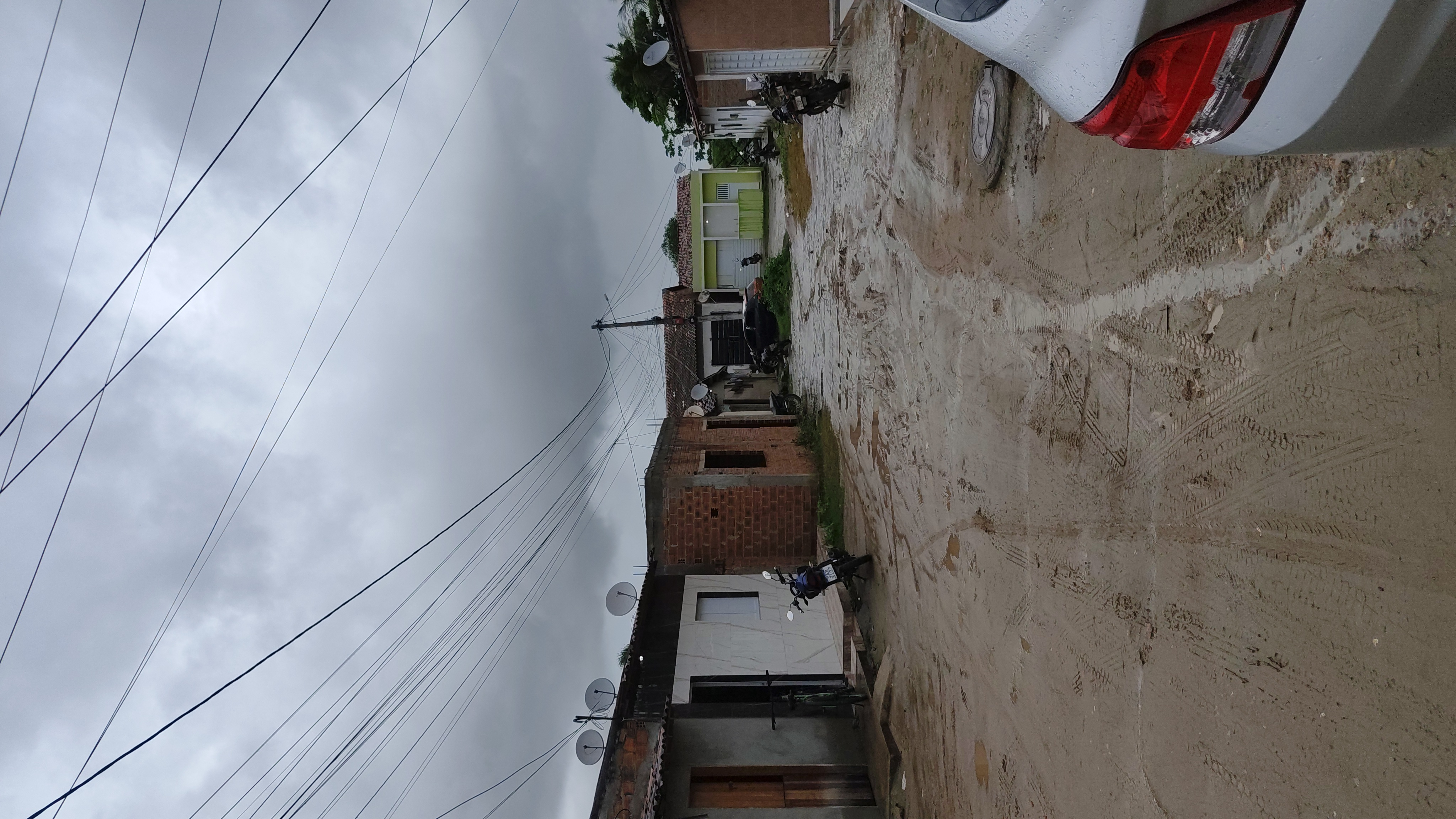
As he talks about the history, he points out various parts of the town. Tarmac roads, houses, shops, streetlights and public buildings. Each of those places, explains the chief, holds a memory. “This street we’re walking down today is known as Rua São Vicente. But this used to be our village. Before we were where we are today, we lived here,” he says.

A few metres away, on the waterfront at Porto Real do Colégio, residents stroll in the shade of the trees. Benches, paving, street lighting and a superb view of the São Francisco have transformed the urban riverside into one of the city’s main public spaces. Children play near the river. Couples take photographs of the scenery. At first glance, there is nothing to suggest that this scene is marked by historical conflicts. “These banks of the River Opará, known to the public as the River São Francisco, are the cradle of our village. This used to be the postcard image of our community. It was the source of everything: health, leisure, food and sustainability, both in physical terms and, above all, in spiritual terms,” points out the chief.
Walking a little further, Pawanã comes to another stretch of the riverbank. The water looks clean. It is hard to spot any problems. He, however, looks at the same spot and sees the past. Just a few metres from the largest river basin situated entirely within Brazilian territory, hundreds of indigenous families were struggling with water supply issues.
According to the chief, the system currently used by the community was only introduced a few years ago, through a project that replaced the old, rudimentary pumping system which drew water directly from the river. “Imagine how much of everything there used to be. There were so many worms. Disease upon disease, the likes of which we’d never seen before,” he recalls.

When the river sustained the village
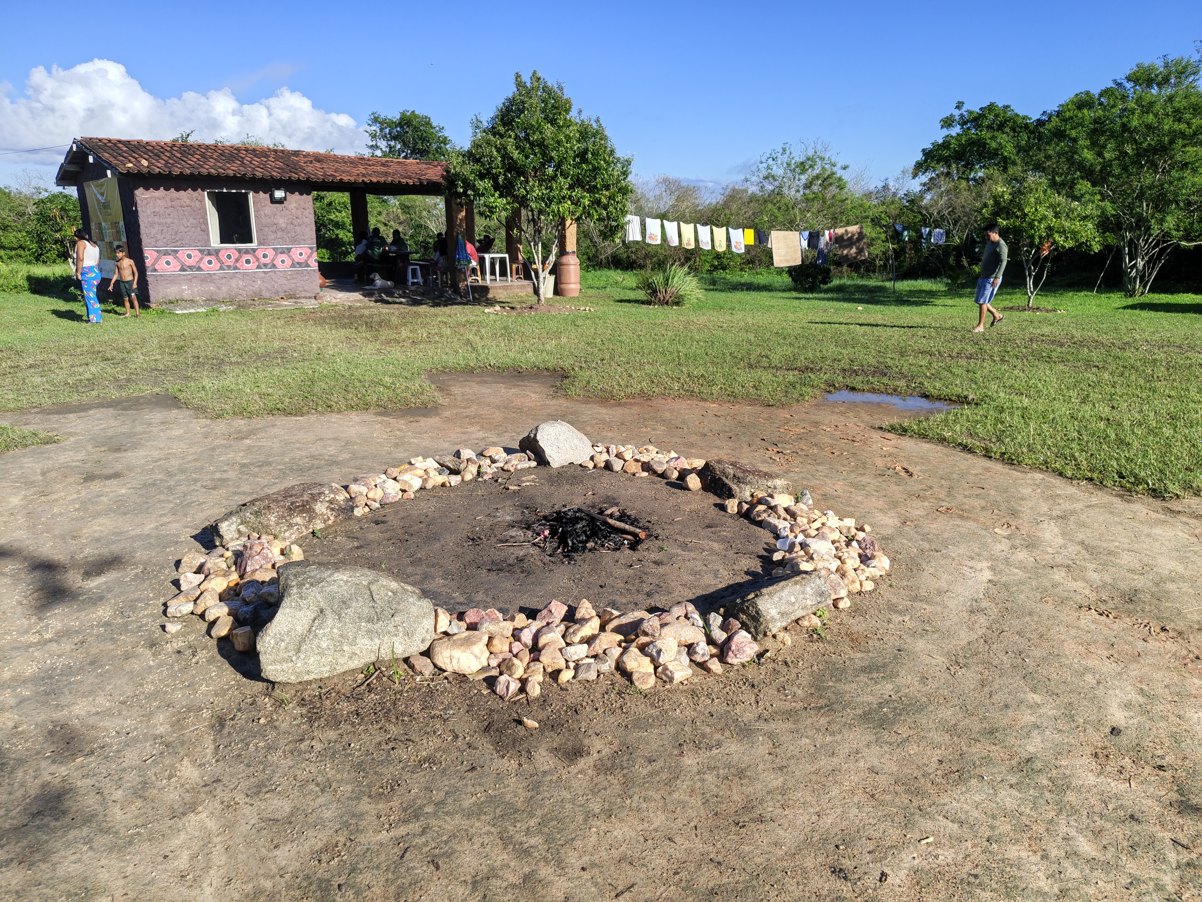
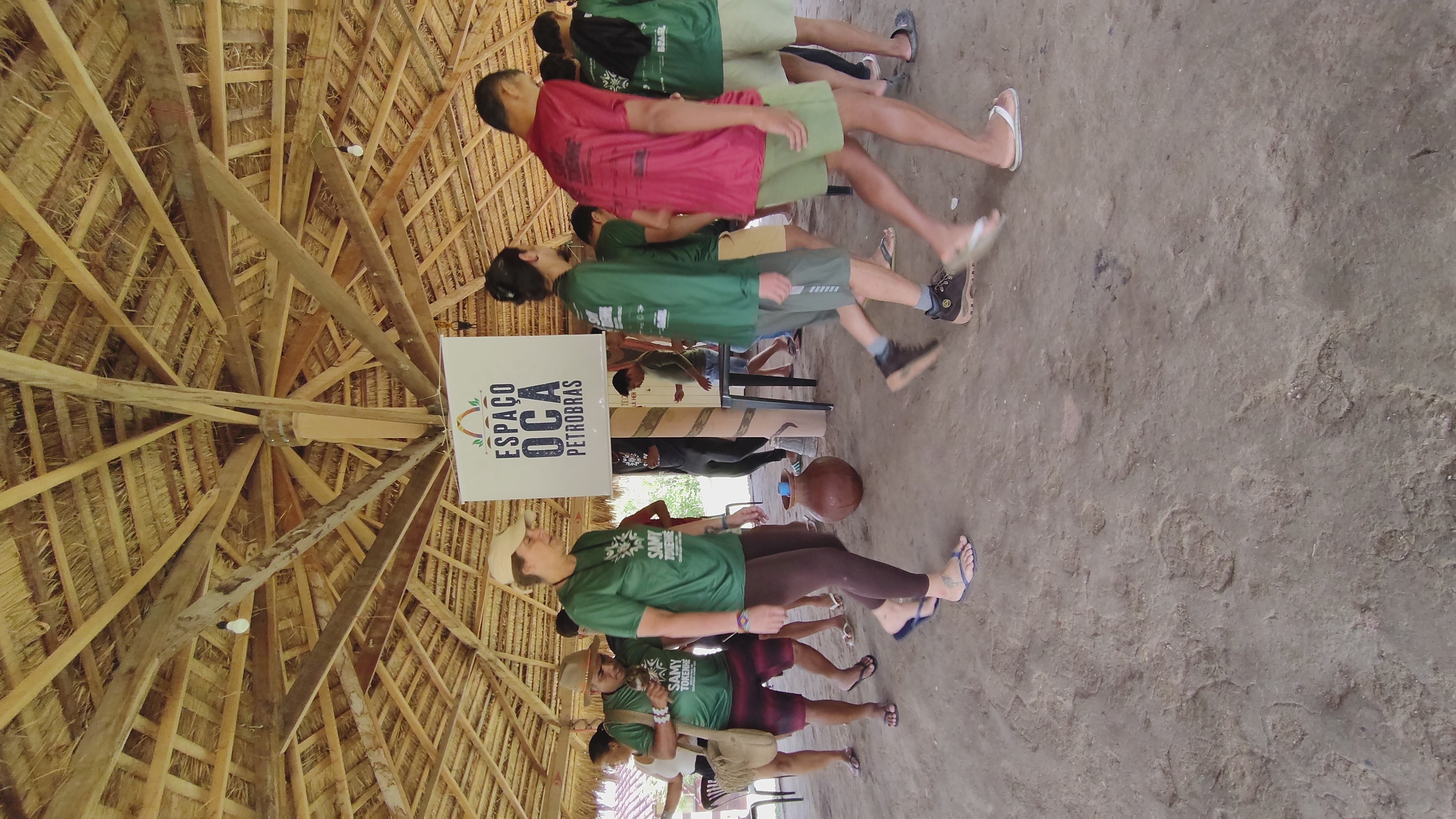
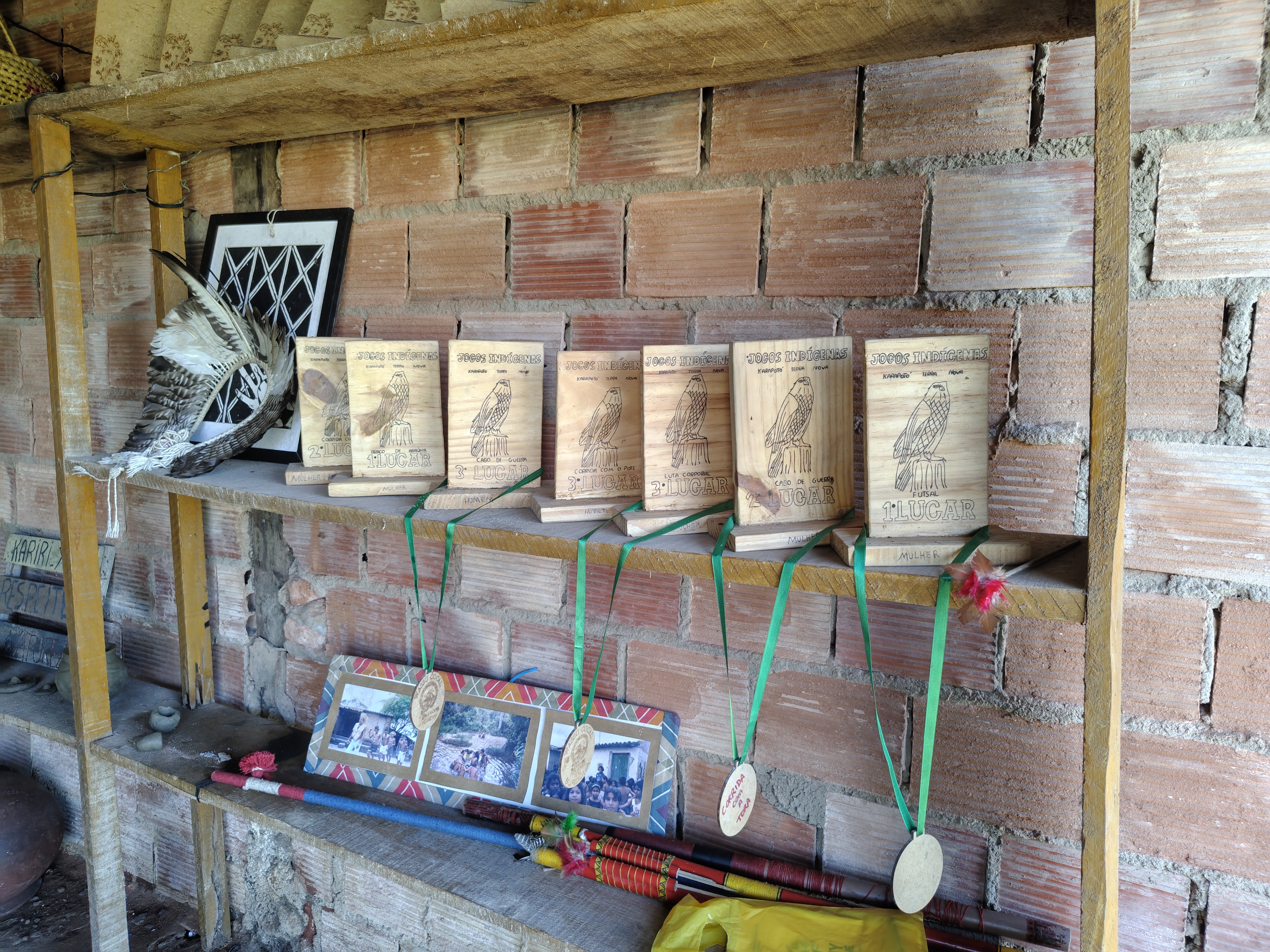
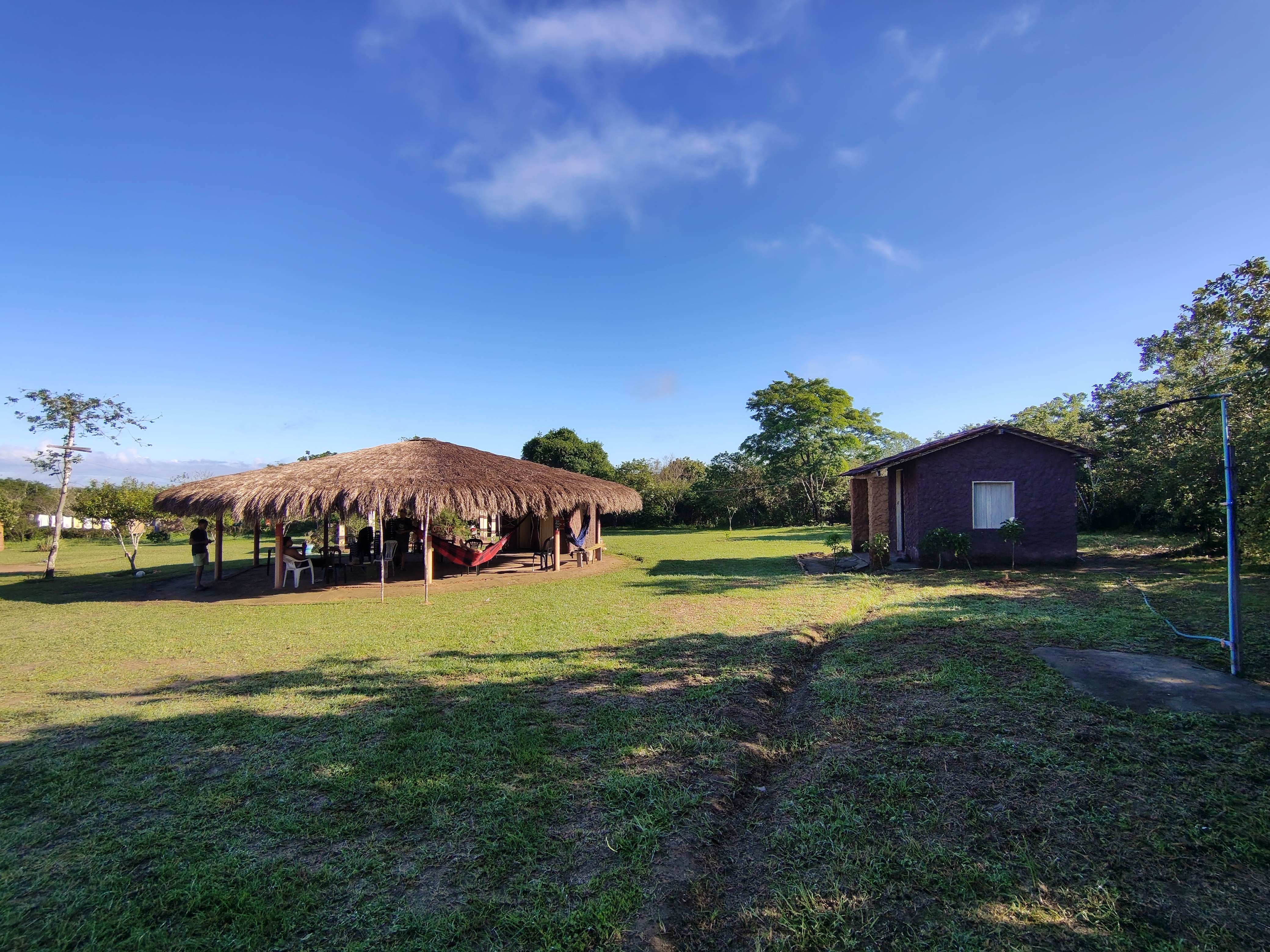
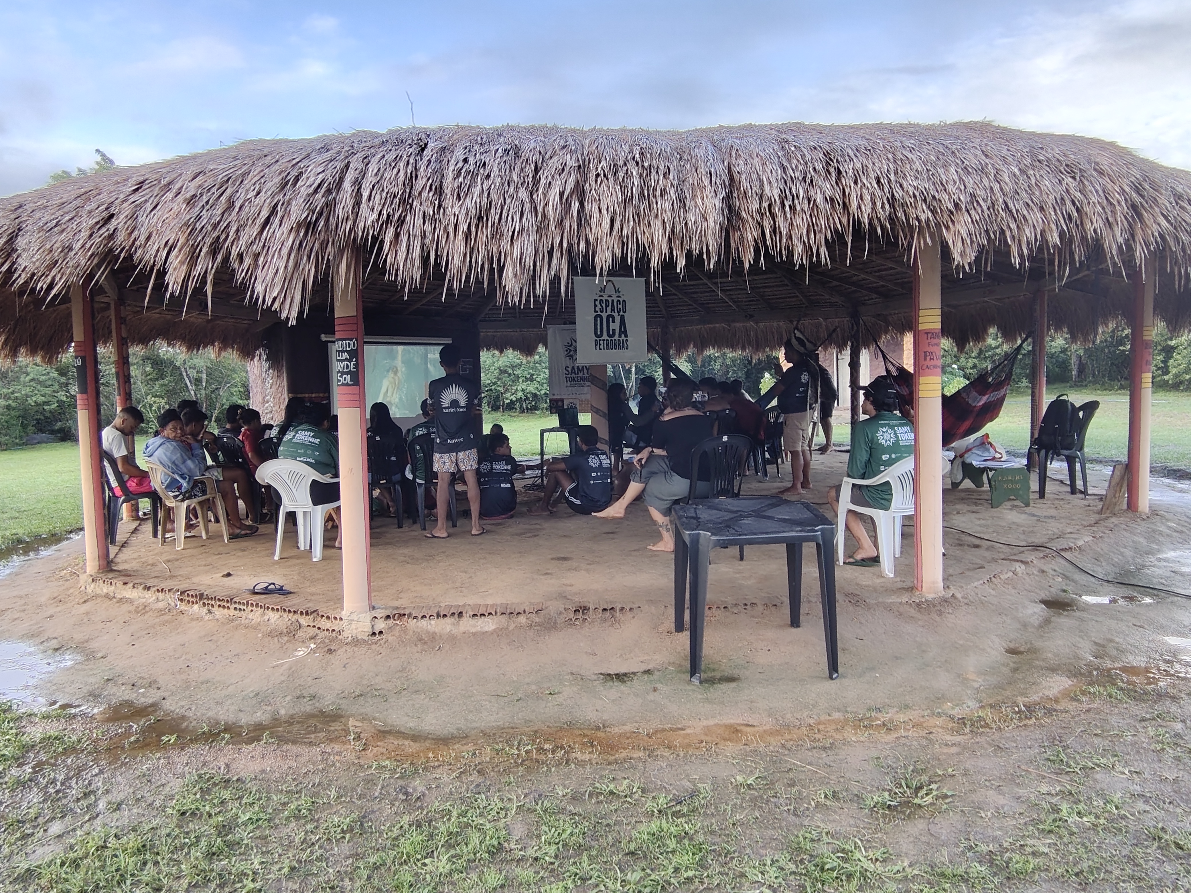
It was during a lesson at school that Dete Kariri-Xocó, aged 46, first heard a prediction that seemed impossible. “The teacher said that if they carried on destroying the river, one day it would dry up,” she recalls. At the time, she didn’t believe it. “I used to say that would never happen. The river looked like the sea,” she explains. Decades later, she says those words have taken on a new meaning. “Today I can see she was right. The river really has dried up. It no longer looks like a river. It looks more like a pond,” says the indigenous woman.
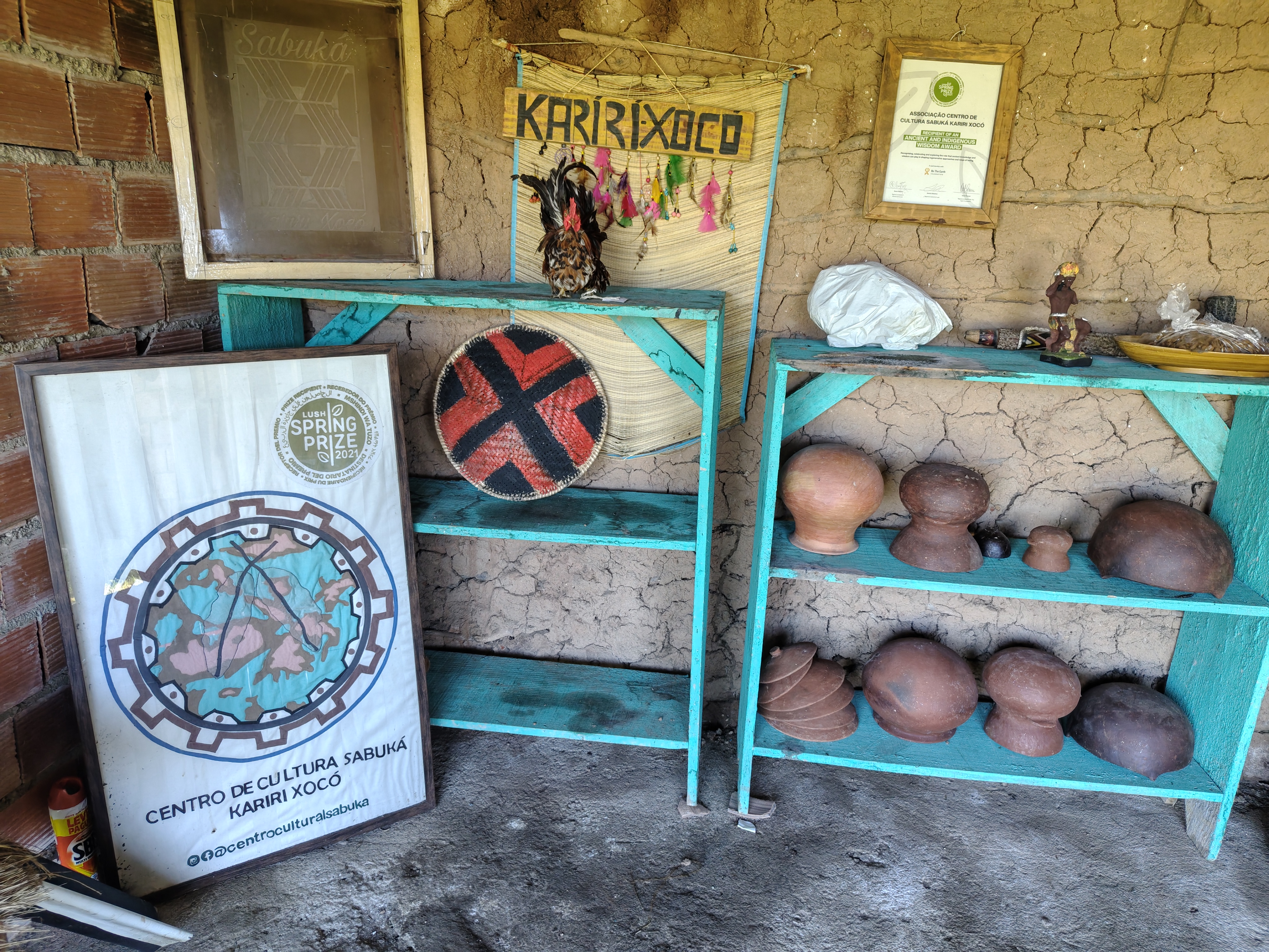
Her friend Dé Kariri-Xocó, aged 69, recalls that she spent practically her entire childhood on the banks of the Opará. “My father made a living from fishing. He would go out onto the river and come back with enough for the whole family. That’s where the fish we ate came from.” Both are potters – women who make clay utensils, whether for domestic use, such as plates, pots, charcoal stoves, pans, etc. – and guardians of the knowledge on how to work with clay, passed down through generations of Kariri-Xocó women. Dé recalls that, when the São Francisco River burst its banks, the water would naturally flood the marginal lagoons, bringing fish that remained there even after the water receded. “I remember three major floods. When the water receded, the pools were full of fish.” She smiles as she recalls her childhood. “We used to go fishing with hooks and gererê… There were so many fish,” she adds.
The lagoons, they say, used to act as an extension of the river itself. There were prawns and fish there, such as piabas, traíras and other species eaten by the village families. Dete recalls that her mother used to go fishing practically every day. “My mum would go to the lagoon. She’d catch saburica, little prawns… There were always fish.” Today, he says, the landscape is quite different. “The lagoons never filled up again. You don’t see that in the river anymore. There’s just mud, undergrowth and snails,” he points out.
These changes have also altered the way the community relates to water. Dete says she no longer goes into the São Francisco River. “These days I don’t have the nerve to go into that water. The water has become stagnant. We’re afraid of catching an illness.” She recalls that some residents even had medical tests carried out following episodes of ill health. “When we had the tests done and received the results, they told us it was because of the contaminated water we’d drunk.” When asked if she believed the source might be the river, she replied without hesitation. “It can only be from the river, can’t it?”
These changes have also affected pottery production. For decades, the clay used by the potters was extracted from specific spots along the banks of the Opará and shaped into pans, pots, jugs and other items for domestic use and sale. “It’s worth remembering that pottery also provided part of the families’ income,” she recalls. “We’d make the pieces, call an indigenous man who had a motorboat, fill the boat with pottery and head upriver into the hinterland to sell them, so we could buy food. We don’t go there anymore. There isn’t enough water. The river isn’t dry, but we don’t go there any more,” she emphasises.
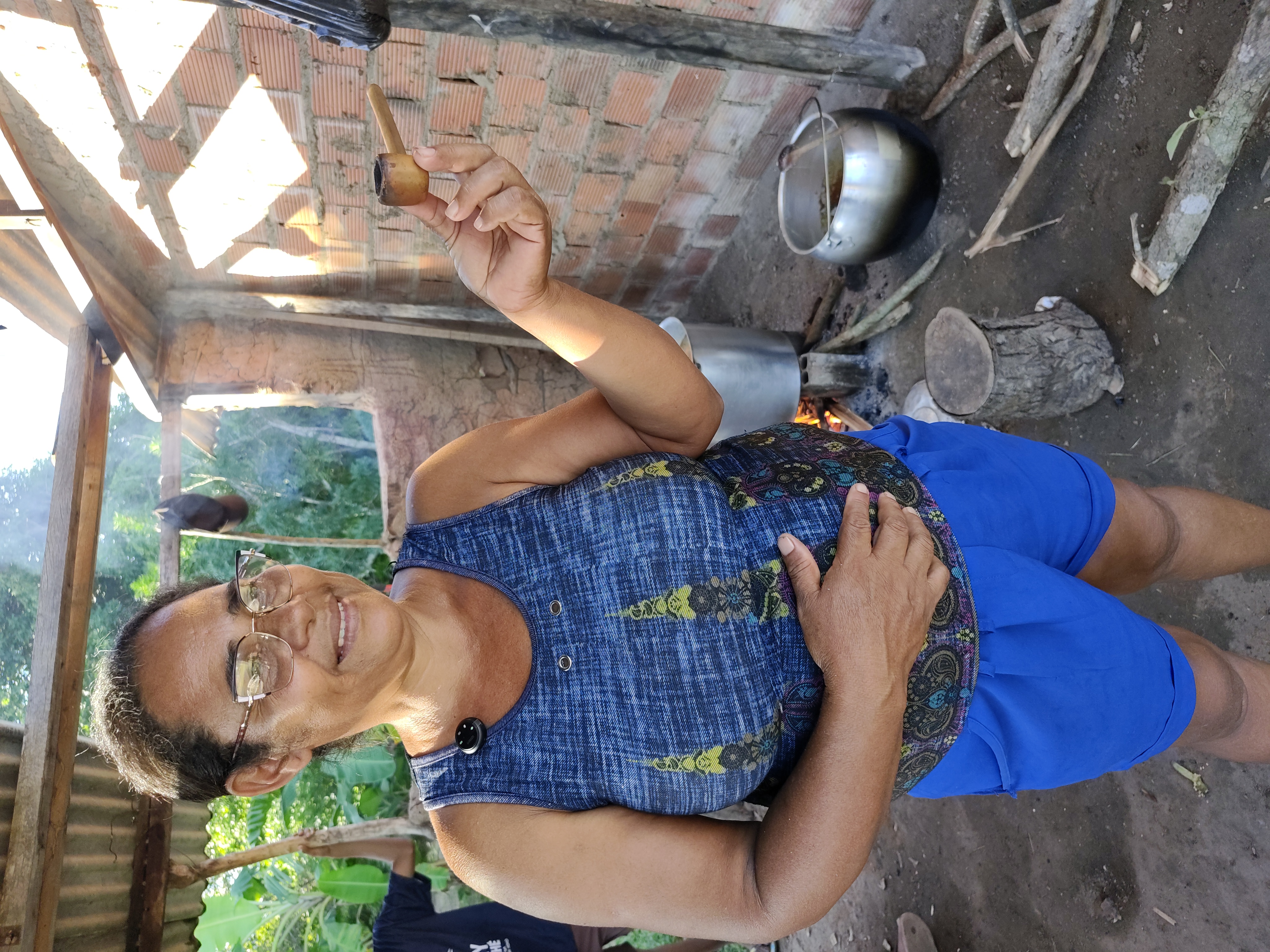
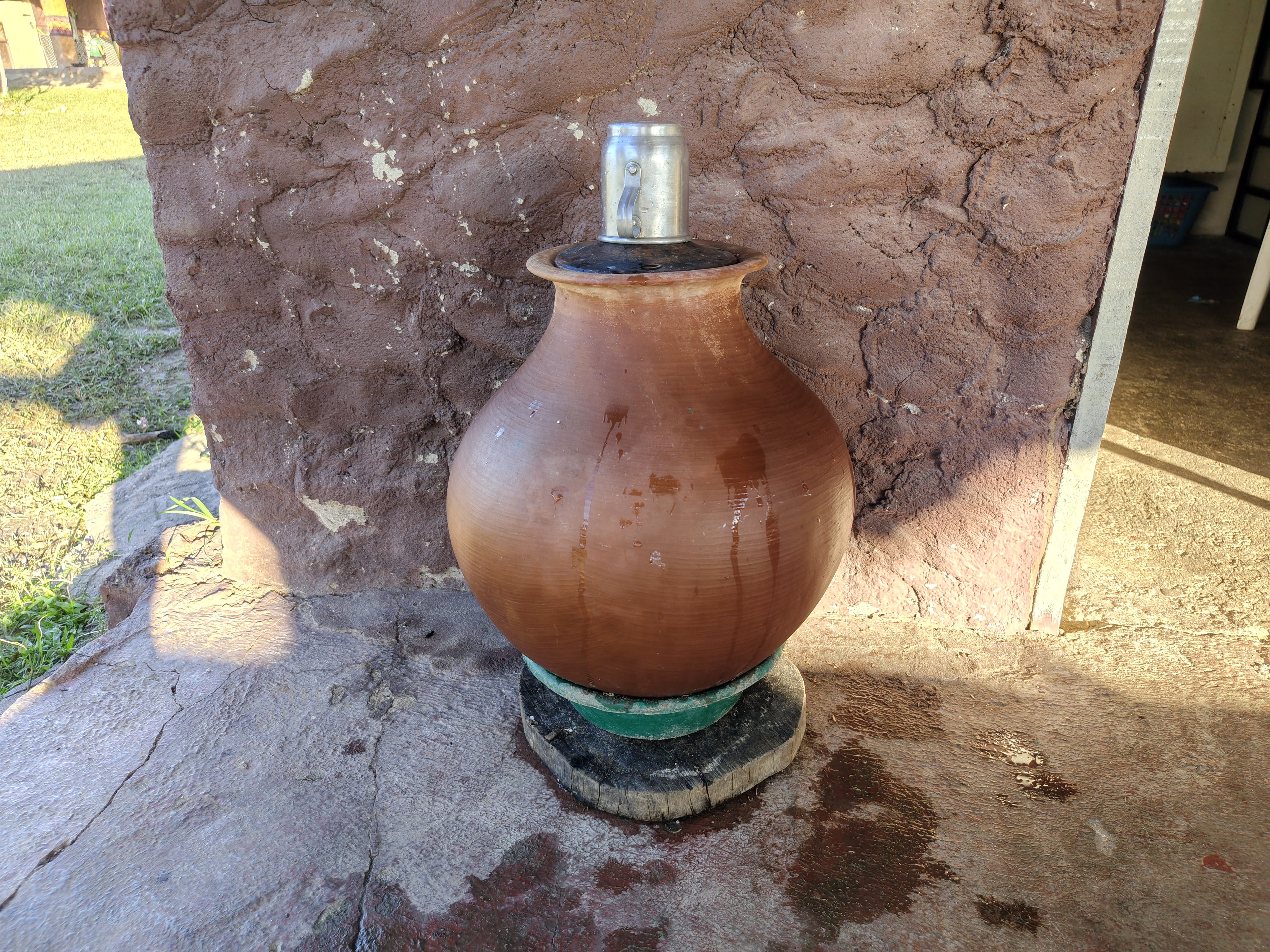
Childhood memories also linger for Nari Kariri-Xocó, aged 38, but they carry a different feeling. As she talks about the Opará, she compares the river that shaped her generation with the one her children have known. “The difference between me and my children is huge. Because I experienced a river that was full. They’ve grown up seeing a different river.” When she was a child, the river was part of practically everything: from bathing to playing, from fishing to everyday chores. “We used to make rafts out of banana leaves. We’d take an inner tube and spend the day in the water. My mum would tell us to wash the dishes, and we’d end up staying in the river playing. We’d only come back when it was getting dark,” recalls Nari.
Today, that experience is part of a generation’s memories. “Everything took place on the river. We used to bathe there, wash our clothes, fetch water and fish. That’s where we lived,” says Nari. When she compares this with her children’s reality, Nari realises that the loss goes beyond the landscape. “Today, our children haven’t experienced that. They’ve never known that river that we knew.” She says she tries to pass on these memories, but recognises the limitations of such recollections when there is no longer the experience to go with them: “I tell them what it was like, but they can’t imagine it. They were born seeing a different river,” concludes Nari.
Kaony Kariri-Xocó, aged 46, a member of the indigenous community, also remembers a time when fishing was part of daily life in the village and recalled the days when fish were plentiful. Pawanã described an Opará very different from the one known to his ancestors.
Changes and impacts over the decades
Whilst Dé and Dete describe changes observed over decades, researchers have also begun to document these transformations. Even before concepts such as ‘ecosystem services’ became commonplace in environmental studies (used to describe the benefits that nature provides to people, such as the supply of water, food and resources for fishing), villagers were already linking the decline in fish stocks, changes to the marginal lagoons, the difficulty in finding clay and changes in the river’s behaviour to the construction of large dams.
These perceptions were documented in 2015 by environmental engineers and researchers Talita Lorena da Silva do Nascimento, Lucas dos Santos Woituski and Lucia Ceccato, from the Federal University of Recôncavo da Bahia (UFRB). The research used semi-structured interviews, field observation and timelines constructed with the residents themselves to understand how the community perceived the transformations of the Opará. The researchers recorded accounts of a decline in fishing, changes in agriculture, alterations to traditional water use and increasing difficulties in accessing natural resources following the construction of the Sobradinho and Xingó dams.
In 2026, Verena Barros Hauschild, of the Brazilian Fund for Environmental Education, published the essay ‘The Third Bank: The Mourning of the Opará – Territorial Trauma and Structural Mal-being’. In it, the indigenous studies scholar argues that the situation faced by the community “is not the result of a random water crisis”, but rather the outcome of a historical process of interventions on the São Francisco River that has profoundly altered the relationship between the indigenous people and their territory. In her view, the Opará was never perceived by the Kariri-Xocó merely as a watercourse. “For the community, the São Francisco River is the sacred Opará, the ‘river-sea’, a sacred and healing entity that symbolises the coming together of ethnic groups and the survival of these encounters as the cornerstone of their very identity,” she wrote.
This understanding helps to explain why the losses described by Dé, Dete, Pawanã and other residents are rarely seen in isolation. When the river changes, so too do ways of life, rituals, communal spaces and the knowledge passed down through the generations. For this reason, Verena maintains that the degradation of the Opará “goes beyond ecology and undermines the cosmology” of the peoples living on its banks.
In her essay, she observes that water – historically associated with healing, leisure, fishing and ceremonies – is now also portrayed as a source of suffering. “Water is no longer portrayed solely as life, but is now also portrayed as pain,” she emphasises.
Elsewhere, she describes how the São Francisco River, once seen as a place of gathering and movement, has become “a drainage channel managed by turbines and monocultural interests”, producing what she defines as “environmental mourning”: the simultaneous loss of a way of life, a spiritual reference point and knowledge built up over generations.
The river is slowly dying
For Carlos Eduardo Ribeiro Júnior, known as Cadu, founder of the non-governmental organisation Sociedade Canoa de Tolda, established in February 1998, the crisis facing the São Francisco is not a recent one, nor can it be explained solely by periods of drought. Since early 1997, around a year before the organisation was formally established, Cadu had already been carrying out activities in the Lower São Francisco region, based at the Mato da Onça Reserve.

For Cadu, this experience helped to reveal that the problems facing the river are the result of a process that has been unfolding for decades. According to him, the changes observed today in the Lower São Francisco are the result of a process that has built up over decades, characterised mainly by the way the river came to be controlled following the construction of the system of large dams. In his view, merely discussing whether there is more or less water available means ignoring a much more profound change. “People look at the São Francisco and still see water. But a river is not just water flowing between two banks. A river is a living system,” he emphasises.
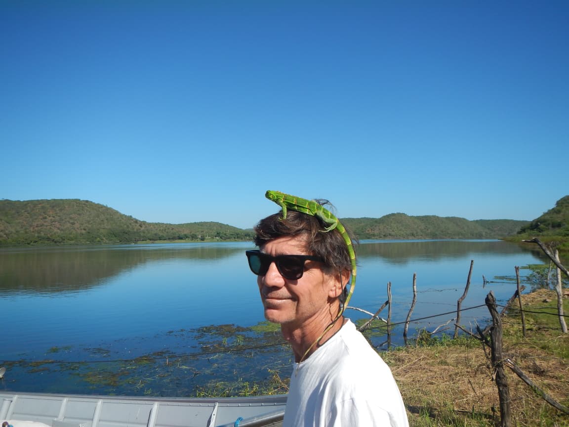
According to Cadu, the annual floods would inundate marginal lagoons, distribute sediment, renew sandbanks, nourish wetlands, transport nutrients and determine the reproductive cycles of countless species of fish, birds, plants and other organisms. It was precisely this alternation between periods of high and low water that maintained the ecological balance of the Lower São Francisco. “The São Francisco had a distinctive cycle between the flood and ebb seasons, due to the rains in the headwaters (during the summer thunderstorms in south-eastern Brazil, in Minas). Thus, in the summer, from October until March, the waters would rise and fill the marginal lagoons of the Lower São Francisco. Then they would recede, and the ebb would set in,” explains the environmentalist.
The Sobradinho dam, says Cadu, eliminated this natural cycle and caused the marginal lagoons to dry up, which quickly made biodiversity conservation unfeasible. “The reproduction of the ichthyofauna [the collection of fish species] took place in the marginal lagoons and also in the estuarine zone. Without these marginal lagoons, species could no longer reproduce, which led to the current chaotic state of the ecosystem: few or almost no fish species,” he points out.
According to Cadu, the Lower São Francisco River, since 1979/80, has been a “channelled river, on the path to the collapse of aquatic, riparian and transitional ecosystems. All riverside communities, regardless of social background, have been affected”. “The problem is not simply a matter of having water or not having water. It is that the river has ceased to fulfil the ecological functions it has always performed,” says the activist. Cadu also points out that “no river has water to spare, not a single one. Every drop of water has an ecosystemic function, to reach the next river (as a tributary) and on to the sea.
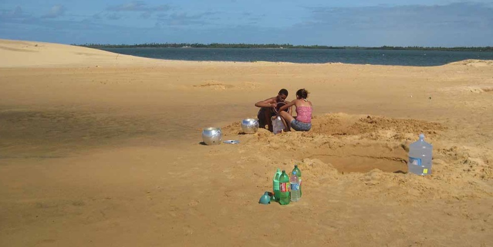
This change, he explains, can be observed in virtually every element of the landscape: “sandbanks are growing, the banks are suffering from erosion in some sections and silting in others, and the marginal lagoons are no longer receiving water during the necessary periods. The reproduction of various species is disrupted, navigation becomes increasingly difficult, and saltwater intrusion is advancing towards the estuary.” And traditional communities are facing growing difficulties in accessing fresh water. “All riverside communities face problems accessing water for human consumption, regardless of their specific circumstances; it is a widespread, generalised problem, which is even worse for those that are scattered and dispersed, receiving no support whatsoever from local authorities, state governments or the central government. They are, quite literally, on their own,” laments Cadu.
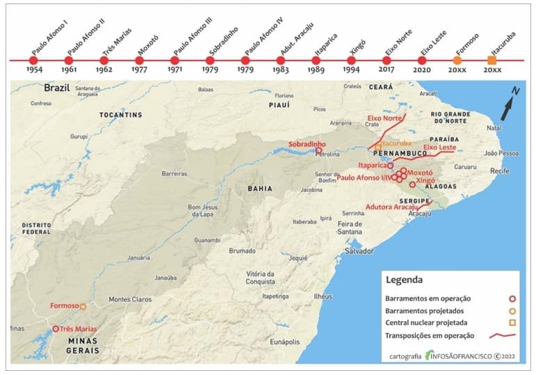
This criticism appears repeatedly in the documents produced by Canoa de Tolda. In submissions sent to the National Water Agency (ANA), the Brazilian Institute of the Environment and Renewable Natural Resources (IBAMA) and the São Francisco River Basin Committee (CBHSF), the NGO maintains that, over the last few decades, “a model has become established in which the flow released to the Lower São Francisco is determined primarily for the purpose of power generation, leaving the river to adap ly to the decisions of the electricity sector”.
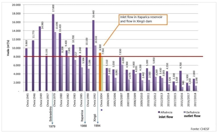
Among the points most criticised by the organisation is the gradual reduction in the minimum flow rates released downstream of the Xingó Hydroelectric Power Station. Documents submitted by the Sociedade Canoa de Tolda to IBAMA point out that the Ten-Year Plan for the São Francisco River Basin originally established a minimum flow of 1,300 cubic meters per second for the lower reaches of the river. In the update to the plan, published in 2016, this parameter was no longer adopted, paving the way for operations with significantly lower flow rates, which reached as low as 700 cubic meters per second during various experimental periods.
According to Cadu, when the flow decreases, the current loses strength, the capacity to transport sediment is reduced, sandbanks encroach on the riverbed, marginal lagoons are no longer fed, wetlands dry up, species lose their breeding habitats, and seawater begins to penetrate the river mouth with greater intensity.
This is exactly what this story found in the Kariri-Xocó Indigenous Territory. Dé and Dete had already described the growing difficulty in finding the clay used by pottery-makers. Chief Pawanã spoke of the river losing its strength. Others told us about the decline in fishing and the younger generations’ lack of connection with the river.
For Cadu, these accounts are not exceptions. They are local manifestations of the same process. “The river responds to the decisions made about it. And those who live on its banks realise this before any graph does.”
Data confirm what the Kariri-Xocó people already knew
An analysis of historical data on the flow of the São Francisco River shows that the indigenous peoples’ oral history is directly consistent with the evidence produced by science. Biologist José Daniel Bastos, affiliated with the Federal University of Rio Grande do Norte (UFRN), analysed the historical data series from the National Water Agency’s (ANA) river gauging station, located near the Kariri-Xocó Indigenous Territory. Bastos also took part in the training programme in Quantitative Ecology run by the Serrapilheira Institute, a partner organisation in the collaborative project Divided Waters, coordinated by the Latin American Centre for Investigative Journalism (CLIP) in partnership with eight media outlets in the region.
Bastos’s analysis revealed a statistically significant change in the flow patterns of the São Francisco River. Using statistical analyses to identify changes over time, he identified 2013 as the main turning point in the entire historical time series, which began in 1995. Up until that point, flow patterns had been relatively stable. After that, a consistent downward trend began.
Firstly, the researcher broke down the data by season, as the aim was to ascertain whether the trend could be explained solely by climatic seasonality (regular and predictable variation in climatic factors such as temperature, humidity and rainfall, which recurs at specific times of the year). The result was that, regardless of the season, all the curves responded in a similar manner. In other words, the behaviour observed was not restricted to a single period of the year.
The result suggested three main points of inflection: the first occurred in 2004, during a period still characterised by rising flow rates; the second appeared in 2013, representing the most significant change in the entire series; the third emerged in 2016, already associated with the period of lowest flow rates recorded in the dataset.

Analysis of the time series reveals four distinct phases in the river’s flow. Between 1996 and September 2004, the figures remained relatively stable. From October 2004 to February 2013, the river recorded its highest flow rates during the period analysed. From March 2013 onwards, however, there was a sharp decline, which continued until February 2016. After that, the flow rate showed a slight recovery, but remained below the levels recorded before the decline.
According to the researcher’s analysis, between 2013 and 2016 the average flow rate of the São Francisco River fell by around 185 cubic metres per second each year. Although the data indicate a slight recovery in flow rates after 2016, statistical tests show that this increase was not sufficient to restore the river to the behaviour observed prior to 2013. In statistical terms, the most recent periods remain significantly lower than those recorded in the first half of the historical time series, indicating that the hydrological system is still operating at a new level of flow.
Translating this figure into everyday terms helps to understand its scale. This reduction is equivalent, on an annual basis, to a volume of water similar to approximately 2.3 million Olympic-sized swimming pools or around 5.8 billion 1,000-litre domestic water tanks. The comparison brings into sharp focus a transformation which, for many residents of the region, had already been apparent long before the statistical analyses.
The findings reported by Bastos echo a concern expressed for years by organisations monitoring the Lower São Francisco region. Over the past decade, various technical reports, monitoring campaigns and meetings organised by institutions such as the Sociedade Canoa de Tolda have documented how the successive reduction in the flow rates released from the reservoirs has profoundly altered the ecological functioning of the stretch of river between Xingó and the mouth.
These studies all indicate that the changes observed by traditional communities are not isolated events, but part of an ongoing process of transformation of the river, which has been monitored for decades by researchers, civil society organisations and public institutions.
What government bodies, companies and institutional representatives have to say
The report sought AXIA Energia – the new name of the former state-owned company Eletrobras and the parent company of the business group following privatisation – and from AXIA Nordeste, formerly Companhia Hidro Elétrica do São Francisco (Chesf), which is responsible for operating the hydroelectric power stations and part of the transmission system in the North-East. In response, the company explained that the construction of the power stations on the São Francisco River, between the 1960s and 1980s, was part of a state policy aimed at energy security and economic development. According to the company, the management of the river involves different uses of water and, for this reason, “has always required shared governance of water resources”, with the participation of bodies such as ANA, the National Electric System Operator (ONS) and Ibama in defining the operating conditions.
AXIA also stated that, since the privatisation of Eletrobras in 2022, it has maintained its operations in compliance with legislation, environmental licences and the requirements of regulatory bodies. The company reported that it had invested R$56 million (approximately US$11 million) over the last four years in environmental programmes and activities in the São Francisco basin. It also highlighted initiatives which, according to the company, go beyond the obligations set out in the licensing requirements, such as the training of professionals from the municipal education network in municipalities in Alagoas, Sergipe, Bahia and Pernambuco, with an indirect impact on around 12,000 students, and the São Francisco Lakes Project, which is said to have benefited approximately 2,600 people through rural capacity-building initiatives, the restoration of springs and riparian forests, and soil conservation.
Among the long-term initiatives, the company highlighted the Water Resources Revitalisation Programmes for the São Francisco and Parnaíba river basins, which were established as part of the commitment made during the Eletrobras privatisation process. According to the company, R$350 million per year (US$68.75 million), adjusted in line with the IPCA, will be allocated over ten years to projects approved by the Brazilian government through the fund’s management committee.
AXIA stated that it acts as the implementer of these initiatives and reiterated its commitment to “conservation, water security, the sustainable use of natural resources and community development” in the areas where it operates.
In addition to AXIA, the report sought to hear from the other public bodies, institutions and companies involved in the management, monitoring and restoration of the Lower São Francisco River, in accordance with the principles of the right to be heard, full participation and journalistic transparency. The responses show that there is agreement on the scale of the problems facing the river, but also differences regarding their causes, responsibilities and ways of addressing them.
The São Francisco River Basin Committee (CBHSF) acknowledged that dams and changes in flow rates have profoundly altered the river’s dynamics, but emphasised that the current situation also stems from other factors, such as environmental degradation, changes in land use and different uses of water. The Committee called for greater public participation in flow management, environmental restoration and measures that take the river’s ecological processes into account.
In the case of the Kariri-Xocó Indigenous Territory, Agência Peixe Vivo – an organisation acting as the CBHSF’s river basin agency – explained its role in implementing the water supply system, stating that the project was driven by long-standing issues relating to water supply, water quality and health risks. The Special Secretariat for Indigenous Health (SESAI), through the Alagoas and Sergipe Special Indigenous Health District (DSEI-AL/SE), reported that the new system, inaugurated in 2023, had resolved the long-standing supply problems and that the water currently distributed meets drinking water standards. The agency also stated that, to date, there is no technical evidence establishing a causal link between the water supplied by the system and any adverse health effects.
On the environmental front, the Alagoas Institute of the Environment (IMA-AL) highlighted multiple pressures on the Lower São Francisco region, including vegetation degradation, unauthorised settlements, waste disposal, effluent discharge and erosion, whilst also reporting on enforcement and restoration measures. The Chico Mendes Institute for Biodiversity Conservation (ICMBio) also acknowledged significant environmental changes associated with the construction and operation of hydroelectric projects, including changes to flow regimes and impacts on aquatic habitats and species. The institute, however, emphasised that the current effects cannot, in many cases, be attributed to a single project, but rather to the cumulative impact of interventions over decades.
Regarding the Xingó Hydroelectric Power Station (UHE), the Brazilian Institute of the Environment and Renewable Natural Resources (Ibama), responsible for federal environmental licensing, reported that the power station is regularly monitored by technical teams and that its operating licence is currently being renewed.
With regard to the São Francisco River Integration Project (PISF), the Ministry of Integration and Regional Development (MIDR) stated that the reported impacts cannot be linked to the project and attributed the changes to a combination of historical interventions, particularly the regulation of water flows by hydroelectric power stations and prolonged droughts. The ministry also acknowledged that the environmental studies produced in the early 2000s are no longer sufficient to reflect the full current dynamics of the Lower São Francisco.
The Ministry of the Environment and Climate Change (MMA) highlighted the need to restore the functionality of ecosystems, improve water quality, restore vegetation and degraded areas, combat erosion processes and strengthen environmental monitoring, whilst also taking into account the knowledge of indigenous peoples and traditional communities. For its part, the National Electricity System Operator (ONS) stated that hydroelectric reservoirs are operated in accordance with the rules of the National Water and Basic Sanitation Agency (ANA) and the guidelines of the National Interconnected System (SIN), taking into account energy security and the multiple uses of water.
The ANA was contacted but stated that it would not comment. The Porto Real do Colégio Town Council, the Alagoas State Secretariat for the Environment and Water Resources (Semarh-AL), the Ministry of Indigenous Peoples (MPI) and the National Foundation for Indigenous Peoples (Funai) were also contacted, but had not responded by the time of going to press. This report will be updated as soon as further statements are received.
The river seen from space
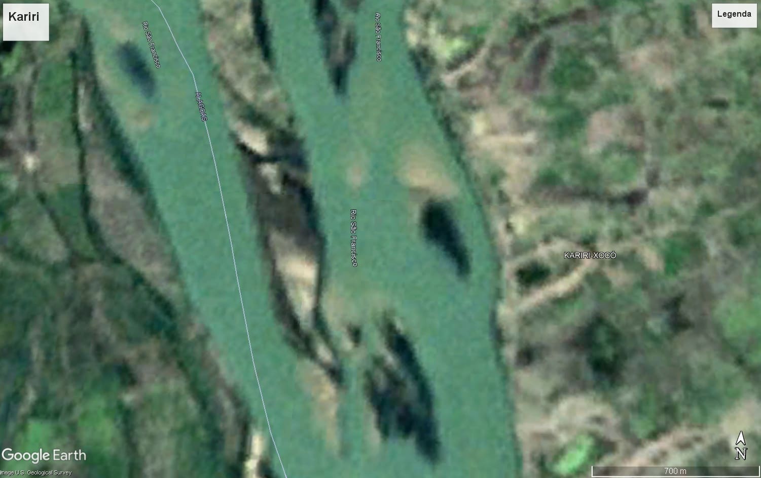
Whilst José Daniel Bastos was observing changes in river flow using historical data series, researcher Larissa Rayanny dos Santos, from the Civil Defence Monitoring, Alert and Alarm Centre in Bahia (CEMADEC/BA) and also a participant in Serrapilheira’s quantitative ecology programme, turned her attention to another set of evidence: satellite images. By comparing records spanning more than five decades, she found a gradual transformation of the landscape precisely in the stretch of the São Francisco River where the Kariri-Xocó people live.
The sequence begins on 31 December 1969, with the oldest available image, produced by the U.S. Geological Survey.
Next are images from 1985, obtained by the European Copernicus programme.
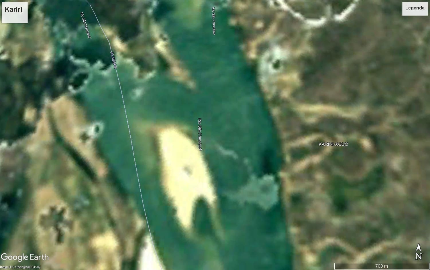
Next come higher-resolution images produced in 2008, 2012, 2014, 2016 and 2025. This chronological overview allows us to observe changes that would be difficult to notice during one-off visits to the area. Until 2012 – a period coinciding with the end of the phase of highest water flows identified in the hydrological analyses – a more continuous channel predominated, with a larger water surface area and less exposure of sandbanks.
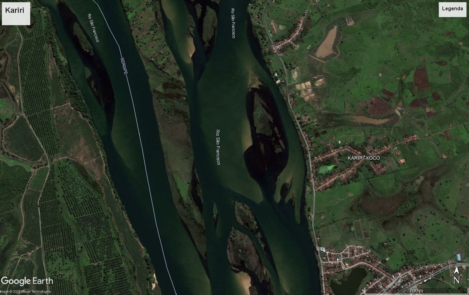
From 2014 onwards, shortly after the main break identified in the time series, more evident changes began to emerge. The sandbanks became more exposed, some secondary channels began to narrow, and the area occupied by water gradually decreased.
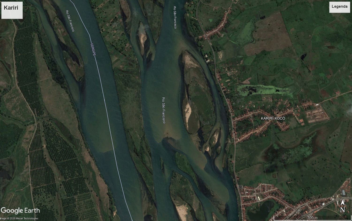
In 2016, a period corresponding to the phase of greatest reduction in flow rates, these changes became even more pronounced. There was an expansion of the exposed sedimentary areas, greater fragmentation of the main channel and a significant reduction in the width of the water surface.
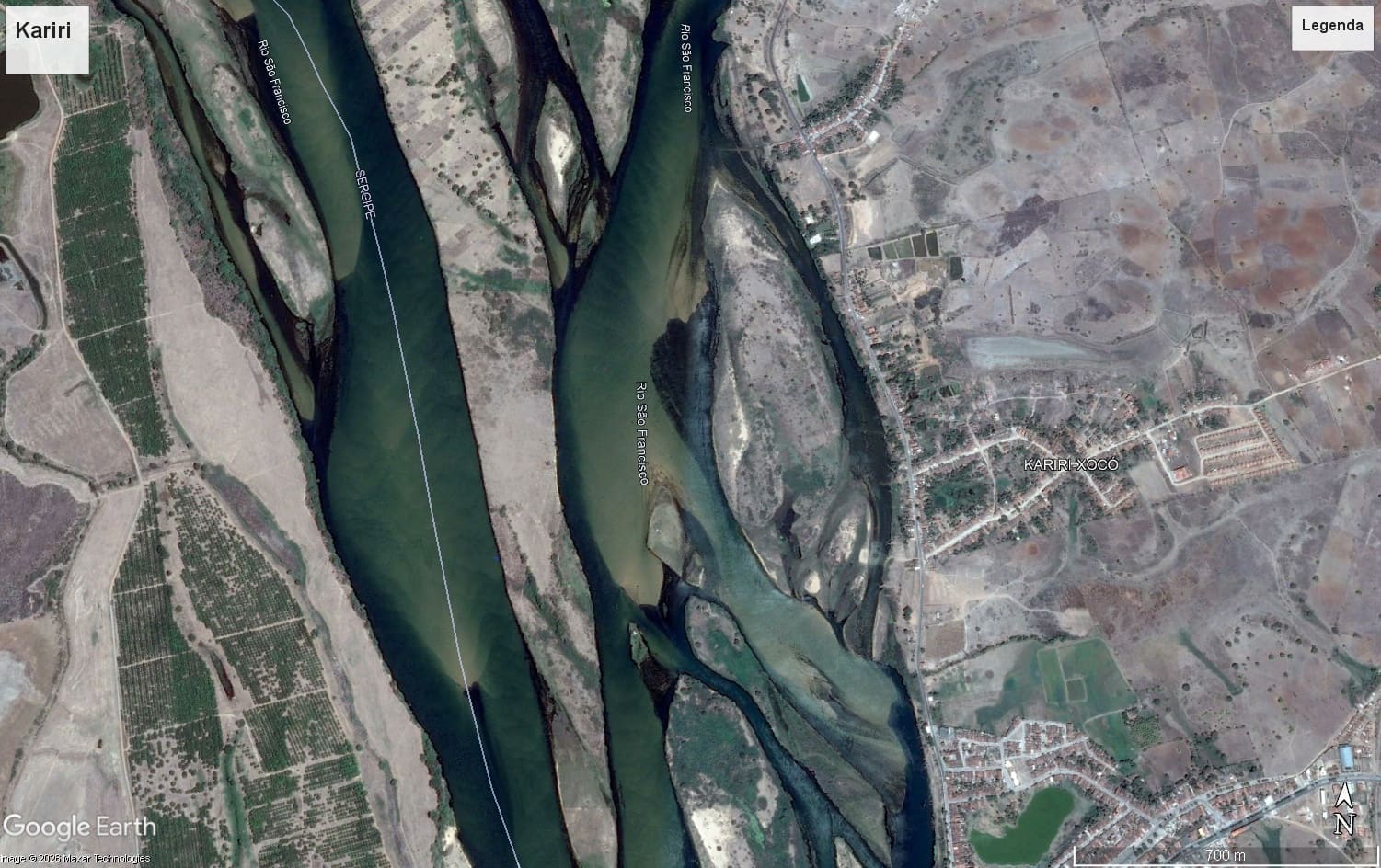
The most recent images, produced in 2025, show that some of these changes remain visible in the landscape.
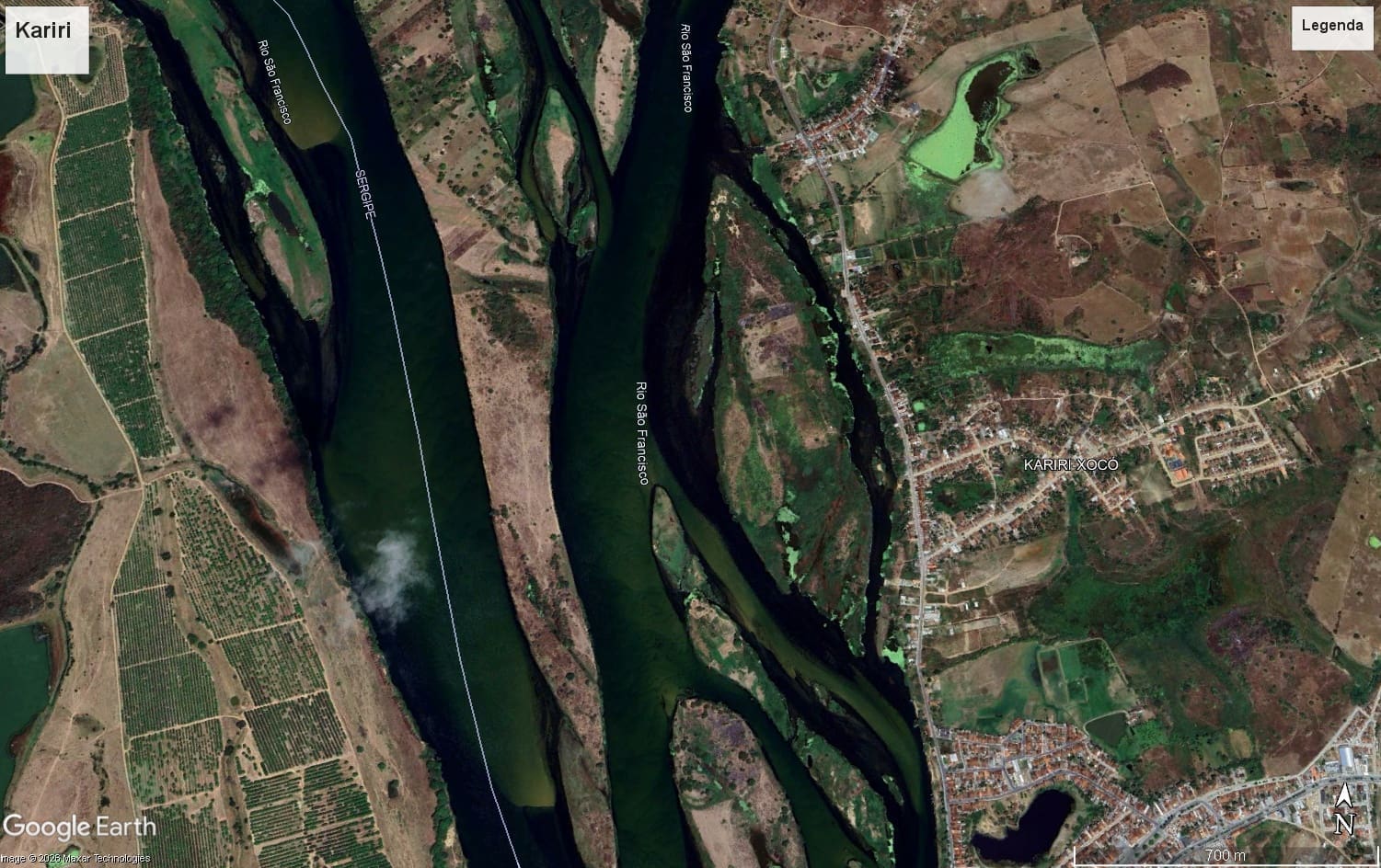
According to researcher Larissa Rayanny, although factors such as seasonality, rainfall patterns and sediment availability also influence the river’s configuration, the significant reduction in river flow over the years coincides with the changes observed in the images. The relationship between the two factors suggests that the decrease in water volume has contributed to transforming the landscape of the São Francisco River in that stretch.
In other words, what the satellites record helps to explain why those interviewed describe a river that is profoundly different from the one known to previous generations.
A river lacking in nutrients
During the visit to the Kariri-Xocó Indigenous Territory, one detail kept cropping up in the accounts of the oldest residents. Many recalled that, decades ago, the Opará carried darker water, rich in sediment. Today, they say, the river appears transparent.
At first glance, the change might suggest an improvement in water quality. For lawyer and researcher Jane Tereza Fonseca, however, the exact opposite is true. According to her – who led the legal battle on behalf of the former residents of the village of Cabeço in Sergipe (a fishing community that disappeared in the late 1990s following the encroachment of the sea) – the change in the river’s colour is one of the most obvious signs that its natural functioning has been profoundly altered. “When, for example, in 1994, the São Francisco Hydroelectric Company (CHESF) began the process of filling the Xingó reservoir, they started to feel the effects of this. This did not necessarily happen in 1994, but when the reservoir was finally closed off further downstream,” she explains.
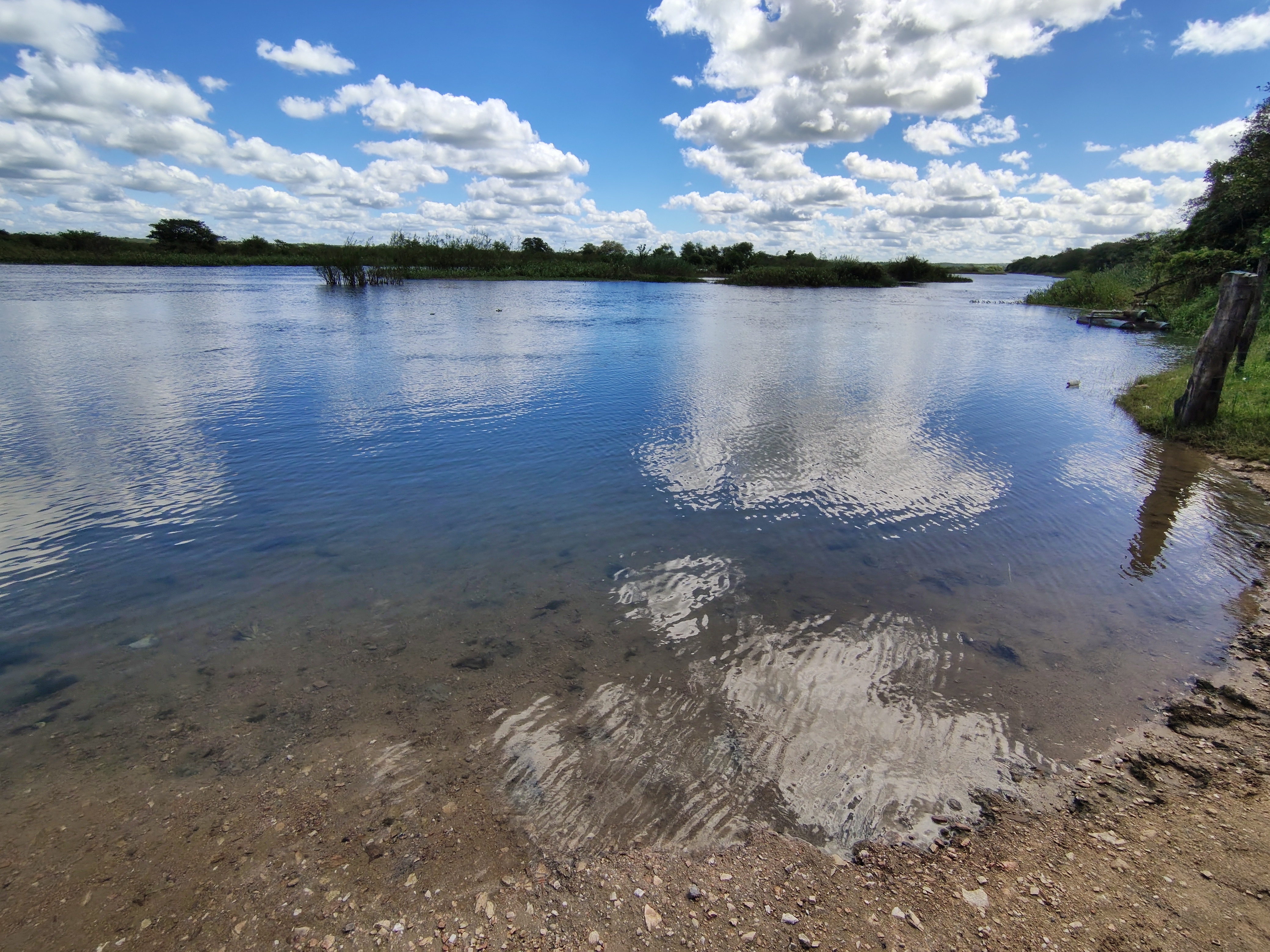
For Fonseca, it is precisely this seemingly cleaner water that triggers a series of ecological impacts that are often invisible to those who observe only the river’s surface. “When you look at the history of the water’s colour, it goes much deeper, because it involves the spawning season; it involves the very process by which fish are able to stay alive.”
The spawning season is the period when fish migrate upstream to reproduce, against the current; it depends on a combination of flow rate, water velocity, sediment transport and connectivity between the main channel and the marginal lagoons. She explains that excessively clear water makes it easier for predators to prey on fish. “When the water is much clearer, fish become much easier prey.” At the same time, according to Fonseca, sediment retention alters the very energy of the river.
Throughout this process, the riverbanks become more unstable. “The riverbanks are gradually eroding,” he observes, noting that this phenomenon can be seen in various sections of the Lower São Francisco, including near the Kariri-Xocó Indigenous Territory. Fonseca’s observations are directly in line with the findings presented by researchers José Daniel Bastos and Larissa Rayanny. Whilst hydrological analyses identify a significant reduction in flow rates and satellite images record the reorganisation of sandbanks and the river channel, Fonseca describes the ecological mechanisms that help to explain these transformations.
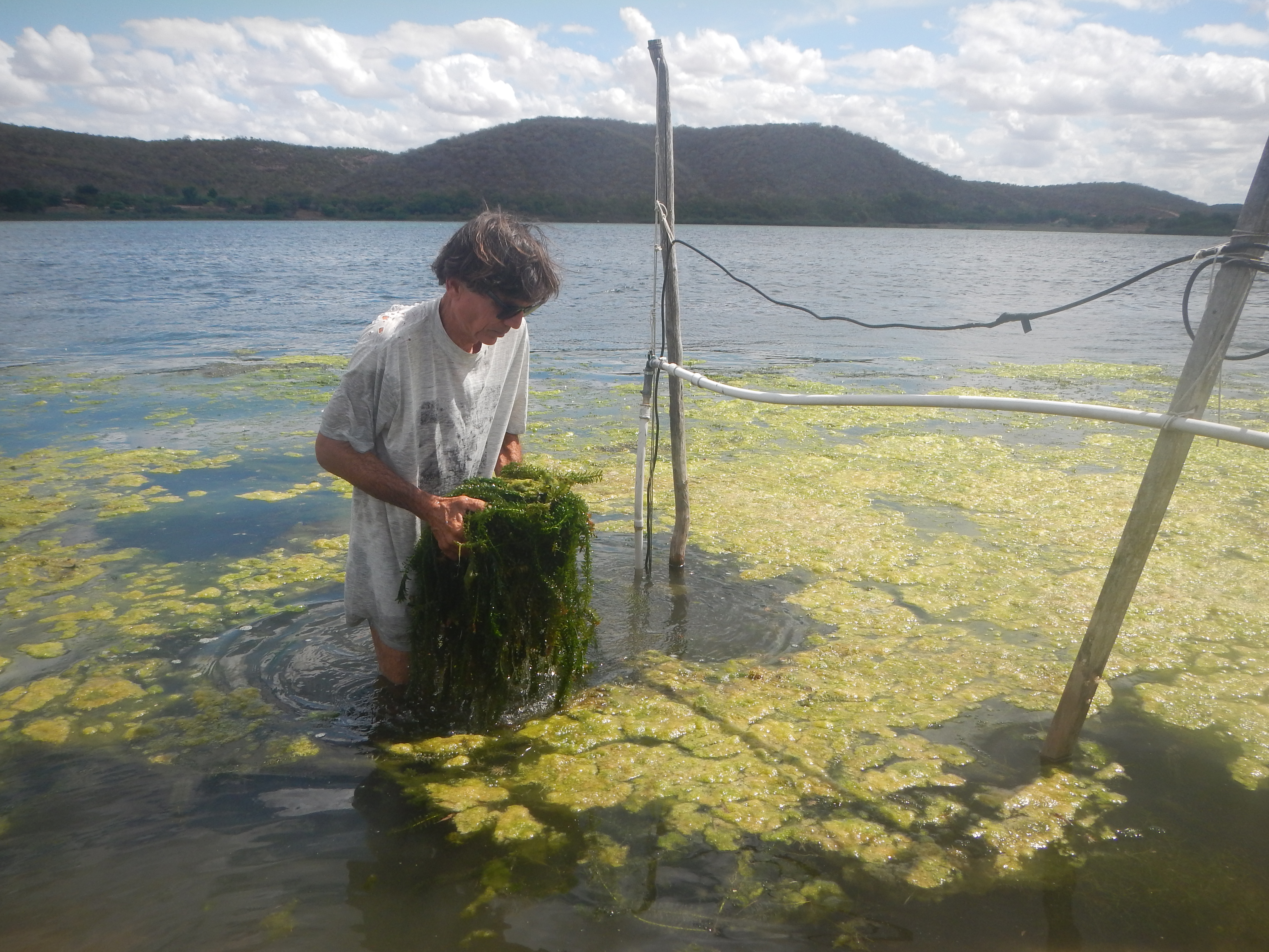
Years later, she states that the situation has worsened. “The environmental damage has reached unimaginable proportions.” According to Fonseca, siltation continues to advance, there is an increase in the presence of macrophytes – plants that live in aquatic or very humid environments – and the quality of water intended for human consumption is increasingly compromised, especially following the adoption of reduced flow rates. “Another perspective we have, when comparing the river’s current dynamics with those of the period when Cabeço was destroyed, is that the river has become normalised with low flow rates, compromising not only the quantity but, crucially, the quality of the water,” she explains.
In the researcher’s view, the consequences are not merely environmental. They affect the entire relationship forged between traditional communities and the São Francisco River. “The river is not the same,” she points out.
When the river loses its strength
For Fonseca, understanding the crisis in the Lower São Francisco also requires moving away from the idea that the river can be analysed solely in terms of the volume of water flowing through its channel. According to her, a river is the result of the constant interaction between water, sediments, vegetation, fish, microorganisms, riverbanks and human communities. When one of these elements ceases to function, all the others begin to respond to this change.
This is precisely what, in the researcher’s view, occurred in the lower reaches of the São Francisco after the dam system was built. “The river starts to function differently.” She explains that damming alters not only the volume of water but also its capacity to transport sediment. “When you retain these particles in the reservoir, you completely change the dynamics of the river.”
These sediments, which are essential for the maintenance of aquatic ecosystems, no longer reach the Lower São Francisco. The result is water that is poorer in nutrients and has a greater erosive capacity. “The water flows out smooth, light and eroded,” she points out. This change triggers a sequence of transformations observed along the entire course of the river: the riverbanks begin to collapse, new sandbanks emerge, and the river seeks out new paths.”
According to Fonseca, this is an ongoing process of reorganisation of the river landscape, in which banks are eroded, sandbanks begin to emerge in places previously occupied by water, and old channels cease to fulfil their former function. These observations are directly supported by the analysis of satellite imagery carried out by Larissa Rayanny. By comparing records produced between 1969 and 2025, the researcher identified an increase in the exposure of sandbanks, a narrowing of secondary channels, a reduction in the water surface area and changes in the configuration of river islands, particularly after 2013.
The team did not rely on a single indicator. Historical flow series, statistical tests, remote sensing and field observations were analysed in a complementary manner. This approach helps to minimise interpretations based on a single data set and to understand the river’s transformations from different perspectives. These findings also align with the hydrological analyses conducted by José Daniel Bastos, which identified a statistically significant break in the historical flow data series precisely from that period onwards.
In Fonseca’s view, however, perhaps the most worrying effect is one that is not immediately apparent in the landscape. “When you alter the river’s dynamics, you also alter the entire ecological chain,” she explains. She cites fish reproduction as an example. When these processes cease to occur naturally, different species find it difficult to complete their reproductive cycles. “The story behind the colour of the water runs much deeper; it involves the spawning season and the survival of the fish,” she points out.
According to the researcher, the very clarity of the water produces new ecological impacts. In naturally more turbid environments, many species find suitable conditions for feeding, reproduction and protection from predators. When this turbidity disappears, the entire ecological dynamic also changes. “Fish become much more vulnerable,” she argues. These changes help to explain why, over the last few decades, various traditional communities have begun to report a decline in fish catches, changes in species composition and alterations in the river’s behaviour.
In the Kariri-Xocó Indigenous Territory, these accounts emerged in various forms throughout this investigation: Dé and Dete, for example, linked the river’s transformation to the growing difficulty in finding the clay used by pottery-makers. For Fonseca, these episodes do not represent isolated problems; they are all part of the same ecological change. “The river responds as a system,” she points out. This is precisely why, according to her, restoring the Lower São Francisco does not simply mean increasing the flow or planting trees; it means re-establishing the ecological processes that allow the river to resume its natural functions.
Communities work to protect the environment to safeguard the future of the Opará
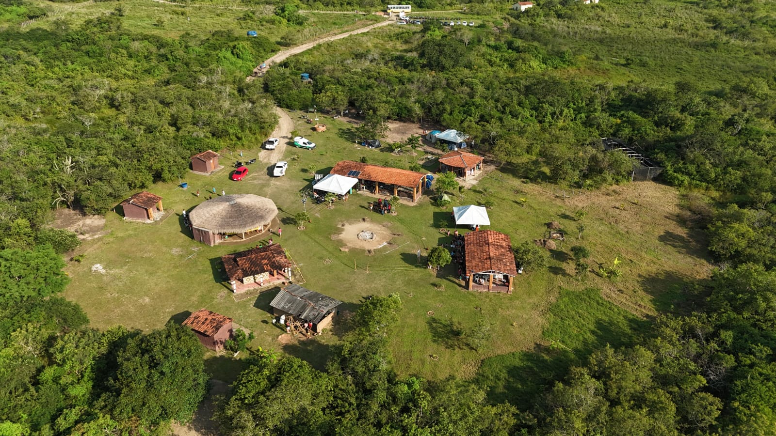
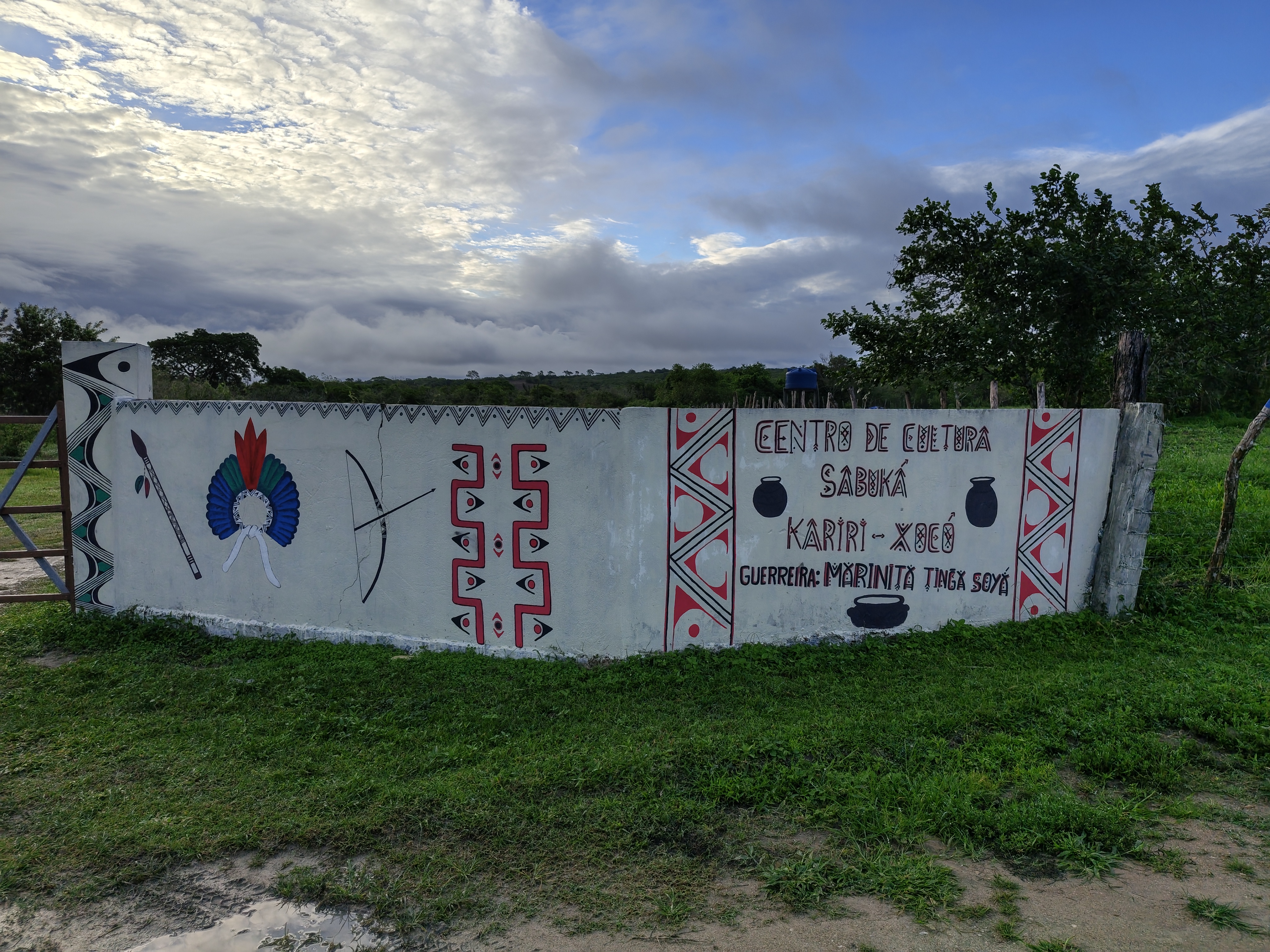
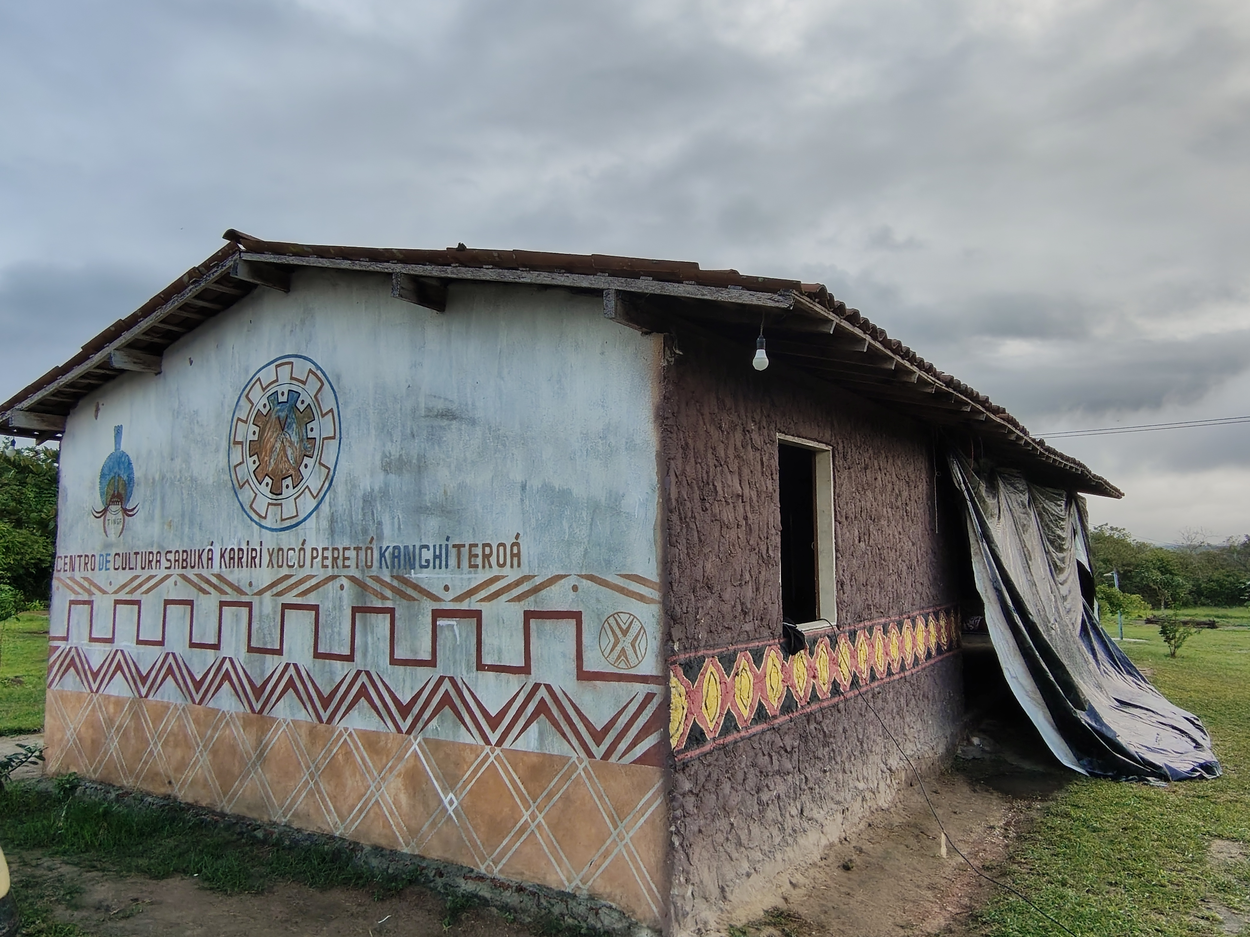
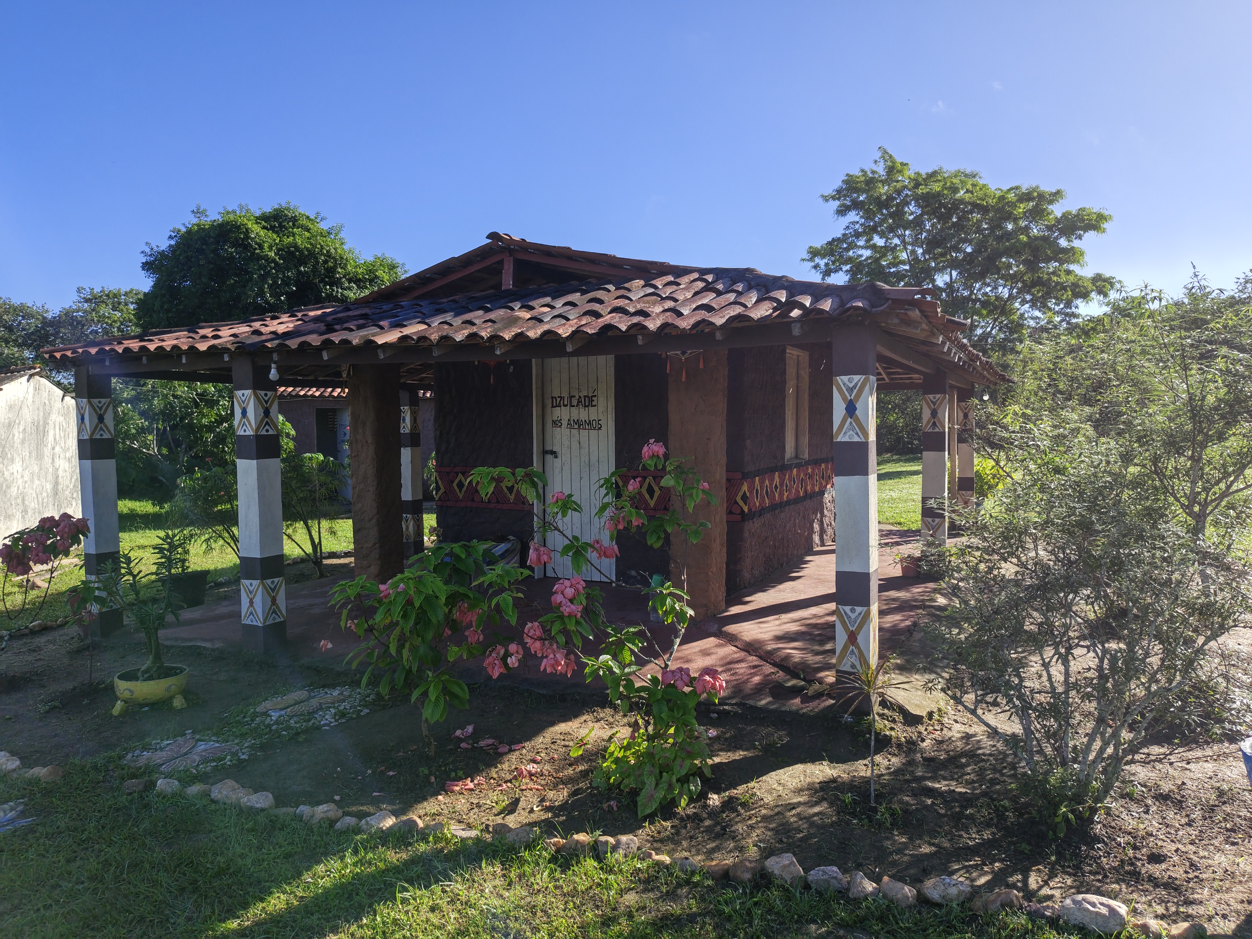
Bearing all this in mind, the communities are working to protect the environment and secure the future of the Lower São Francisco region. In the Kariri-Xocó territory, for example, after years of observing the community’s daily life and working alongside the Kariri-Xocó themselves to develop a strategic plan for the Sabuká Cultural Centre Association, Verena Barros Hauschild realised that various demands all pointed to the same place: the territory. The discussions centred on the restoration of the Caatinga, the protection of water sources, income generation, the strengthening of the ‘louceiras’ (traditional pottery workshops), keeping young people in the village, and the promotion of traditional knowledge. “When we draw up this plan, two things emerge very strongly. The first is the production of pottery. The second is the restoration of the Caatinga. And, to us, it seemed as though these were different issues. Later, we realised that it was exactly the same discussion,” she recalls.
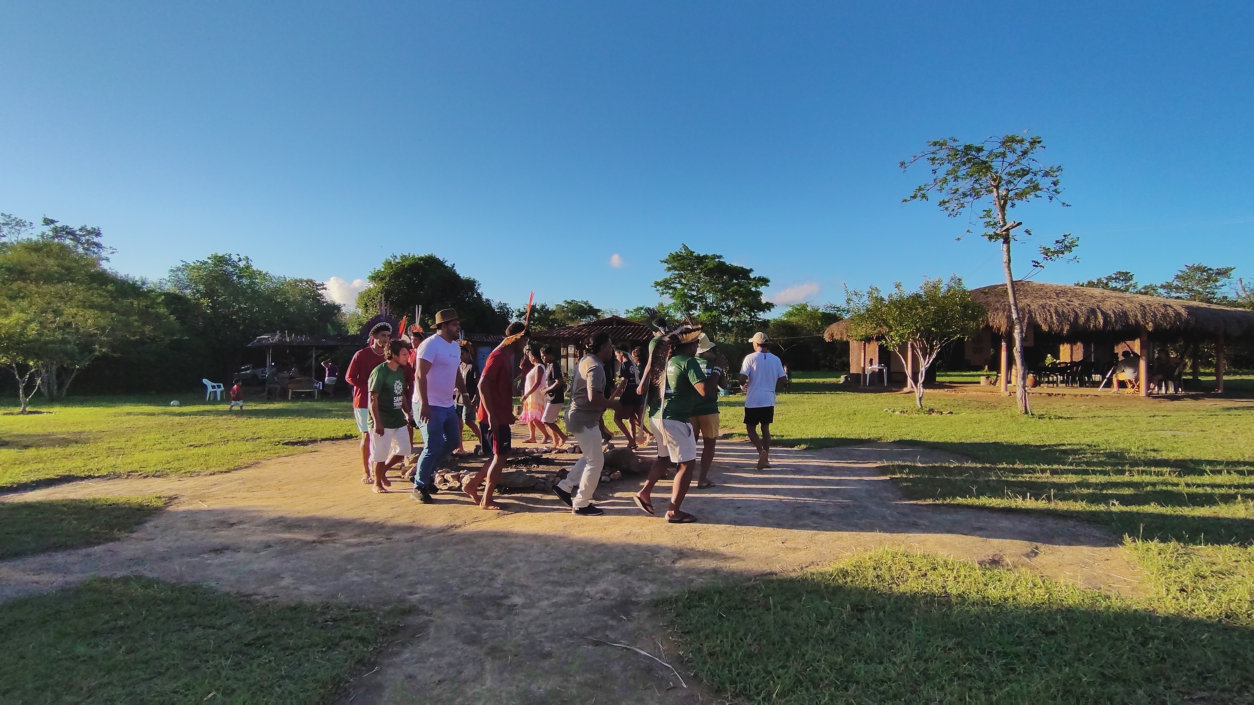
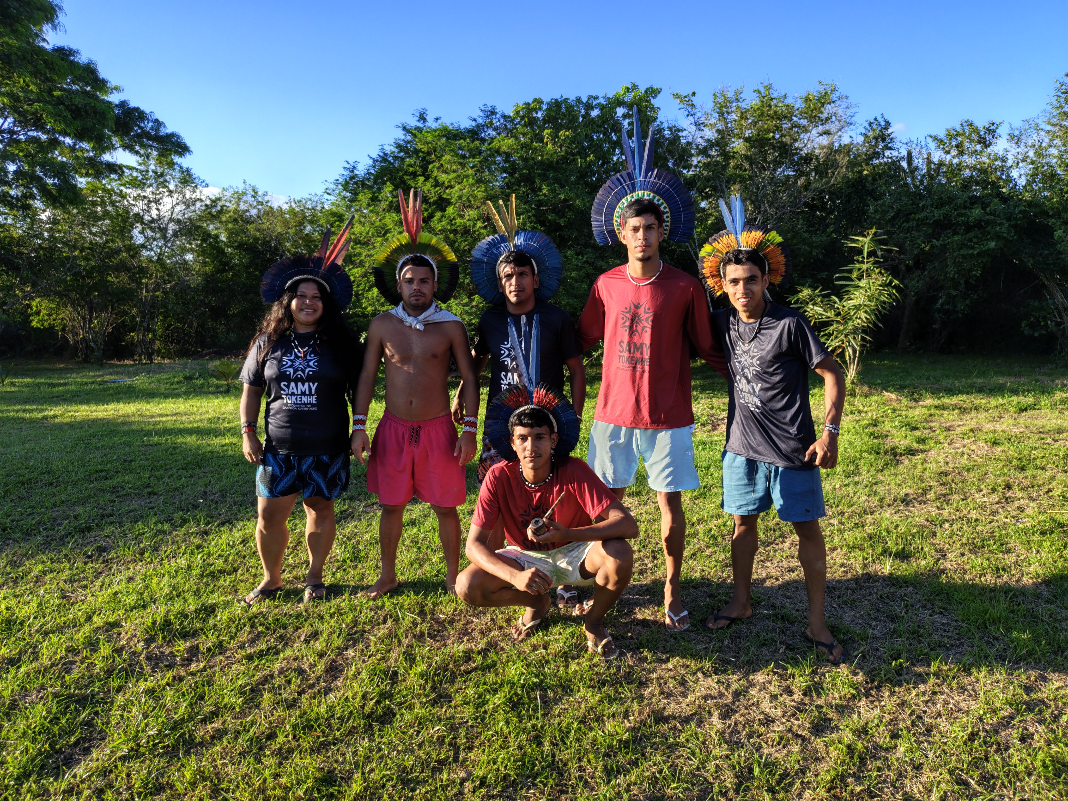
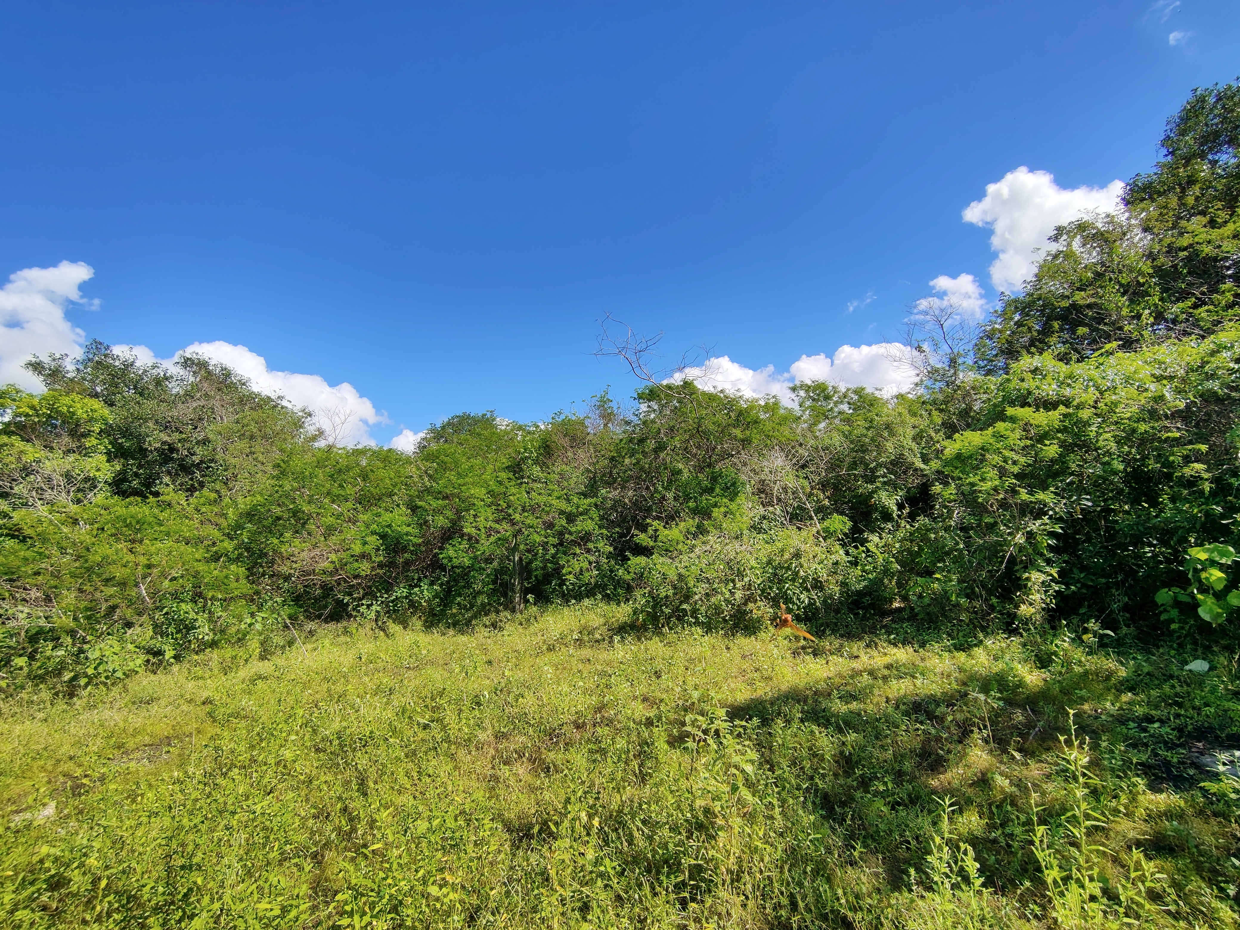
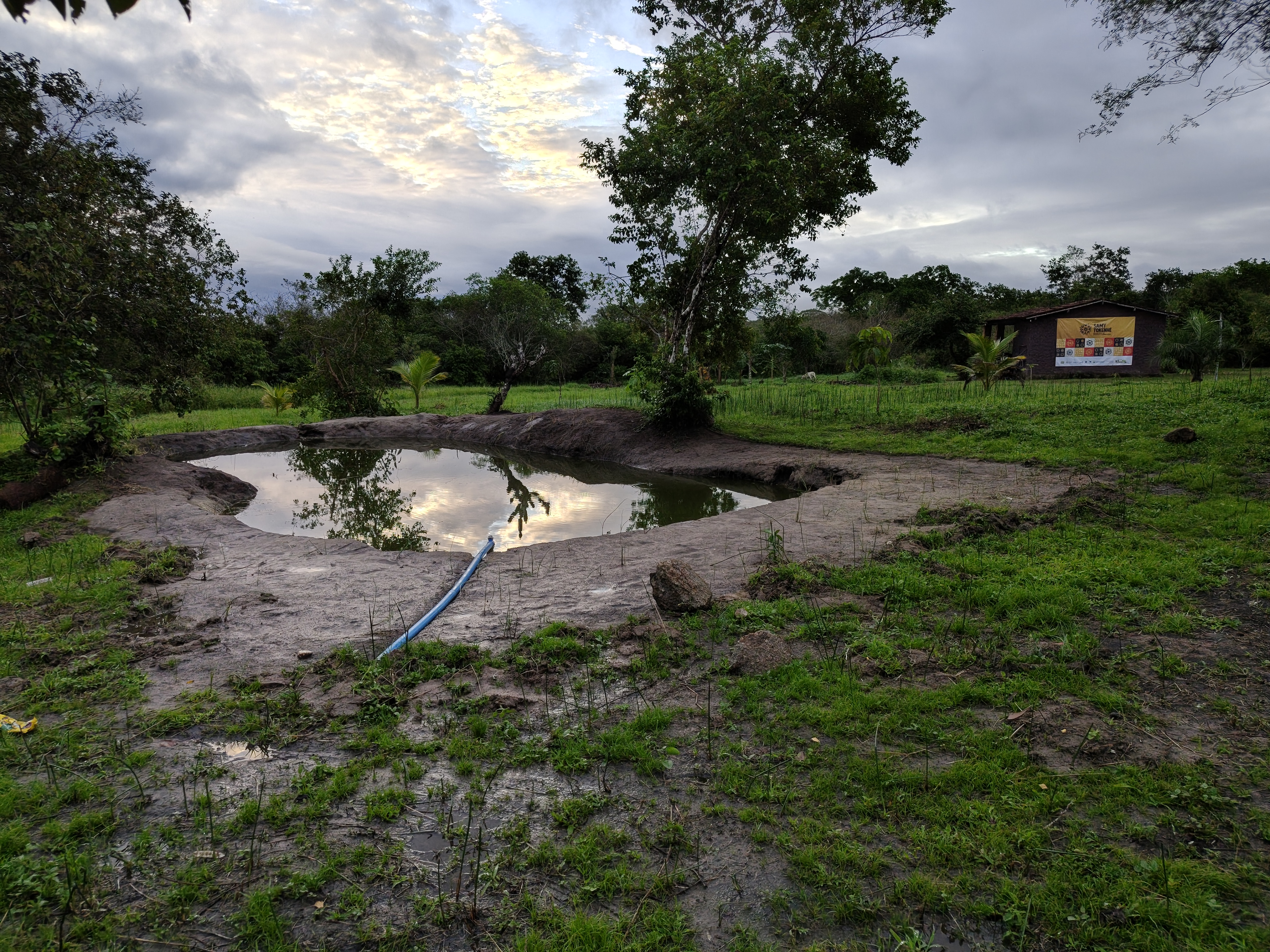
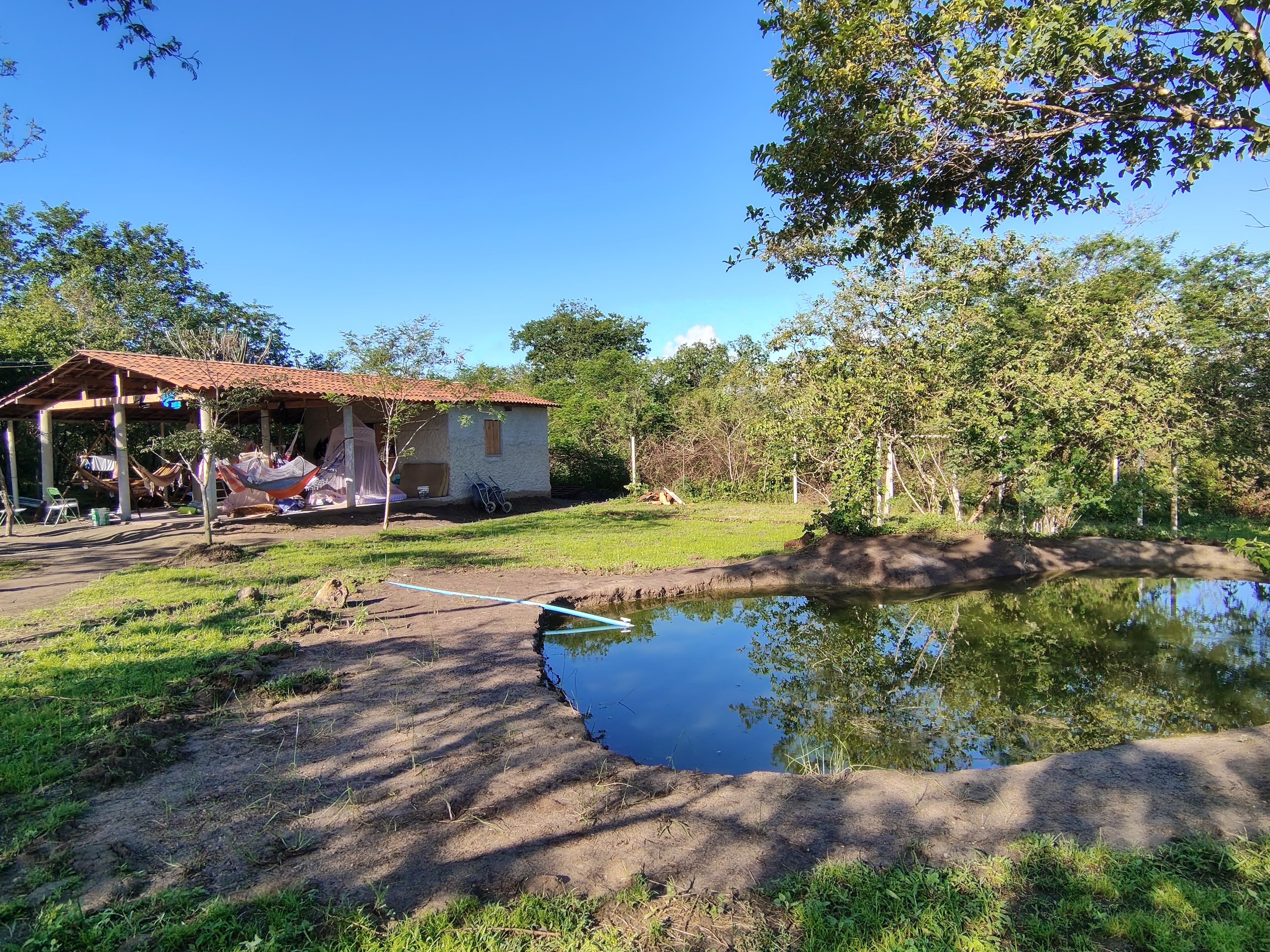
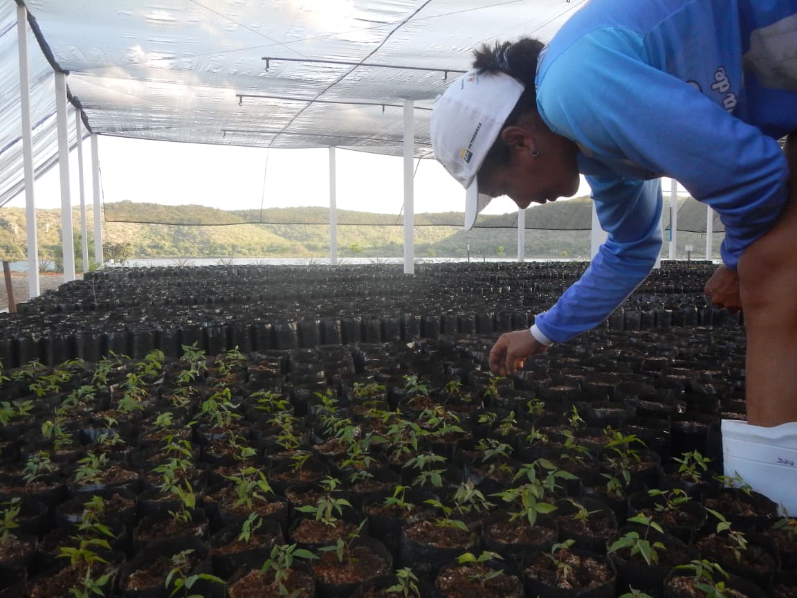
It was from this process of listening and collective planning that the Tinga Resistência Project emerged, conceived not merely as an ecological restoration initiative, but as a strategy for territorial empowerment led by the Kariri-Xocó themselves. For Verena, this process needed to be based on the community’s own priorities, rather than on solutions devised from outside. “There was no point in turning up with a ready-made project. Our role was to create the conditions for the community’s own ideas to gain momentum.” The project thus came to combine ecological restoration, territorial governance, traditional knowledge and community participation. Among the objectives are the restoration of 37 hectares, the installation of 70 half-moon-shaped basins for rainwater retention and the training of 40 environmental agents.
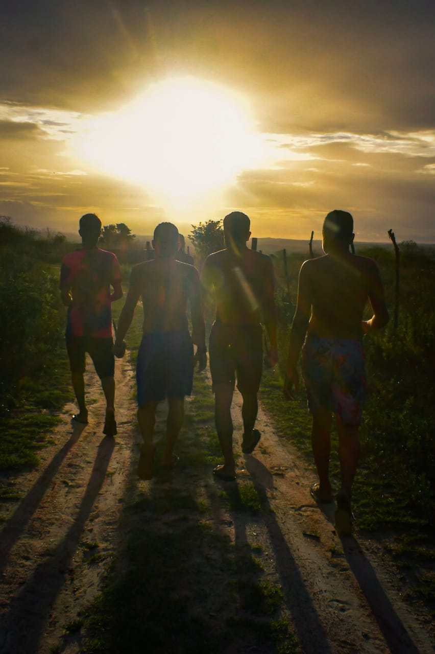
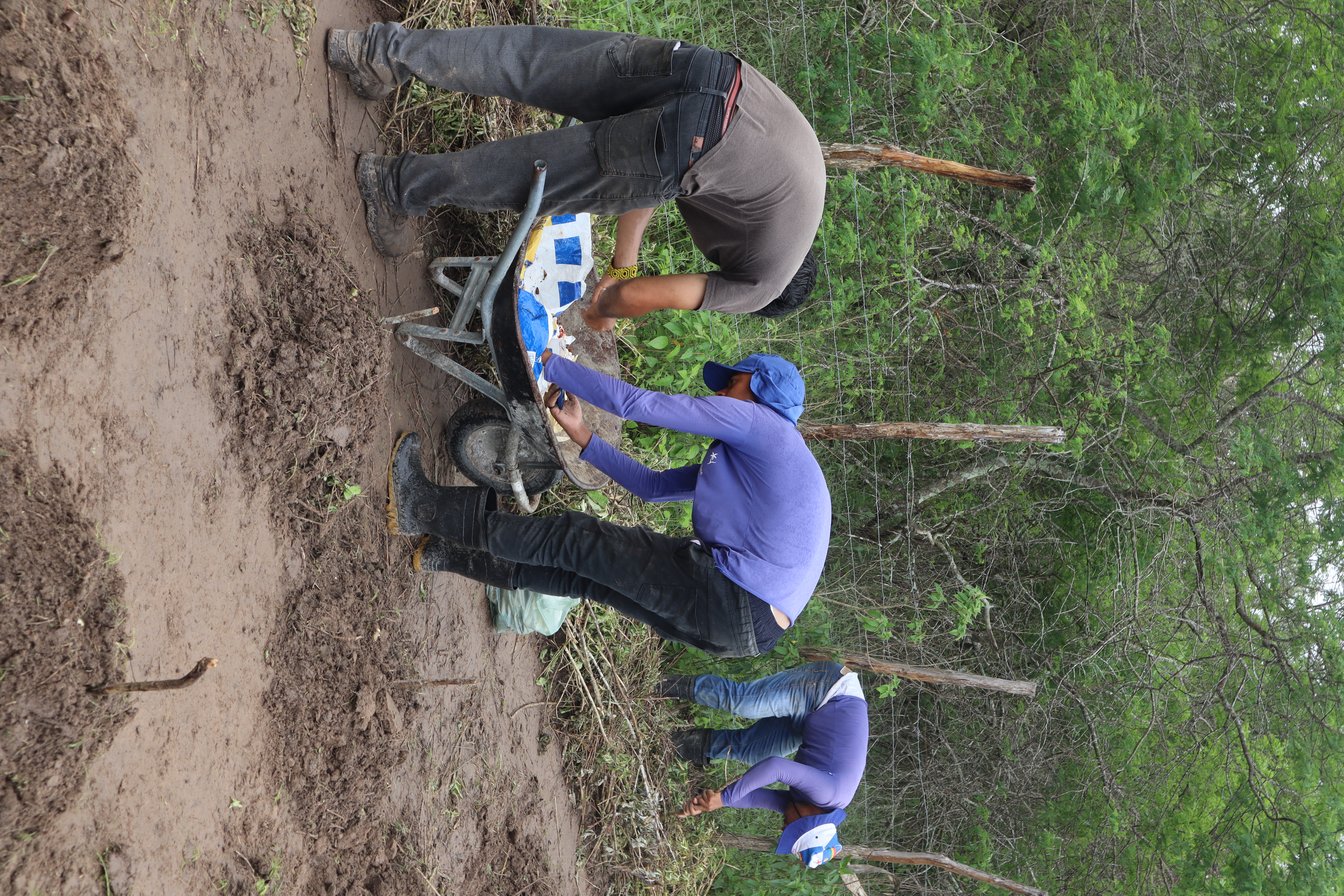
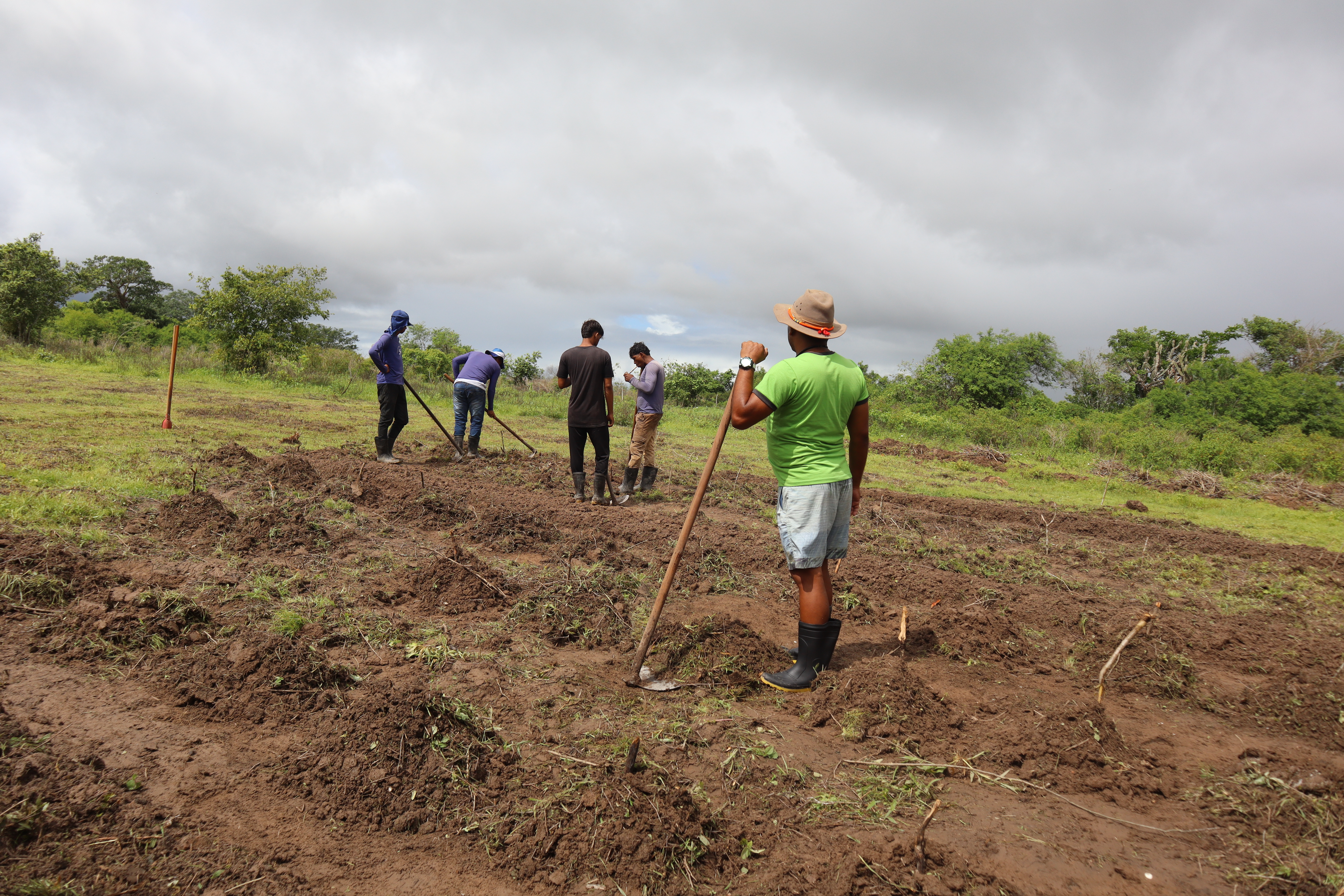
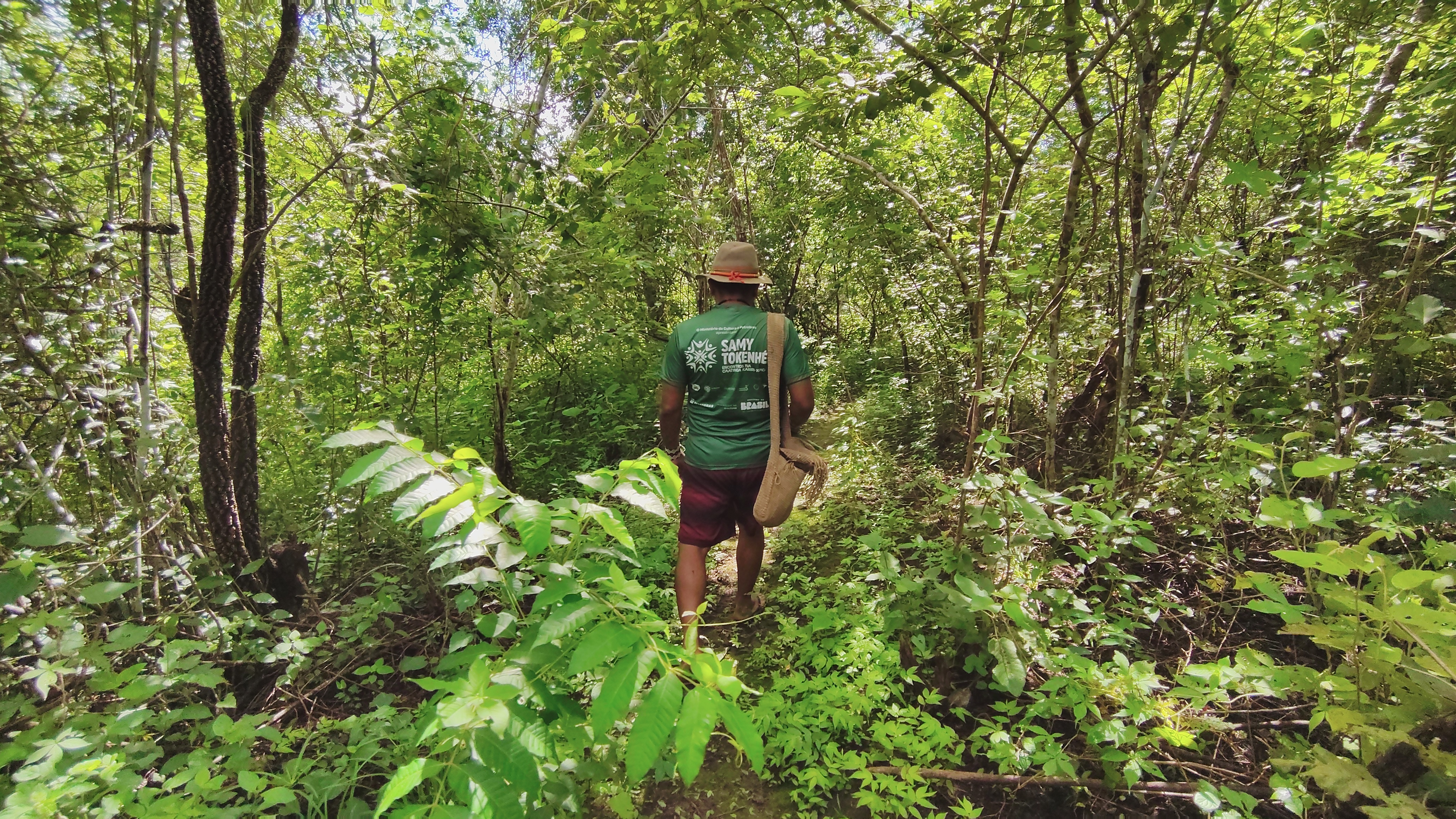
Among the young people involved is 21-year-old Içam Kariri-Xocó. He is involved in the restoration of the Caatinga, the protection of water sources and the strengthening of traditional land management practices. For him, the involvement of young people shows that conservation is also a way of keeping the Kariri-Xocó culture alive. “As a young person in my community, I am truly delighted to see that not only I, but also my brothers – who are young people too – are steadfast and determined in preserving our forest and keeping our culture alive within it,” he emphasises.
As he walks through the restored areas, Içam demonstrates how this work combines water conservation techniques with traditional knowledge. The so-called ‘half-moons’, for example, help to retain rainwater and nourish the plants during dry spells. For him, preserving the forest also means protecting cultural and spiritual practices passed down through the generations.
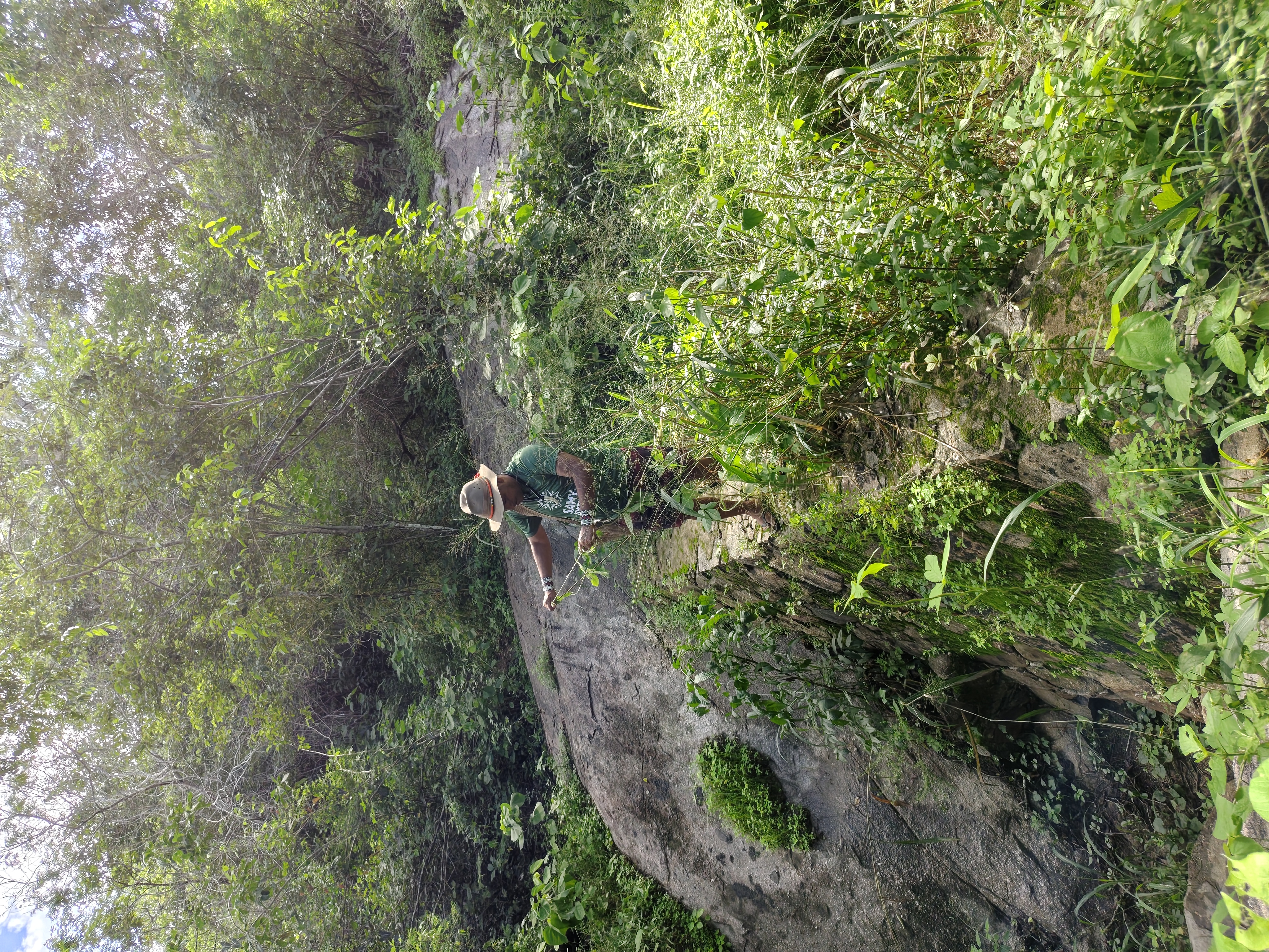
But the recovery of the territory also depends on how the community tells its own story. Kayã Kariri-Xocó, aged 21, son of the shaman Pawanã, is a member of the Sabuká Kariri-Xocó Cultural Centre and coordinates activities aimed at the village’s young people. For him, the village’s proximity to the city also poses challenges for cultural preservation. “The influence of non-indigenous people is becoming very significant.” Among the strategies to bring young people closer to their culture are initiatives to restore the Caatinga, agroforestry, environmental education and reforestation. “Our focus is on bringing these young people into the culture.” At the same time, Kayã is concerned about the drift away of some of the younger generation: “I see that many are already leaving. Sometimes they’re even ashamed to say they’re Indigenous.”
When recalling his childhood, he compares the river today with the descriptions he heard from his elders: “I never got to see the river as it used to be. They say it was very beautiful, much bigger, and reached right up to the village gate.” Today, pollution is one of his concerns: “Pollution is a major problem in our river,” he explains.

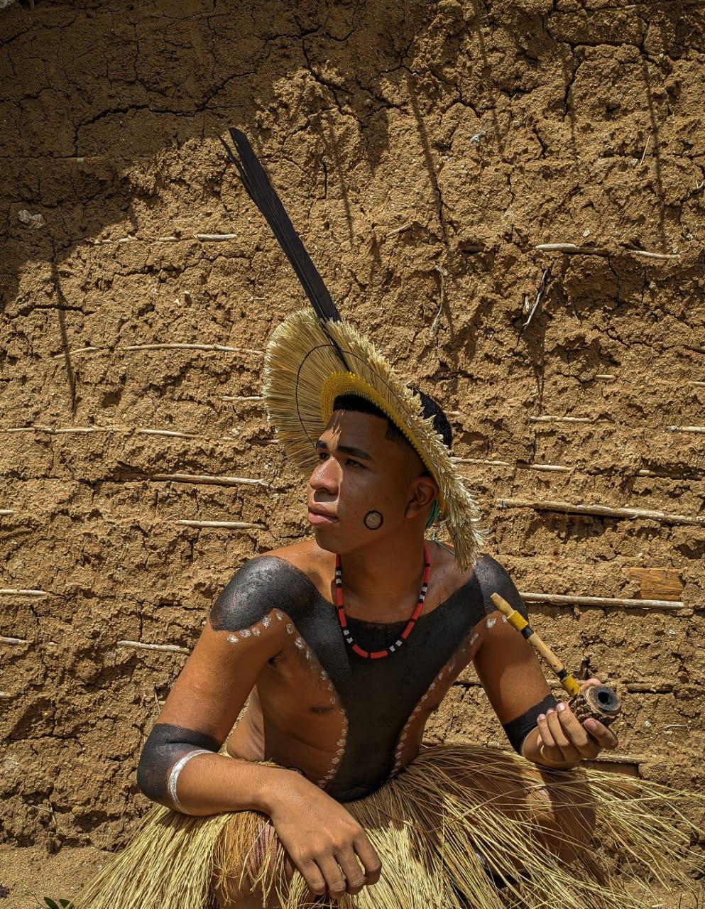
This connection between identity and territory also emerges in the words of Karu Kariri-Xocó, aged 19. When asked what it means to be an Indigenous person living near the city, he states: “Being Indigenous isn’t about what you wear. Being Indigenous is in our blood.” And, speaking of the Opará: “The river causes me great pain. It hurts a lot to see people throwing rubbish into the river today.” For Anami, defending the river is also a defence of their own history: “When we talk about the river, we’re also talking about our history.”
Midzé Kariri-Xocó, aged 21, works as a photographer and audiovisual producer at the Cultural Centre. He captures the community’s daily life, documents its cultural activities and uses photography, video and the internet to share this experience beyond the village. “I bring this culture to white people and also to my own community. If they can’t come here, we can show it both to them and to the white people who like us,” he emphasises.
In Midzé’s view, these tools do not replace traditional knowledge, but have become part of the indigenous struggle. “As our shaman says, we showcase our culture through the digital arrow.” Through them, he says, those who cannot be there in person can learn about the culture and strength of the Kariri-Xocó people. When asked what it means to be born a Kariri-Xocó, he replies: “It’s a gift. I’m very proud to be Kariri-Xocó.” And, speaking once more about the Opará, he sums up the significance the river holds for his people: “There is no Kariri-Xocó without the São Francisco River,” he concludes.

This project is the result of a collaboration between Latin American journalists and scientists, promoted by the Serrapilheira Institute in Brazil and the Latin American Centre for Investigative Journalism (CLIP), with the aim of exploring the Atlantic–Amazon–Andes hydrological cycle and the disruptions to the environmental services it provides to the continent.


