


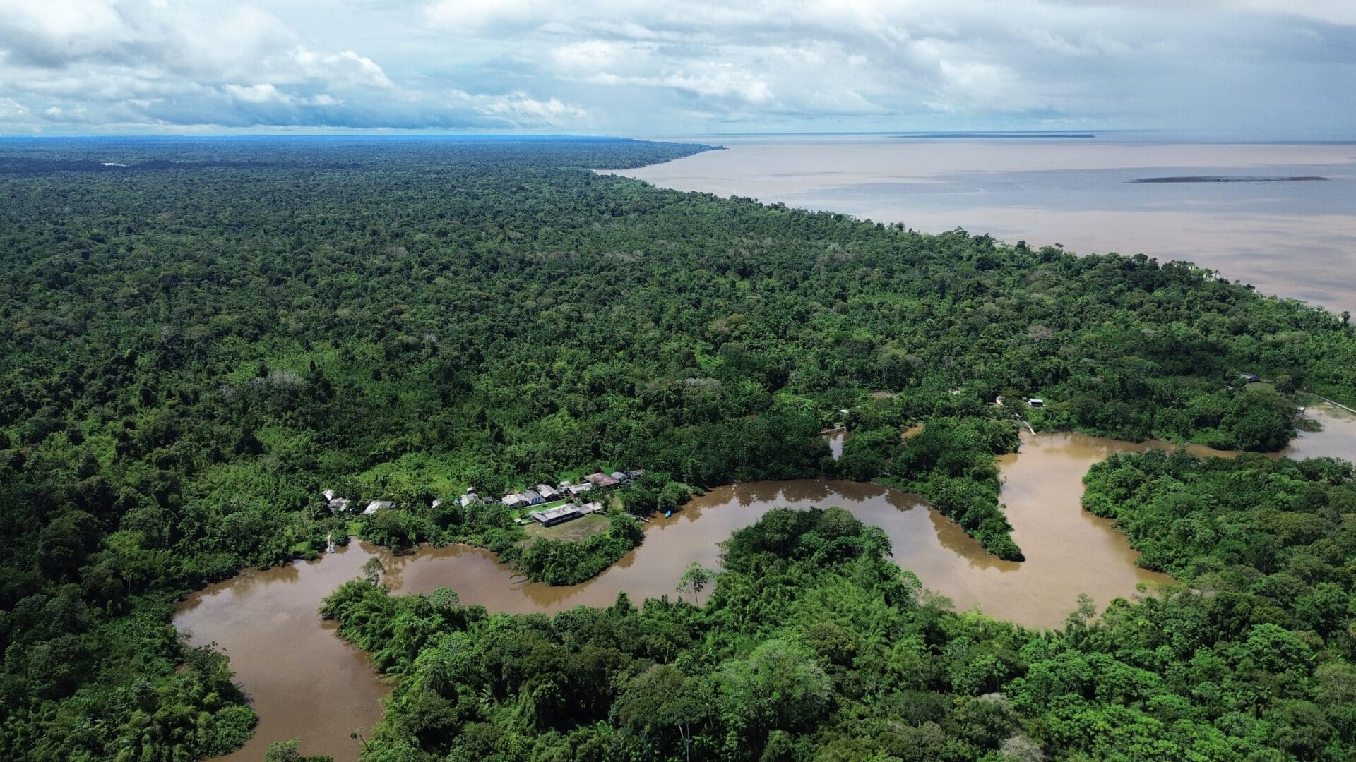
Sea level at the mouth of the river with the largest flow on Earth has risen 12.4 cm in three decades, eroding riverside territories and reshaping the local economy, according to an unpublished analysis. Intense rains and droughts in the Amazon are altering the interaction between the river’s mouth and the Atlantic Ocean, driving higher tides and coastal salinization. The effects of these changes are already visible in the availability of the species most commonly caught along the Amazon coast. They are also closely tied to deforestation on the continent: by 2050, a 45% reduction in forest cover could weaken the force with which the Amazon’s plume reaches the Atlantic.
Gustavo Faleiros (InfoAmazonia)
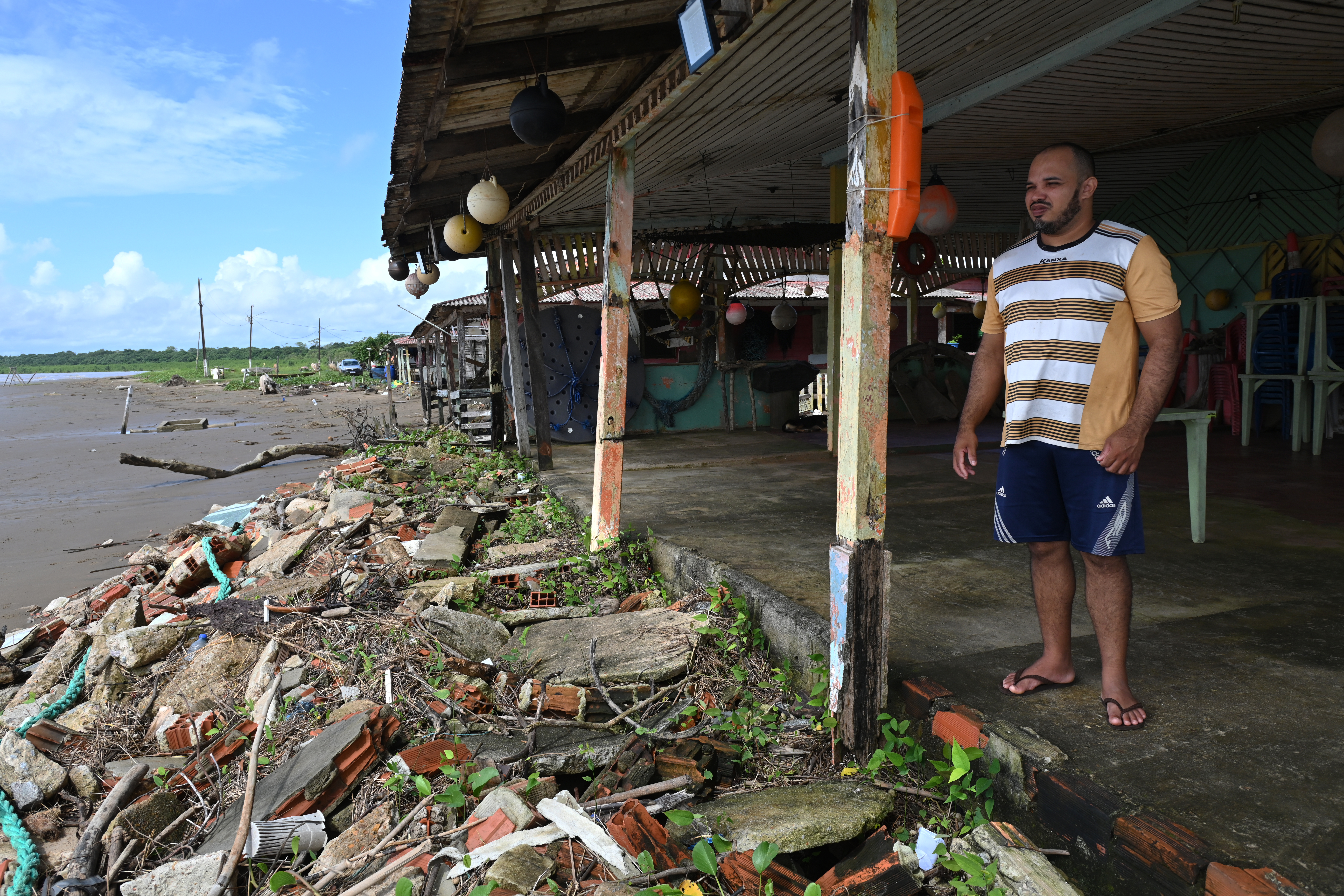
Goiabal beach, in the state of Amapá, bears the impact of the high tides. Photo: Luis Ushirobira*
The mouth. Here, two great forces of nature meet: the Amazon River and the Atlantic Ocean. During the rainy season, it is the river that pushes farther out into the sea. Then, in the dry season, it is “the salt water” that begins to win the battle.
The trail of the world’s largest river reaches, during its peak discharge period between February and April, as far as 1,000 km into the Atlantic. When this river plume reaches the sea, it carries a huge load of nutrients. Driven by the North Brazil Current, it moves toward the Caribbean, feeding the rich biodiversity of the coral environments in that part of the Atlantic.
In this banquet of micro-organisms and sediment carried by the Amazon River live thousands of species, and an entire society and economy depend on them. The waters of the Amazon and the Atlantic have shaped one of the most beautiful regions on the planet and a coastal culture that is little known to the world. When people speak of the Amazon, they think of the forest, not the diversity of landscapes along its coast. Much less of its sea of muddy waters.
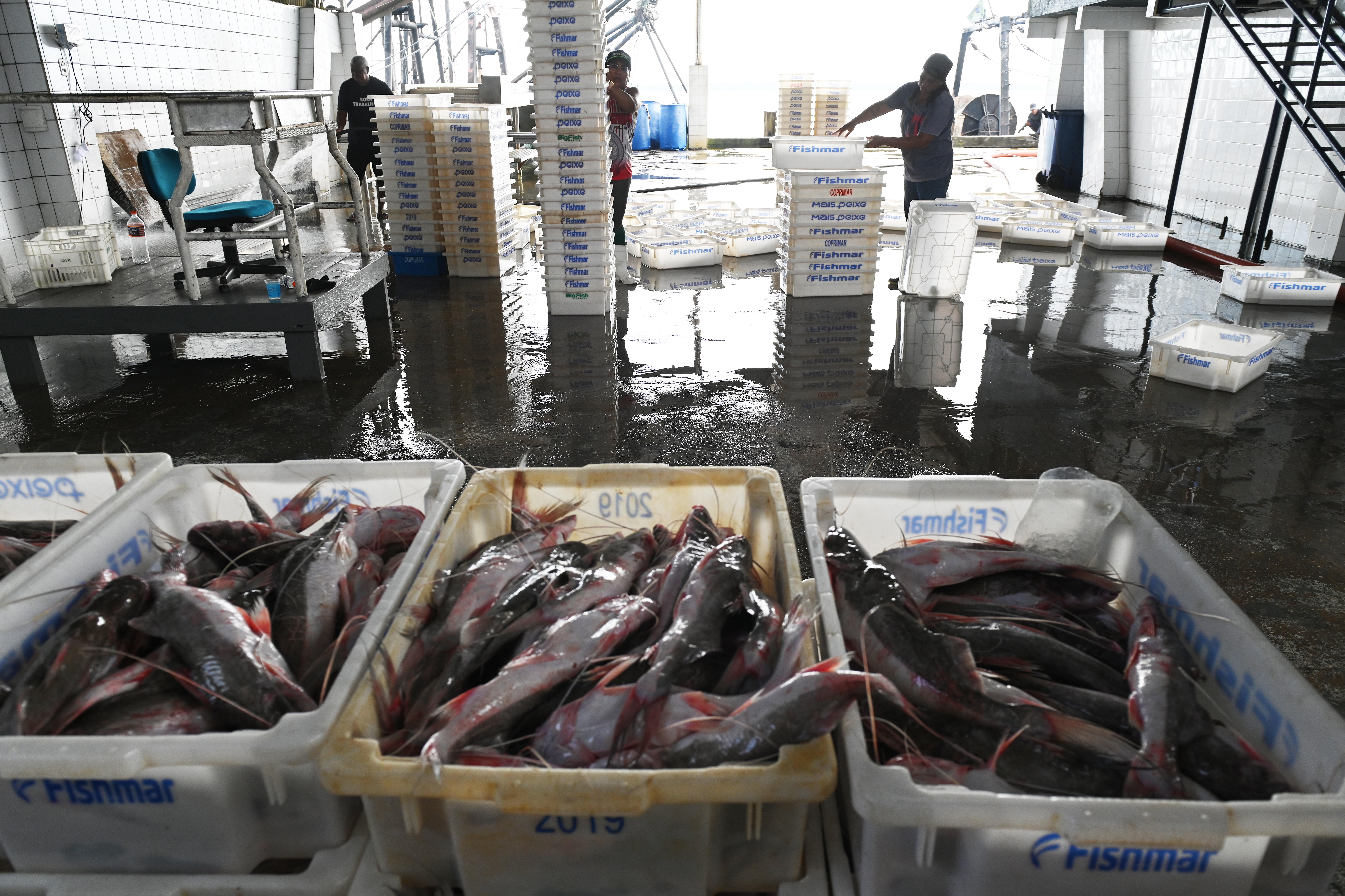
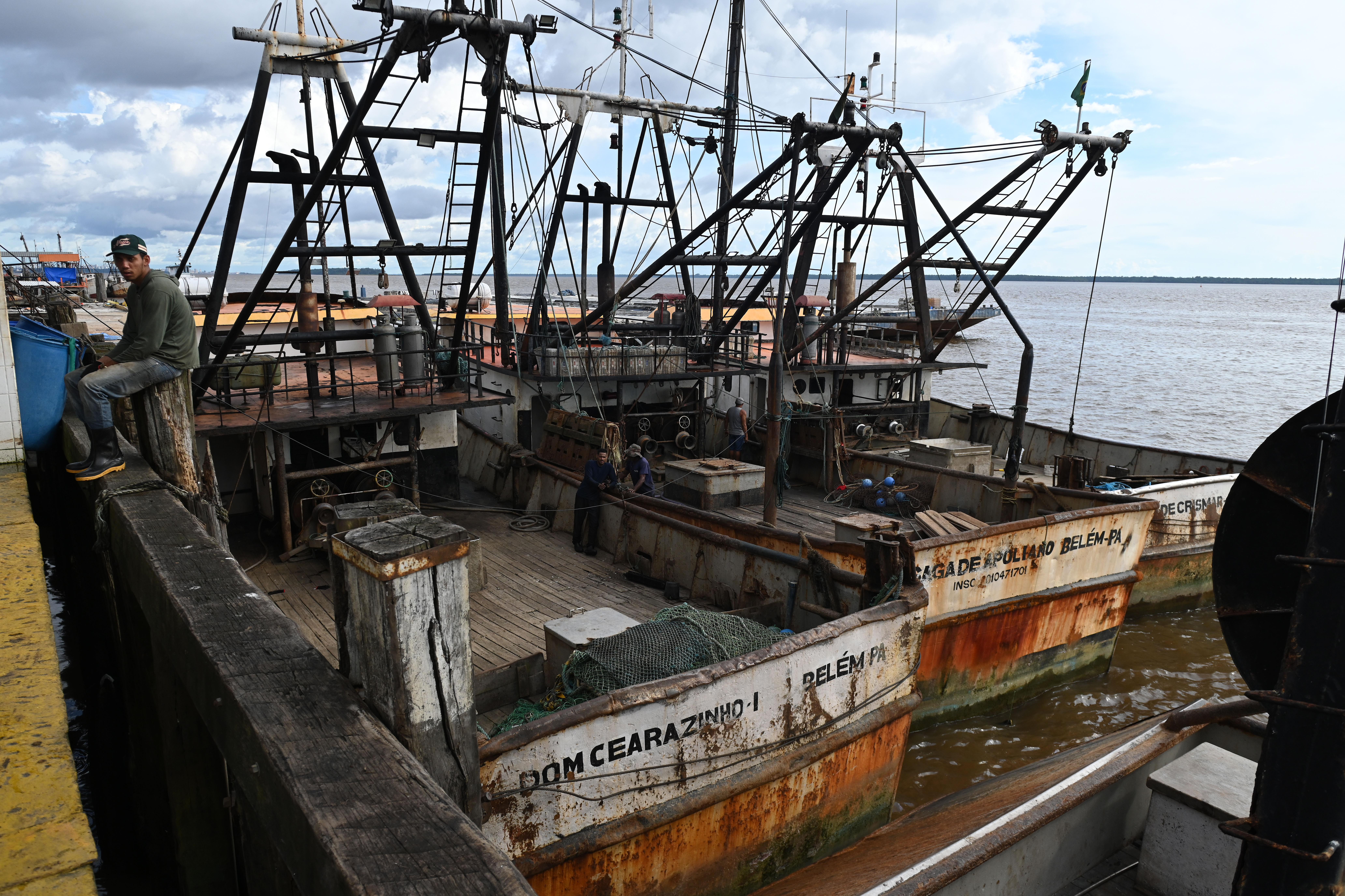
In this society bound to fish, mangroves and the rhythm of the tides, fishermen, shellfish gatherers and the fishing industry are the protagonists. Closer to shore are the artisanal fishermen and those who catch shrimp and crabs in brackish water. A little further out to sea are the industrial vessels that trawl their nets for pink shrimp, yellow croaker and migratory catfish.
Yet this balance between river, sea, humans and nature is changing fast. Global warming is intensifying the Amazon’s hydrological cycle, causing more extreme rains and droughts. The timing and volume of Amazon water reaching the Atlantic are no longer so regular.

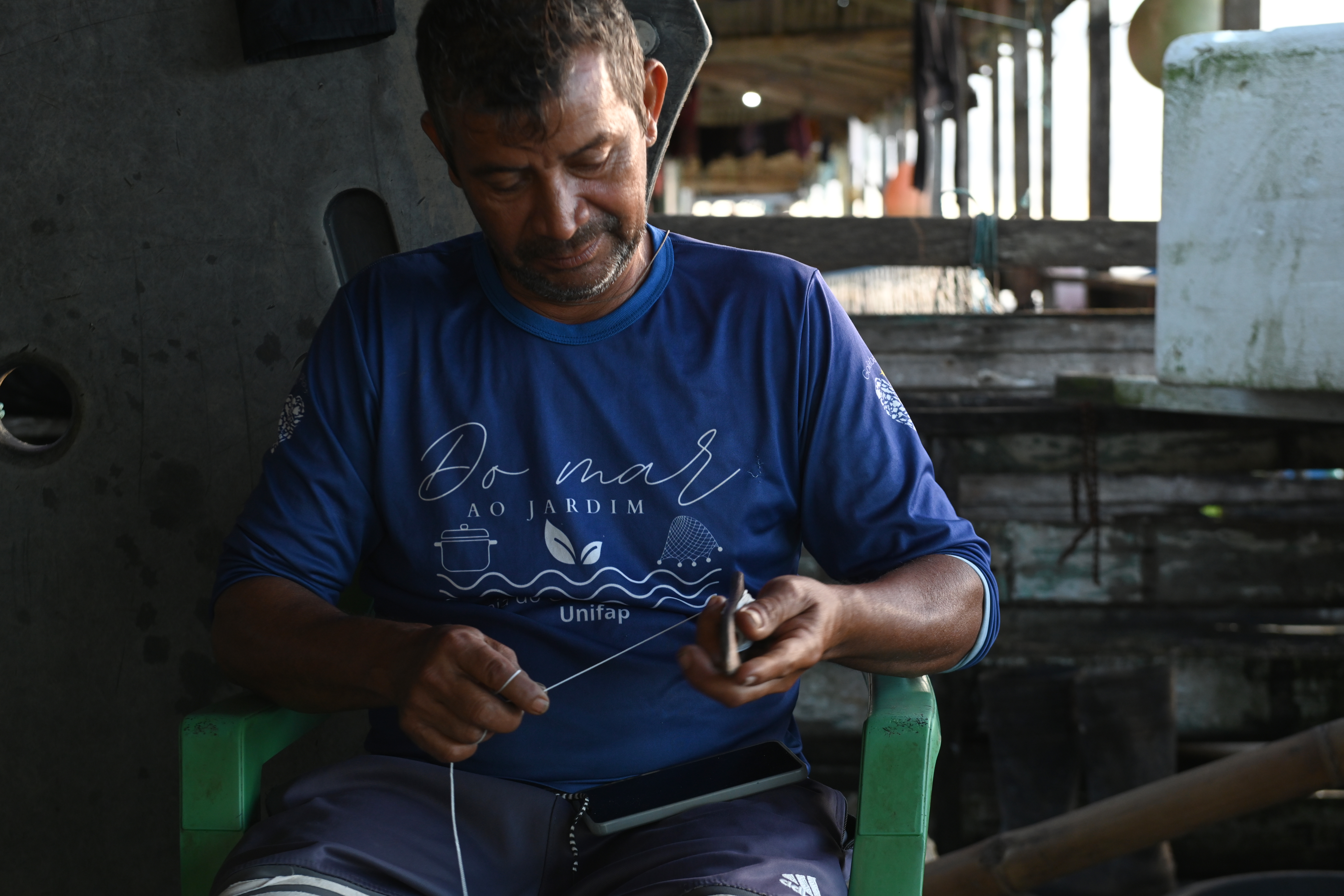
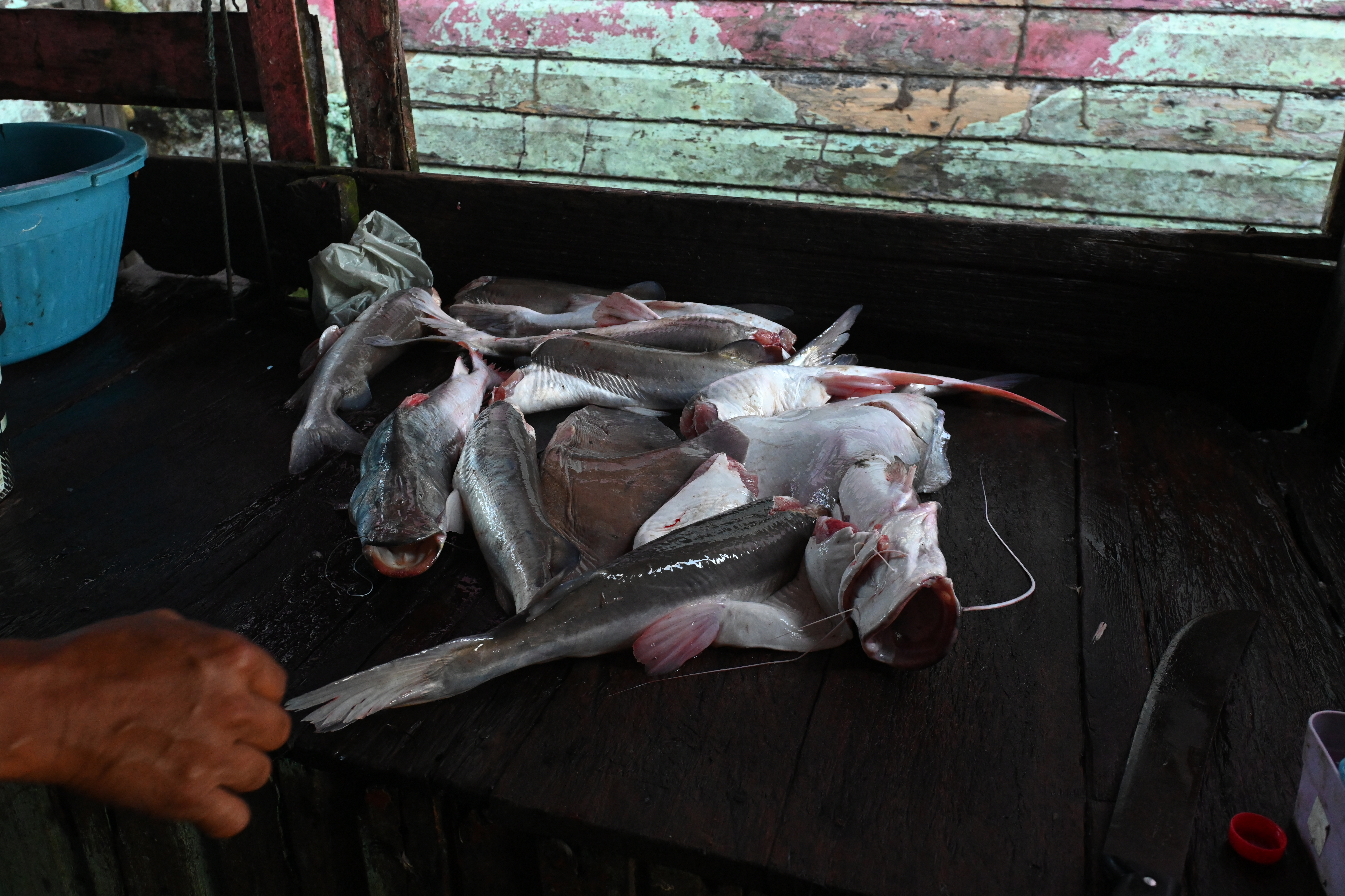
Fisherman on Goiabal beach, Osiel Barbosa Balieiro, known as Bicudinho, knows that when he finds yellow croaker, Spanish mackerel, mullet and other saltwater fish in his net, it means the lighter-colored salt water is gaining ground. But when he and his fellow fishermen return from a day’s fishing with freshwater fish — species that breed at the mouth of the Amazon, such as the gurijuba catfish, the golden croaker or the piramutaba catfish — it is a sign that the river, with its muddy color, is winning out.
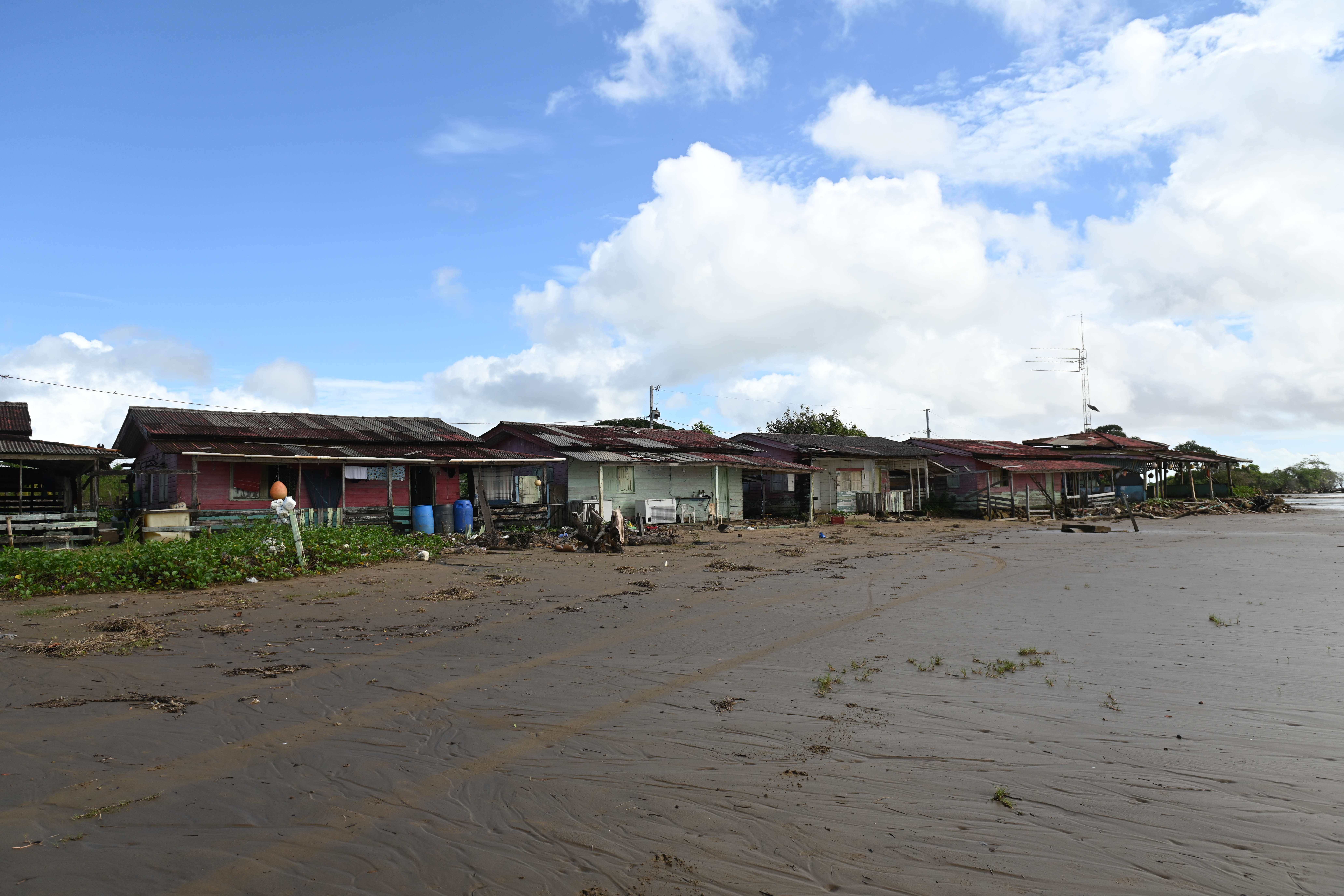
Bicudinho is 49 years old and has lived for 32 of them in Goiabal, a beach in Amapá, Brazil’s northernmost state. He says he has witnessed major changes over the years: the main one was the advancing tides. Starting in 2013, he says, so-called “surging tides” began happening more often. These are the “big water” tides that sweep over the coast. Houses, guesthouses and other tourist attractions were destroyed by the sea. Many residents have already left Goiabal, and almost only fishermen remain.
“The salt water just keeps pushing in,” says Bicudinho.
At this stretch of the coast, fishermen don’t need a boat to cast their nets into the sea. The land is so flat that the tide does the work for them. Wooden stakes with a net attached are driven into the sand at points far from the beach. The fish brought in by the tide become entangled when the sea begins to recede.
The tide can recede and advance, daily, by three to four kilometers in Goiabal. At 40 km long, the beach is one of the few stretches of sand in all of Amapá. The rest of the coast is almost entirely covered by mangroves.
Precisely because of its extremely flat topography and its location at the mouth of the Amazon, the Amapá coast is one of the most affected by rising sea levels in Brazil. On a global average, according to data from the Copernicus Marine Service, of the European Union, the sea is already about 20 cm higher than it was at the start of the 20th century, and by the end of this century projections indicate it could be up to 1 meter higher. In the region at the mouth of the great river, an unpublished analysis carried out for this report shows that in just three decades the rise was 12.4 cm.
The main reasons for the rise, according to the Intergovernmental Panel on Climate Change (IPCC), are increasing sea temperatures and melting polar ice caps, phenomena linked to ongoing climate change.
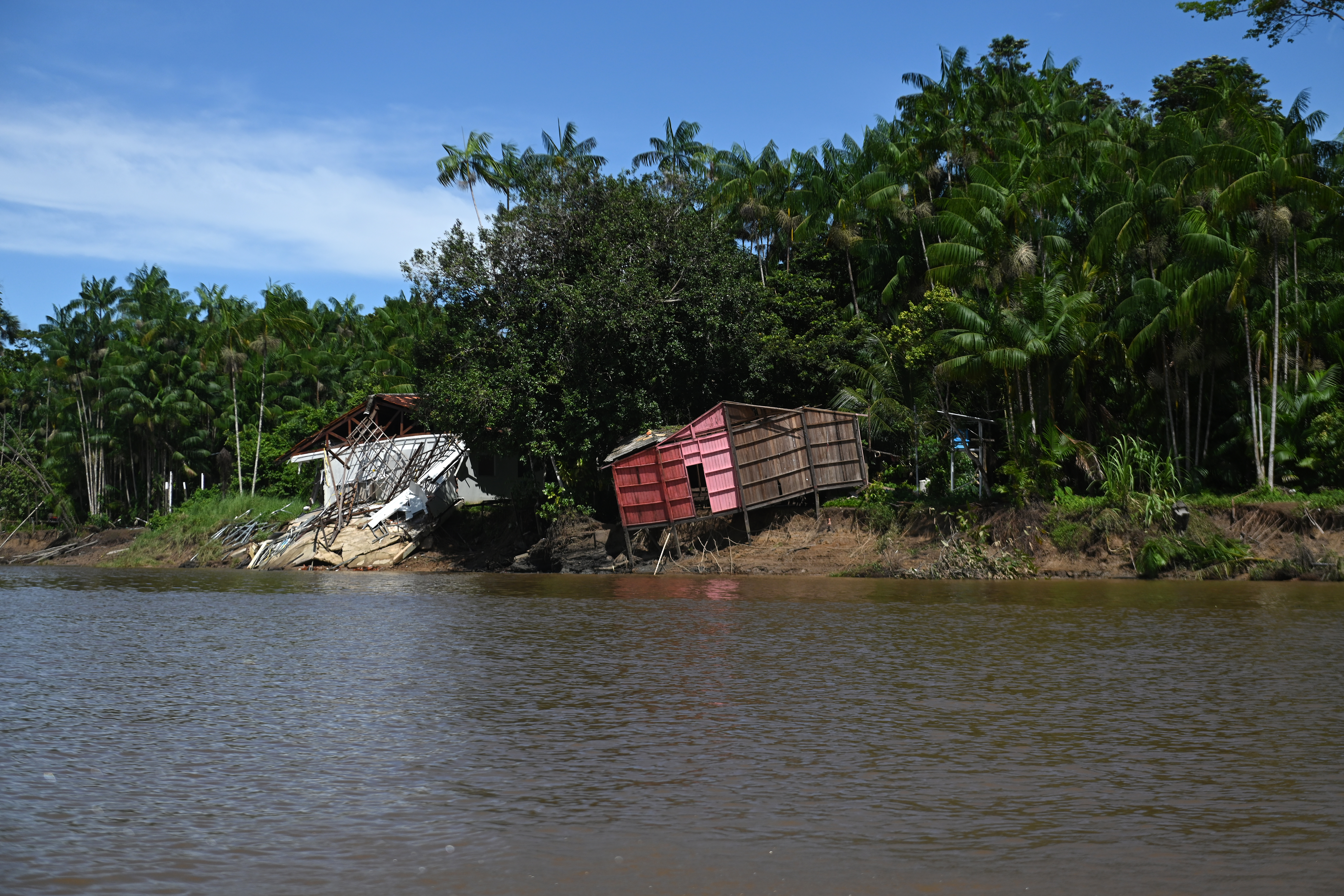
Accelerated erosion is one of the most visible signs of rising seas, but the salinization of land and streams near the coast is also felt by riverside populations and fishermen. Areas flooded for longer periods and saltier water are reshaping the local economy, which is based on fishing and gathering.
Only seven families live in Goiabal — 18 people, most of them men. Wives and children stay in the nearest town, Calçoene, where there are schools and health clinics. Meanwhile, the fishermen live in small, simple houses, equipped with just enough to work, eat and sleep.
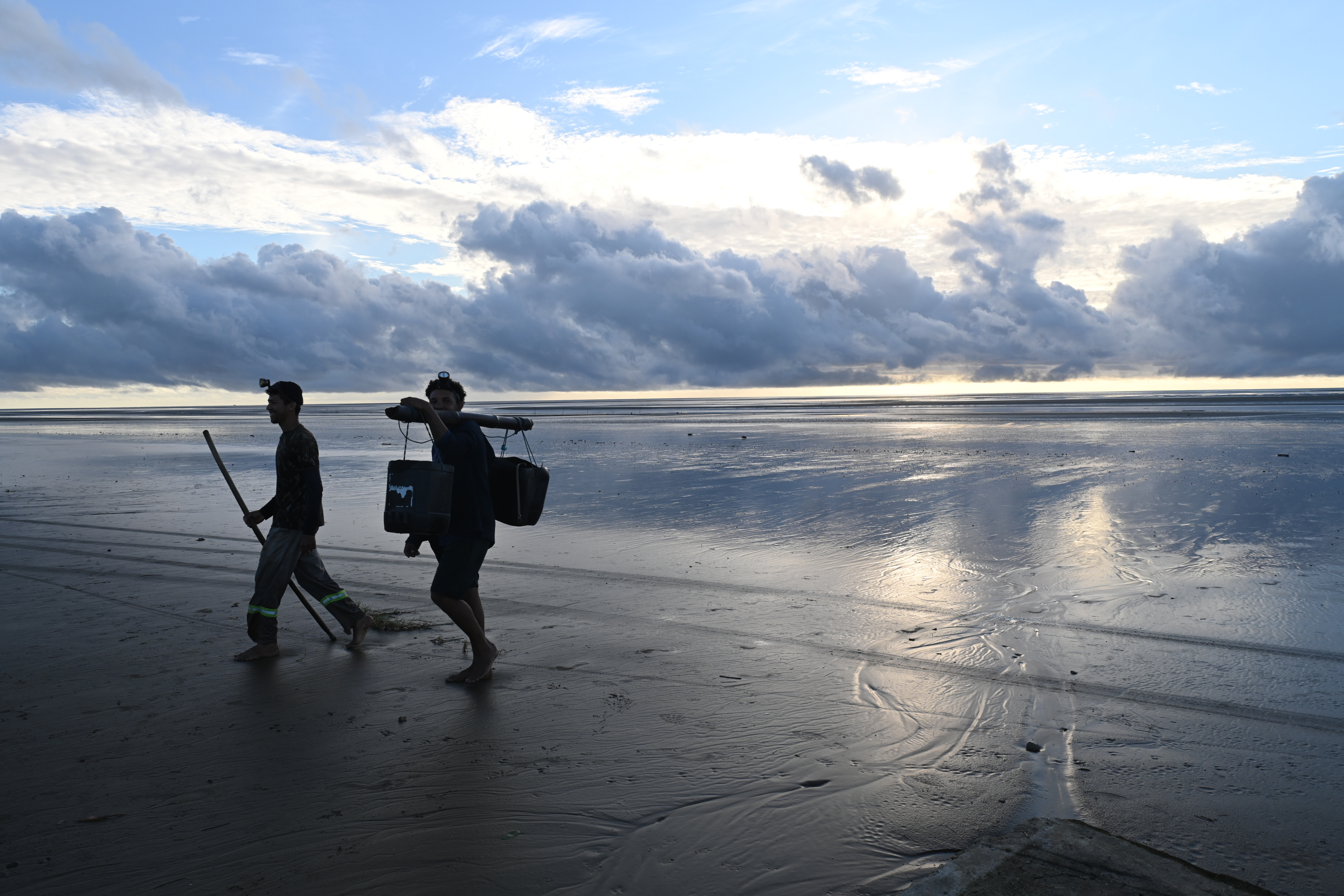
Sleep, actually, not so much. As one resident, Elita Santos, who hosted us at her guesthouse in Goiabal, observed: “these people barely sleep because they follow the tides.” If the tide starts to go out in the middle of the night, the men walk out, following the receding sea to the stakes. Once there, they collect the entangled fish and walk back, with the rising sea at their heels.
In the early hours of a May morning, a group of fishermen appeared on the horizon, their black silhouettes barely visible. As on any other day, they had followed the ebb and flow of the tide and walked six kilometers. Bicudinho’s son, Antônio, and a colleague, Pedro, had left at four in the morning as the tide was receding. They came back mostly with river fish: gurijuba and piramutaba catfish.
Besides Dona Elita’s guesthouse, one of the few businesses still operating on Goiabal beach is the restaurant run by Thiago Monteiro de Lima, 34, and his family. He and his parents moved from the Lourenço gold-mining camp, in Laranjal do Jari, 12 years ago, hoping to take advantage of tourism on one of the few beaches in Amapá. But the hoped-for new business never quite panned out. In front of the terrace where meals are served, he shows us the floor of his house. “We rebuilt this just a year ago!” Just ahead of the concrete flooring lie the ruins of the previous terrace, destroyed by the sea.
For this report, produced by InfoAmazonia for the “Divided Waters” investigation, coordinated by the Latin American Center for Investigative Journalism (CLIP) in partnership with the Serrapilheira Institute and eight regional media outlets, we visited fishing communities along the coast of Pará and Amapá. We listened to how these changes are recorded through the lens of traditional knowledge. We also interviewed researchers dedicated to understanding how these large-scale changes are altering the mouth of the river with the largest flow in the world.
Big tides
When we spoke with riverside residents, many told us that high tides used to be expected only around the full moon. In recent years, though, the change has become noticeable, and surging tides are now recorded during both full moon and new moon periods.
Residents’ perceptions match what the data show. An unpublished analysis of the Amazon river mouth region between 1995 and 2025 reveals a consistent trend of rising sea levels.
Using a Copernicus model that combines numerical simulation with satellite observations, researcher Guilherme Couto, who holds a master’s degree in Computational Modeling from the Federal University of Juiz de Fora, produced an analysis showing that, over the past three decades, sea level rose by an average of 4.13 mm per year. Over 31 years, that amounts to a cumulative rise of 12.4 cm in average sea level in the region, according to the model.
Between 1995 and 2025, more than half of the years had sea levels above the historical average, according to Couto’s analysis, part of the Serrapilheira Institute’s training program in quantitative ecology. In 2025, for example, throughout the entire period, sea level at the mouth of the Amazon stayed above that threshold. That is, even the lowest point of 2025 was still higher than the highest level recorded in years before 2010.
The data reinforce what coastal communities in the Amazon have reported: high tides are not only more frequent, but also longer-lasting.
“The red squares indicate that, in that month, the average monthly water level crossed and exceeded the height of the worst 10% of months in the reference period. The visual pattern confirms the climate change happening in the region: the first fifteen years of the chart are almost entirely blue, while the last decade turns into an almost continuous red block,” Guilherme Couto wrote in the methodological note detailing the analyses of rising sea levels.
READ THE FULL METHODOLOGICAL NOTE
Another parameter tracked in Couto’s analysis is the duration and severity of these sea-driven floods. The charts show that in recent years, up to 12 consecutive months have crossed the risk threshold. The length of critical coastal flooding is growing by 3.8 months per decade.
“The lower panel, shaded in red, shows severity. It answers the following question: in the months when the water crossed the risk line, how far above did it go? The rising slope shows that flooding is not only lasting longer, but is also becoming increasingly more intense along the coast,” he noted.
One environment, many ecosystems
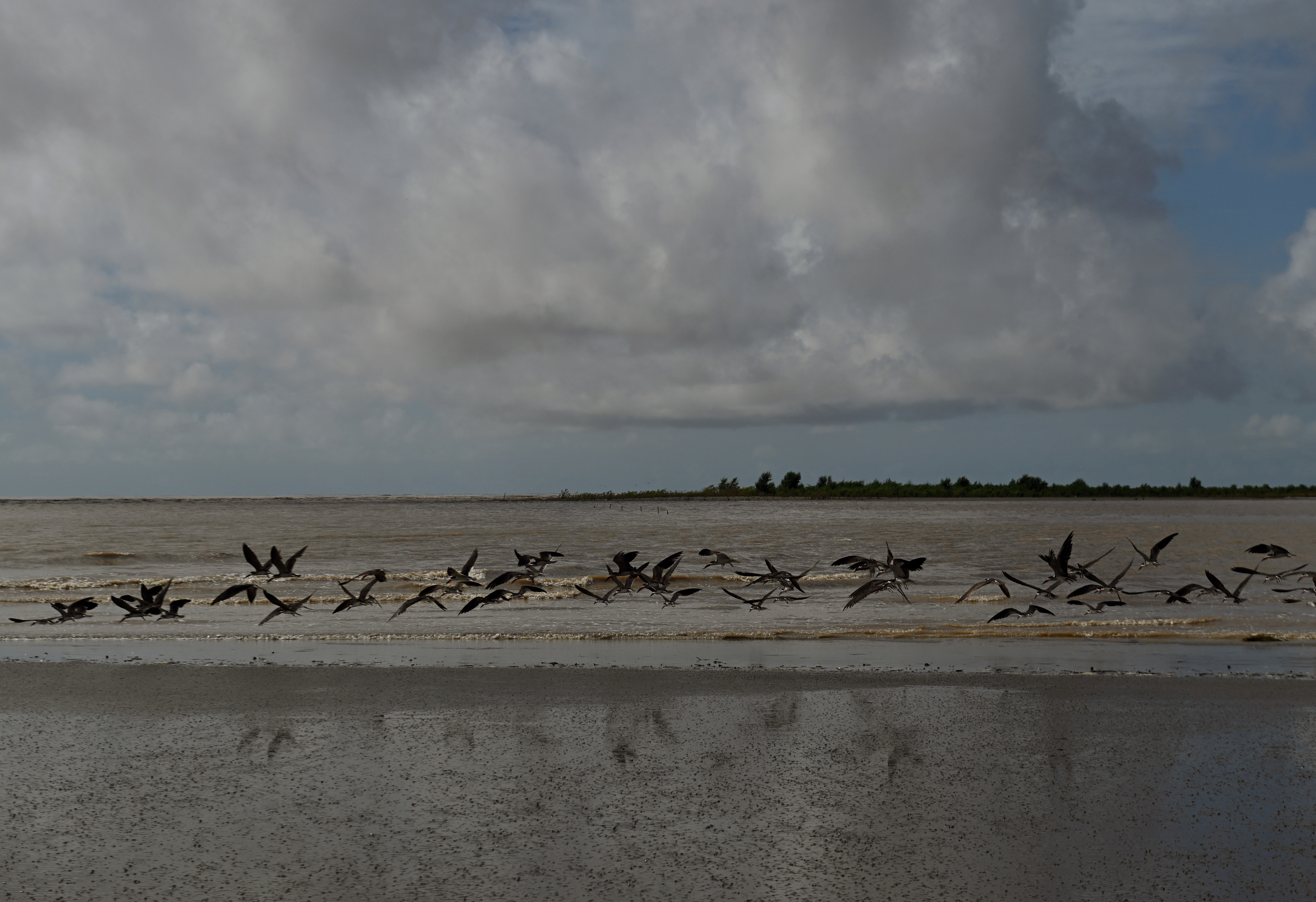
The Amazon carries out the largest discharge of fresh water into the ocean anywhere on the planet. Nearly a fifth of all the water that mixes with the sea comes from this enormous river — 17%, to be exact. That is why, when its waters meet the Atlantic, the fate of thousands of living creatures is determined. This dynamic of the plume, combined with ocean currents and winds, has created an environment that is extremely favorable to life.
Along the Brazilian Amazon coast, stretching from the state of Amapá to Maranhão, lies unrivaled marine biodiversity, including one of the largest continuous stretches of mangroves in the world. In Amazon alone, 80% of the mangrove area found across all of Brazil is concentrated. This explosion of life is also closely tied to the well-being of artisanal fishing communities and to the performance of the industrial fishing sector.
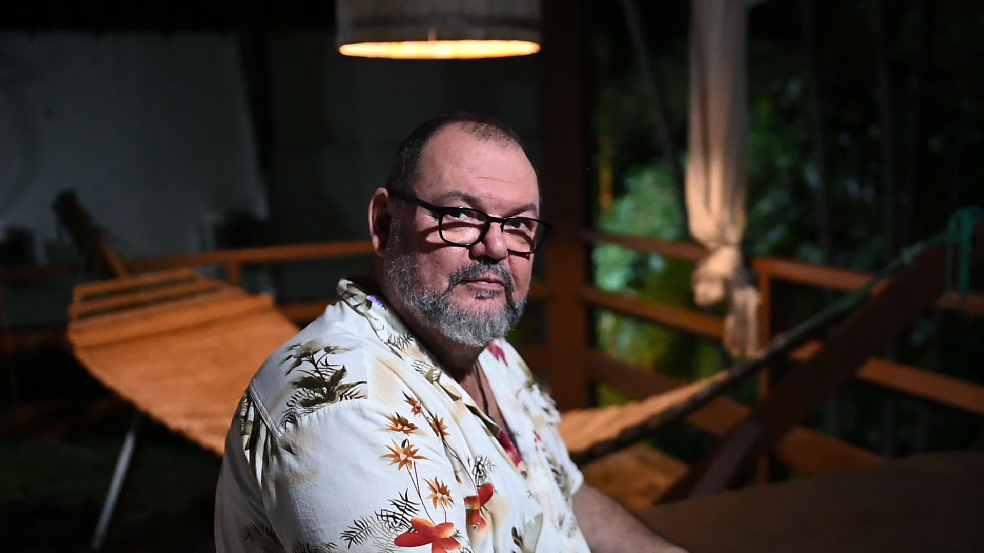
“The Amazon River plume is one of the greatest productive phenomena in the world,” says marine ecologist Eduardo Tavares Paes, of the Federal Rural University of Pará, who has dedicated the past fifteen years to studying what he calls the ‘Amazon sea.’ He says his work has involved, beyond research in the estuary itself, synthesizing many studies — “putting the pieces together,” as he puts it.
Paes explains that this unique quality of the marine environment at the mouth of the Amazon stems from the relationship between different ecosystems — the mangroves, the coral reefs and the river plume itself. That is why this Amazon sea can be considered a meta-ecosystem, that is, an ecosystem that only exists thanks to the interaction of other ecosystems. “Among these ecosystems, the plume is perhaps the most important — with its nutrients, it is an ecosystem in itself. And given its scale, it is probably the main modulator of salinity in the Atlantic,” says the researcher.
The plume, or the footprint of fresh water and nutrients, extends as far as 1,000 km out to sea during the periods of peak discharge, generally from February to April each year. It carries large quantities of dissolved nitrogen and carbon, ensuring a layer of organic matter crucial for the success of thousands of species, such as the piramutaba catfish and the yellow croaker, both caught in large numbers by industrial trawlers.
A study coordinated by the Northern Region Center for Marine Biodiversity Research (Cepnor), part of the Chico Mendes Institute for Biodiversity Conservation (ICMBio), published in 2025 identified 3,286 species living at the river mouth, many of them migratory. Considering conservation status, 67 of them are threatened at some level according to Brazil’s list of endangered species, mainly cartilaginous fish (40%), bony fish (31%) and seabirds (11%). Among the threatened fish, for example, is the dourada, a species that undertakes the largest freshwater migration in the world. Read a special report about it here.
Paes points out that we know very little about the Amazon sea, an environment on which thousands of coastal communities depend. In the so-called Salgado Paraense alone, 40,000 families make their living from the preserved mangroves and fishing at the river mouth. The Cepnor study states that “fisheries generate more than 3,500 jobs in the region, creating a market for more than 330 formal companies and 2,796 small businesses, which together generate over US$ 82 million per year in exports alone.”
Over the years, red snapper and pink shrimp have been the region’s main export products, while species such as the dourada and the piramutaba catfish — a migratory catfish with life cycles split between river and sea — serve mostly the domestic market.
“We know much more about the forest and what happens in the Amazon’s inland areas. There are years of research on the Amazon’s terrestrial issues and few resources devoted to marine issues,” the researcher notes.
Intensification of the hydrological cycle
Some scientists, including Paes himself and colleagues at Brazil’s National Institute for Space Research (INPE), have been drawing attention to what they classify as an intensification of the hydrological cycle in the Amazon. That is, magnified wet and dry seasons. According to research published using measurements from rainfall stations and river-flow gauges, rainfall intensity has increased in recent decades. That increase has also been captured in the Amazon’s discharge.
There is a “synergistic effect” between the greater volume of fresh water arriving at the river mouth and the warming of Atlantic waters. Rising ocean temperatures push more water vapor into the atmosphere, which increases the intensity of the rainy season. That greater volume of water gives the river more force against the sea, but, in fact, the following dry season is also more intense, precisely because of the heat generated by the amount of moisture in the atmosphere.
Researcher Nelson Gouveia, who works with Brazil’s National Institute for Space Research (INPE) and is now affiliated with the University of Victoria, in Canada, investigates how climate change and deforestation may affect the environment at the mouth of the Amazon. Together with colleagues from INPE, he published a paper in 2019 describing the intensification of the hydrological cycle and how it relates to deforestation in the Amazon.
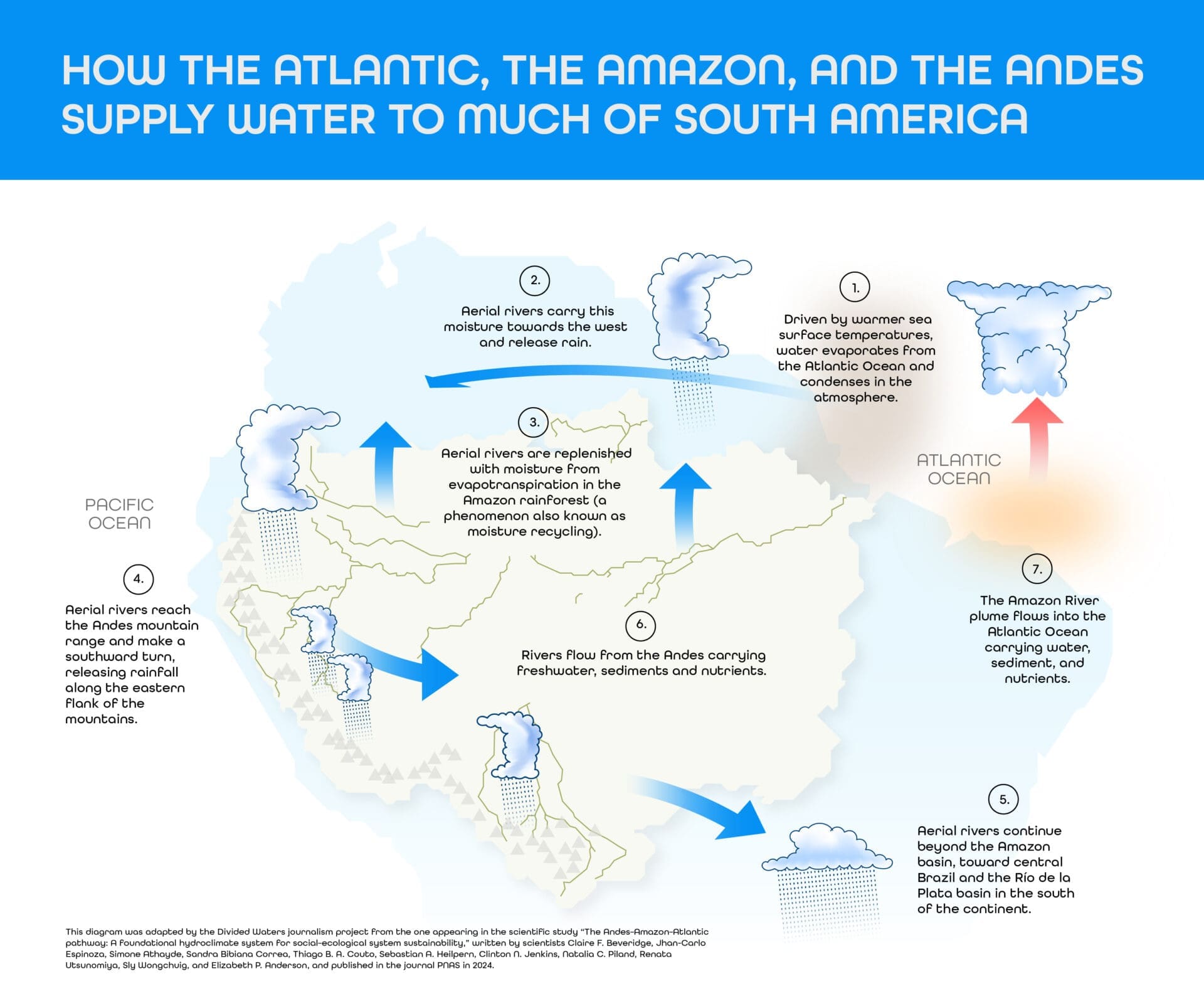
“We are deforesting the Amazon. This means the water that falls stays in the basin for less time. In other words: it rains, and the water is already draining out to the mouth and falling into the sea. That changes the resilience of the basin, as the water leaves too quickly. So the process of evapotranspiration, the formation of ‘flying rivers,’ is affected,” explains Gouveia.
Another growing body of research examines how deforestation could affect the behavior of the Amazon plume in the future. In an as-yet-unpublished paper under review, Gouveia and INPE researchers modeled what the impact would be if deforestation were to resume growing in the coming years. A projected loss of 45% of the Amazon’s vegetation shows that the discharge of tributary rivers south of the Amazon Basin could fall by 50%. In other words, even though climate change may be driving an increase in precipitation, the long-term trend, the researchers point out, is toward a reduction in the amount of water.
Citizen science to understand the changes
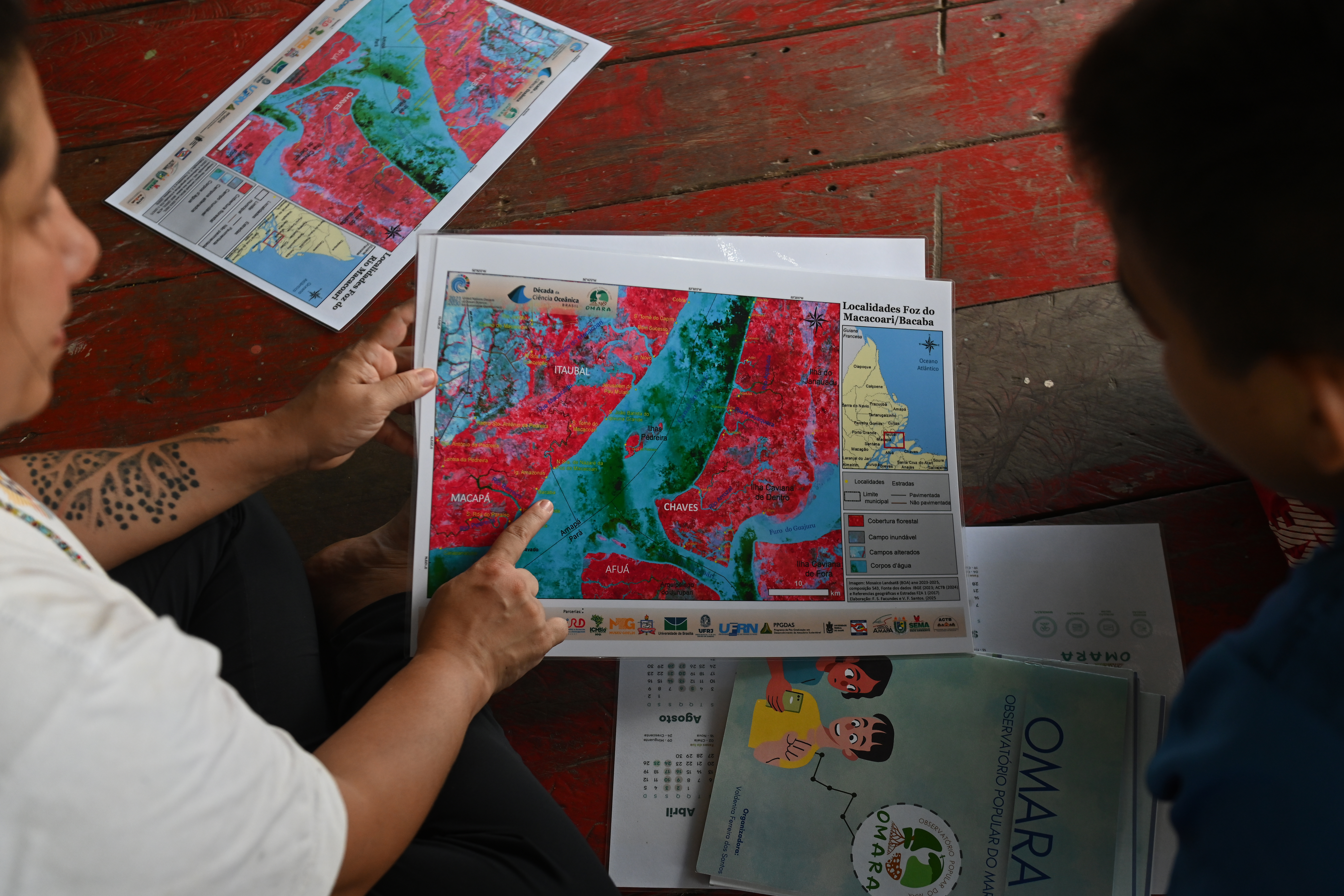
To track the changes brought about by rising sea levels, such as erosion and the problem of saltwater intrusion, researchers from the State University of Amapá (UEAP), together with IEPA, the state’s research institute, created the Popular Sea Observatory (OMARA), in partnership with riverside and coastal communities.
The observatory has already carried out measurements at 72 locations in 11 communities since 2022. The project, funded by Brazil’s National Council for Scientific and Technological Development (CNPq), promotes the use of citizen science in investigations into the impacts of climate change. Its methodology involves doing research with the support of community members in data collection and interpretation.
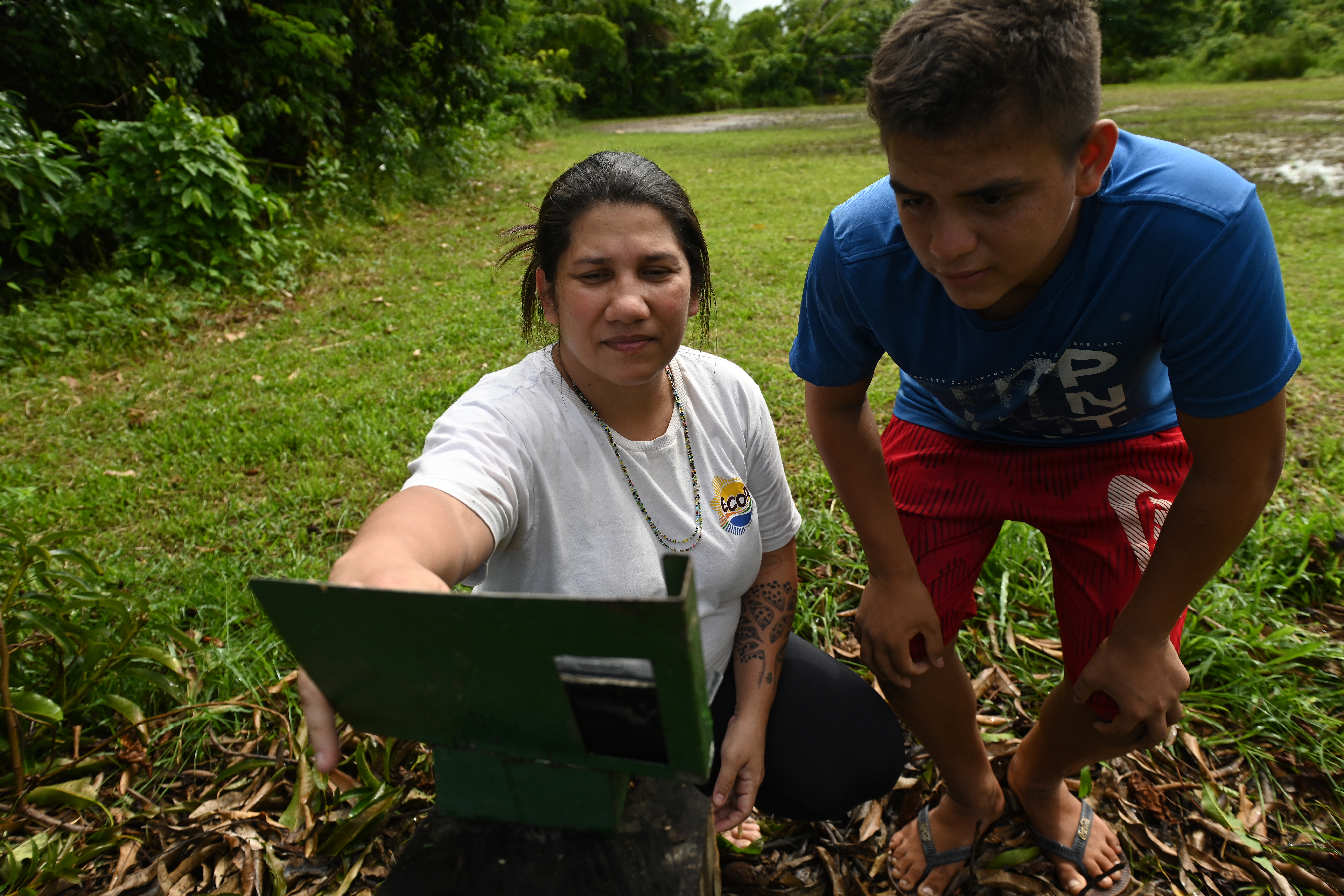
In May, the author of this report and an InfoAmazonia photographer accompanied an OMARA project mission to communities in the Lower Amazon, located roughly 100 km from Macapá, the capital of Amapá. Although these communities are dozens of kilometers from where the Amazon meets the Atlantic, they are directly affected by high and low tides. In the community of Bacaba, on the river of the same name, researcher Janaína Freitas Calado recruited a young community member to measure the rate of erosion caused by high tides.
Janaína works on community mobilization and was showing the new citizen-researcher, 16-year-old Diogo Araújo da Costa, how to position a cellphone on a fixed metal stand near the riverbank. The photos collected are sent by the monitors in a WhatsApp group, along with information about topographic changes caused by tidal erosion. The student, who is in ninth grade, must also record the frequency of surging tides on a project form.
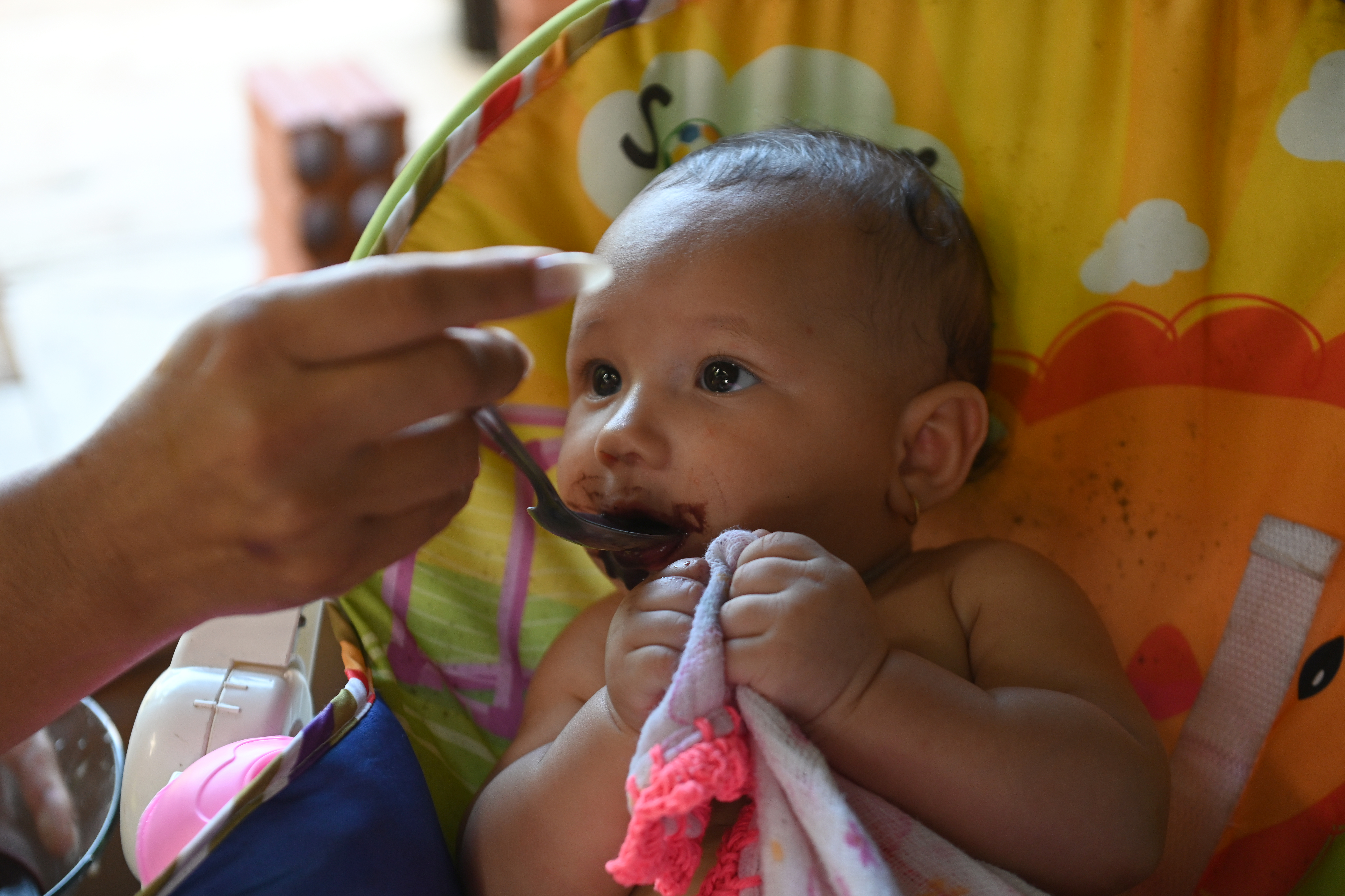
In Bacaba, Nelito Corrêa da Costa was the community’s pioneer, having inherited the land from his grandfather. When our reporting team arrived in the village, home to 33 families, the remains of a big party celebrating Mr. Nelito’s 70th birthday were still scattered around the community center. They had celebrated the community’s history, kept alive in the patriarch’s memory. In a conversation in his kitchen, where his one-year-old grandson was enjoying some açaí, he pointed out to us the impacts of climate change he has witnessed over his lifetime.
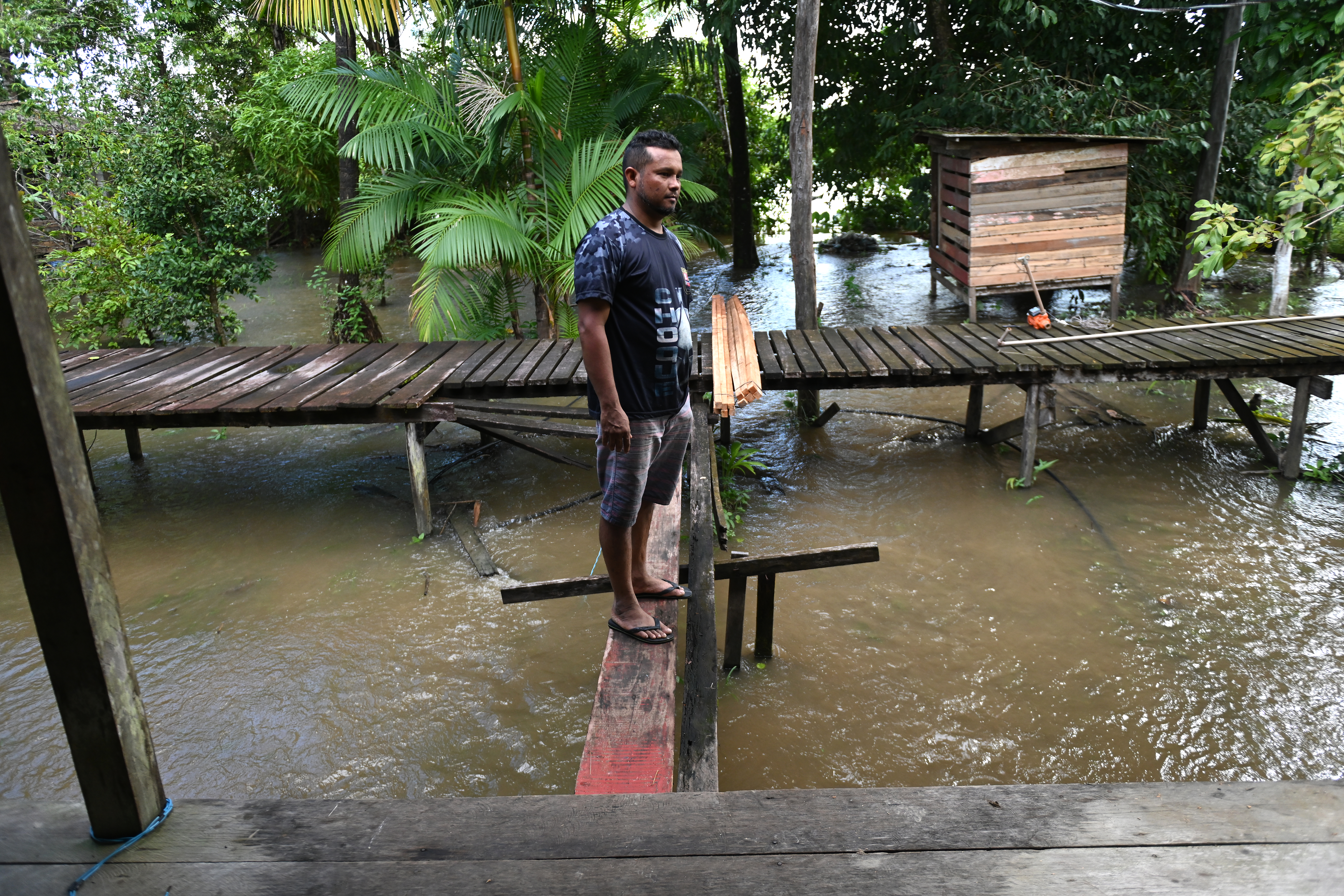
In his perception, “it’s much hotter now,” and high tides are far more frequent. “Now it’s constant,” he says, pointing to the water beneath the raised boards of his house. That is why, he says, he supports the citizen science project run by the university. “It’s very important to understand what’s changing,” he states.
On one hand, Corrêa worries about the intensity of the tides. On the other hand, he and his relatives have seen a boost in açaí production, since the variety found in this part of the Amazon depends on flooded land to bear a fruit that is now valued internationally. With higher tides lasting longer, the açaí harvest has improved.
In the community of Nossa Senhora de Nazaré, about 10 kilometers from Bacaba, the Macacoari River meets the Amazon. Aldemir Santos Corrêa says that in recent years some houses in the community have had to be removed because of erosion. As he spoke with InfoAmazonia, the tide was rising beneath the boards of his own house. One of Aldemir’s daughters, 9 years old, listened, frightened, as her father told us: “in 15 years, this part of the territory won’t exist anymore.” At the school she attends, Omara researchers installed a ruler to track the tide cycle — a way of involving younger generations in the effort to understand how their territory is undergoing complete transformation.
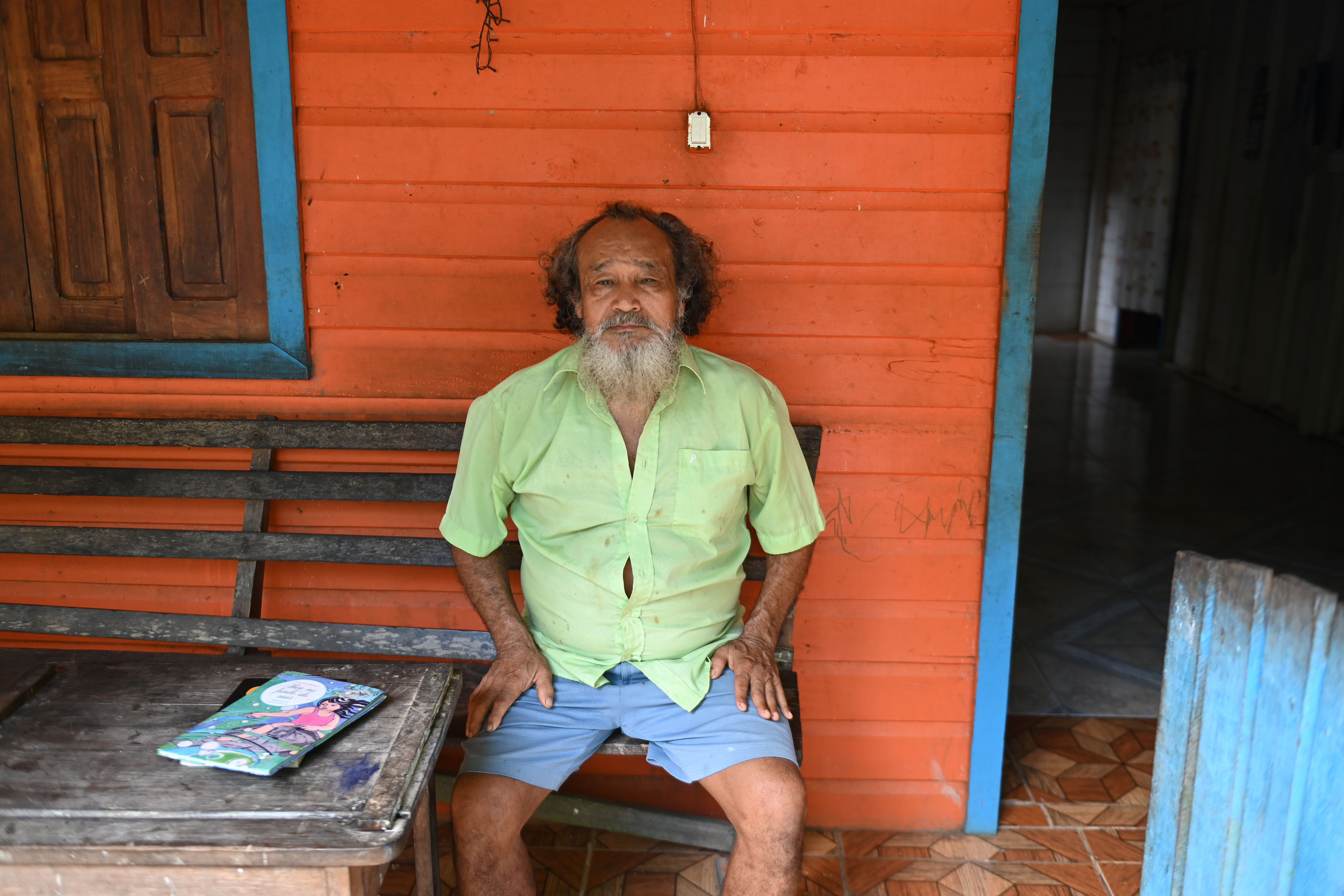
Aldemir’s father, Paulo Edilson Corrêa, known as Seu Martinho, is the oldest person in the community. He confirms the sense that rain, floods and droughts no longer follow a regular pattern. “We’re at the end of May and we have a huge amount of water,” he observes. Like his relatives in the Bacaba community, he notes that it has now become possible to harvest açaí all year round. “Summer is shorter.”
Geographer Valdenira Ferreira Santos, a researcher at IEPA and one of the founders of OMARA, is one of the longest-standing scholars of the ongoing changes at the mouth of the Amazon, especially along the coast of Amapá. “We can observe cycles related to the El Niño and La Niña phenomena. But the intensity of these cycles is increasing,” she notes, describing the extreme floods and droughts in the Amazon.
She stresses the importance of taking measurements in order to know what may happen to the communities, the economic activities and the biodiversity of the region. “With the measurements, we confirm what the older generations report. Our work is meant to make this knowledge visible,” she said.

Impacts on fishing
The transformation at the river mouth is reshaping one of the most vital sectors of the Brazilian Amazon’s economy: fishing. Pará ranks second in fishing activity nationwide, trailing only Santa Catarina. Beyond supplying strong regional demand, the state exports fish to other regions and trades valuable byproducts, such as swim bladders — known locally as “grude” — which are highly prized by foreign markets, particularly in China.
In Pará, three species vital to the fishing industry are closely tied to the rhythm of the tides: the piramutaba catfish, the yellow croaker, and the dourada. Other species, such as pink shrimp and regional freshwater shrimp, also play a major role in regional cuisine and drive significant revenue for local fishing companies.
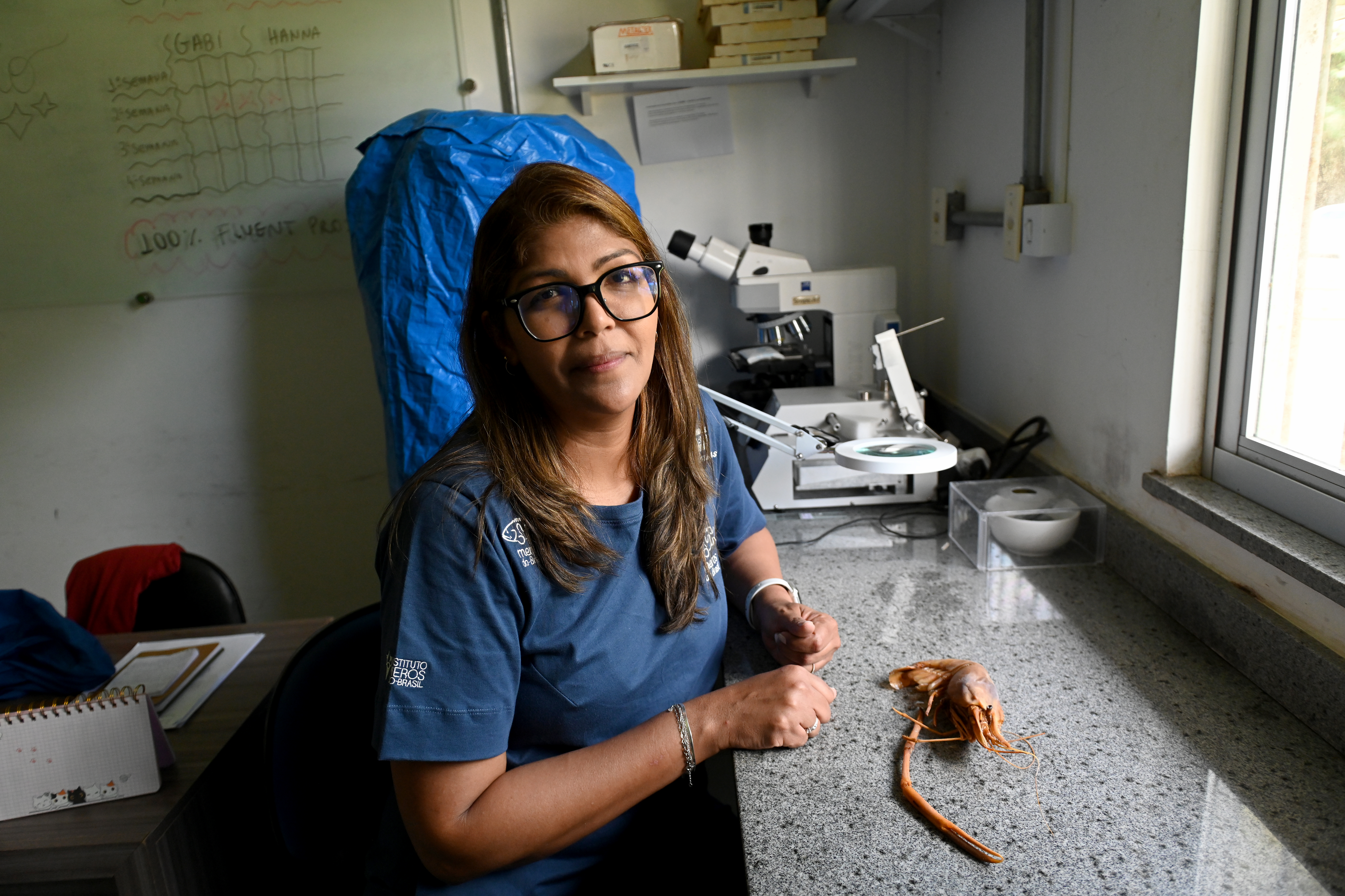
Professor Bianca Bentes from the Federal University of Pará (UFPA) notes that, despite the scarcity of data, most harvested fish species at the mouth of the Amazon are likely in decline. She recalls that two decades ago, while researching for her master’s thesis, regional freshwater shrimp could still be found in the streams of Belém, even at the university campus. Today, they have completely disappeared.
“In fact, some municipalities that used to hold a shrimp festival no longer do, because there’s no more shrimp. Our hypothesis is that it was caused by the salinization of water. Either they are disappearing, actually dying off, or they are moving to other places,” Bentes said in an interview on the UFPA campus in Belém.
The researcher notes that recent events demonstrate how fish and crustaceans are responding to environmental shifts. As an example, she pointed to the record piramutaba harvest in 2025. According to Bentes, the fishing industry at the river mouth achieved these strong results due to the severe drought that impacted the entire Amazon basin the previous year. Because migratory fish rely on the river’s natural flow to navigate upstream from the mouth, the piramutabas likely halted their migration in response to the drought.
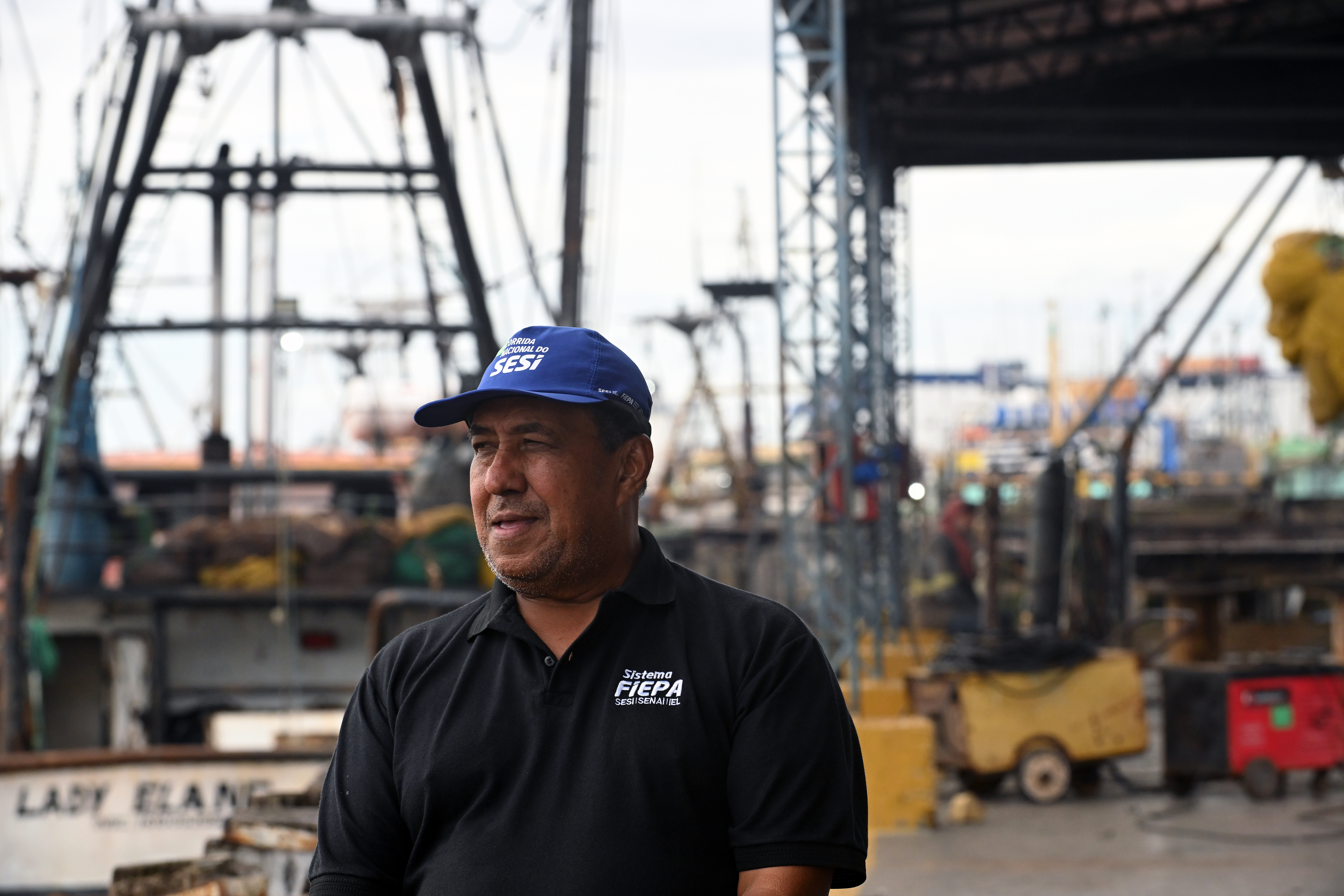
The president of Pará’s fishing industry union (Sinpesca), Apoliano Oliveira do Nascimento, disagrees with the hypothesis raised by Professor Bianca Bentes. According to him, catches in the sector keep shrinking, and it would not be accurate to say the changes are being caused by climate change. For him, fuel and labor costs are the main reason behind the sector’s decline. Changes in regulations for shrimp exports to the American and Japanese markets, he says, have also directly affected the industry.
Considered one of the leading fishing businessmen in Pará, Nascimento owns 24 vessels, half of which, he says, have been out of operation for the past two years. “A boat costs around R$300,000 to operate these days. That’s the cost of spending 50 days at sea. The shrimp fishing grounds along the northern coast are enormous. […] The price of our product hasn’t kept pace with the cost of operating,” says the Sinpesca president.
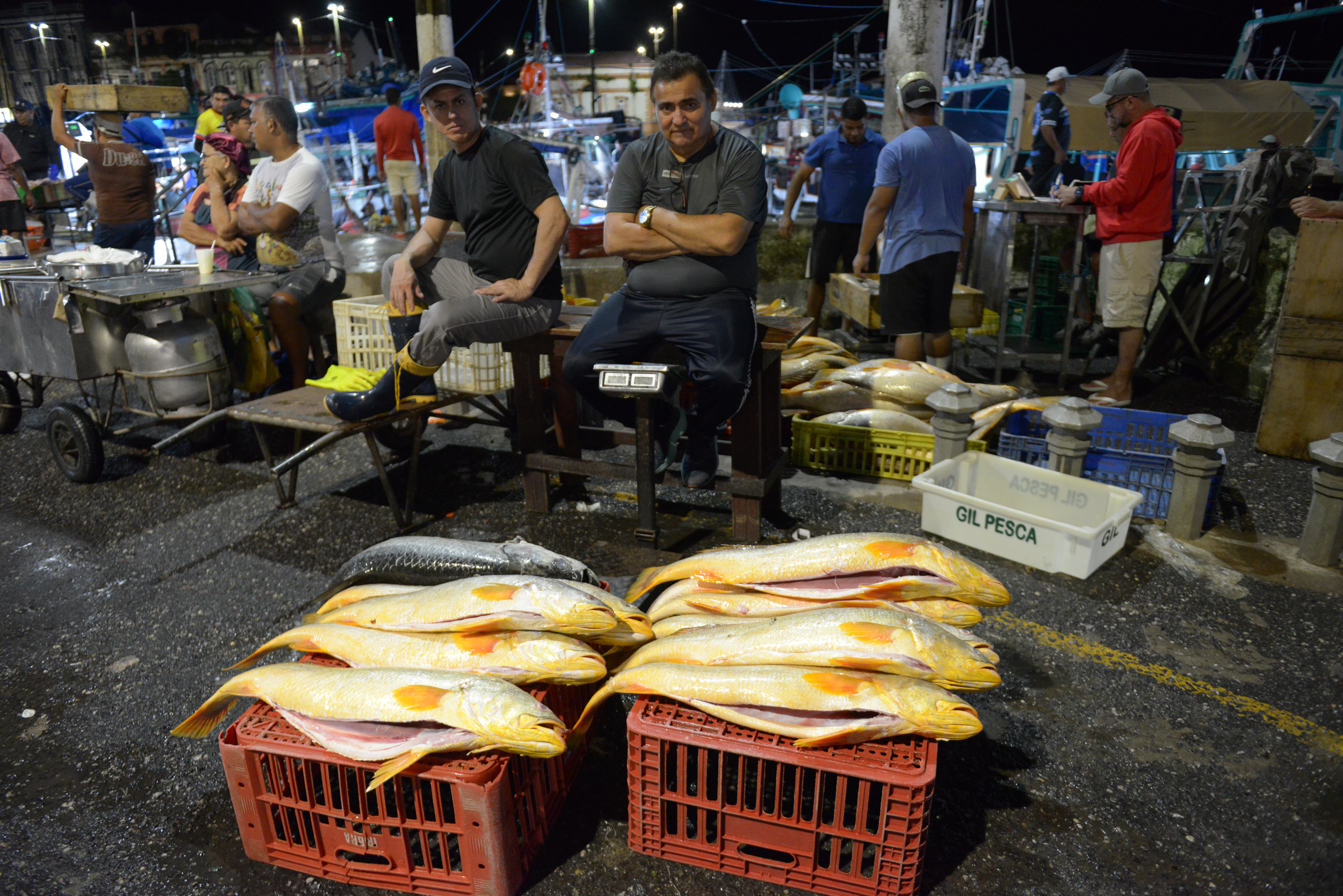
At the famous Ver-o-Peso Market in Belém, one of Brazil’s main fish trading hubs, another businessman, known as Gil da Pesca, complains about working conditions but also reports changes in seasonality. His business is selling yellow croaker, one of the most sought-after species, found offshore along almost the entire Amazon coast, from Maranhão to Amapá. For years, the fishing season for this species was concentrated in the driest periods, starting in May. Now, not only does yellow croaker show up out of season, but it is also hard to find the large specimens once common, the businessman explained during a meeting at Pedra do Peixe, the traditional landing point for fishing vessels in Belém.
His role as a shipowner involves providing financial backing to fishing vessels. In the yellow croaker fishery, these businessmen finance mid-sized boats that spend weeks at sea before sharing the returns from the catch. It is a high-risk venture, as the yield may not always cover the initial capital investment. Like Apoliano Nascimento, Gil points to the rising costs of operating a large fleet. With declining fish catches alongside soaring fuel and supply prices, margins continue to shrink.
Many open questions remain regarding how these transformations at the mouth of the Amazon — driven by sea level rise and climate change — will impact the livelihoods of artisanal fishermen, like those in Goiabal, as well as commercial operators like Apoliano and Gil.
Urged by these unanswered questions, scientists continue to investigate and warn against the toll of these transformations. These threats are no longer distant; they are steadily encroaching upon coastal communities and an economy that relies entirely on the interplay between the Amazon and the Atlantic.
Referências científicas
Serviço do Meio Marinho Copernicus Scientific references1. Copernicus Marine Service.(Consultado em julho de 2026). (Accessed July 2026) https://marine.copernicus.eu/pt
Contribution of the Amazon River Discharge to Regional Sea Level in the Tropical Atlantic Ocean. Por Pierrick Giffard et al. (2019) https://www.mdpi.com/2073-4441/11/11/2348. By Pierrick Giffard et al. (2019)
Ramsar Sites Information Service – Amazon Estuary and its Mangroves
(Consultado em agosto de 2026) https://rsis.ramsar.org/ris/2337?__goaway_challenge=meta-refresh&__goaway_id=f64ef1081acf82c59eb149afc35a015a
Ramsar Sites Information Service – Amazon Estuary and its Mangroves. (Accessed August 2026)
Expedição científica registra megadunas submarinas, cânions gigantes e enorme biodiversidade no fundo do mar – Site UFRA. (consultado em julho de 2026) https://novo.ufra.edu.br/index.php?option=com_content&view=article&id=4035&catid=17&Itemid=121
Expedição científica registra megadunas submarinas, cânions gigantes e enorme biodiversidade no fundo do mar – Site UFRA. (Accessed July 2026)
Meta-ecosystems: a theoretical framework for a spatial ecosystem ecology. Por Michel Loreau et al (2003)
https://onlinelibrary.wiley.com/doi/abs/10.1046/j.1461-0248.2003.00483.x
The Role of the Amazon River Plume on the Intensification of the Hydrological Cycle. By Michel Loreau et al (2003). Por N. A. Gouveia el al (2019) https://agupubs.onlinelibrary.wiley.com/doi/10.1029/2019GL084302. By N. A. Gouveia et al (2019)
Biodiversity hotspots and threatened species under human influence in the Amazon continental shelf. Por Alex Klautau et al (2025) https://www.nature.com/articles/s41598-025-11261-x
Intensification of the Amazon hydrological cycle over the last two decades. Por M Gloor et al (2013) https://agupubs.onlinelibrary.wiley.com/doi/full/10.1002/grl.50377
Biodiversity hotspots and threatened species under human influence in the Amazon continental shelfBy Alex Klautau et al (2025)8 – Intensification of the Amazon hydrological cycle over the last two decades. By M Gloor et al (2013)
Projected Amazon forest loss alters tropical Atlantic circulation and surface heat exchange through reduced freshwater input. Por N.A. Gouvea et al (Pre-print – 2026). https://assets-eu.researchsquare.com/files/rs-9752662/v1/6f8b6752-66ed-480f-81c1-5fe58051fe1b.pdf?c=1782788418 By N.A. Gouveia et al (Pre-print – 2026)

This project is the result of a collaboration between Latin American journalists and scientists, spearheaded by Brazil’s Serrapilheira Institute and the Latin American Center for Investigative Journalism (CLIP), to explore the Atlantic-Amazon-Andes water pathway and the disruptions to the ecosystem services it provides to the continent.


