

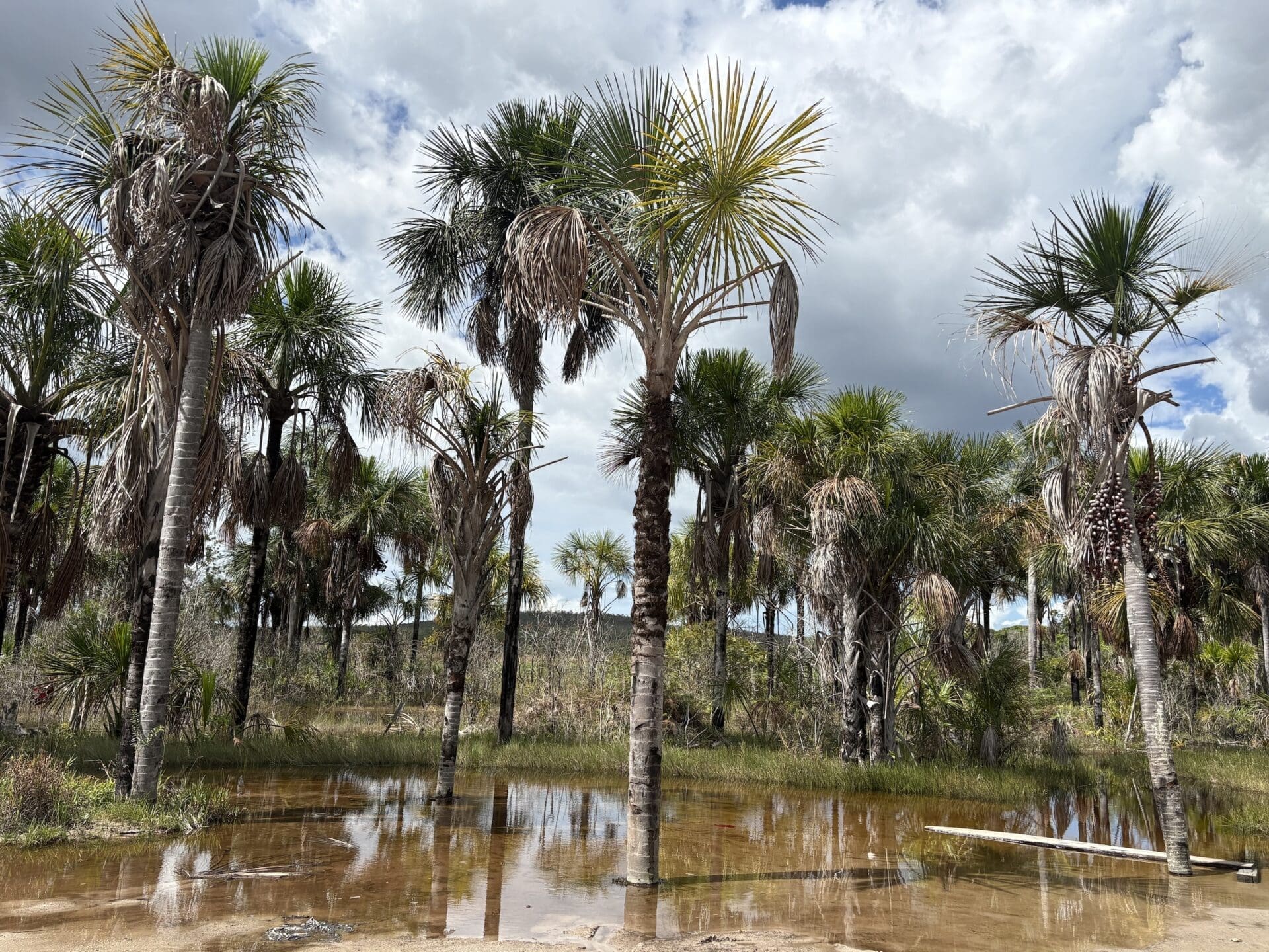
In Apoipó, a Pemón indigenous community on the Kukenán River in the Venezuelan Amazon, there is no room for half-measures. Frankly and without mincing words, its chief Constantino Díaz supports mining, as — he insists — they have no other means of survival. The rise in gold mining has already led to the disappearance of a morichal (Mauritia wetland) and the Morompo Deuta lagoon, where locals used to fish and bathe as children. “Everything is polluted; even the little fish in the Kukenán River are polluted,” laments indigenous leader José Bolívar.
Por: María de los Ángeles Ramírez (Correo del Caroní)
Much has changed around the indigenous community of Apoipó in the Gran Sabana municipality, in the south-eastern corner of Venezuela, just a few kilometres from the border with Brazil. The Amazon rainforest along the winding route to the community is no longer as lush as it was decades ago; the animals they used to hunt — deer, guan and guácharos (oilbirds) — are no longer abundant; the river is no longer crystal-clear; and the climate has changed, with residents now perceiving it as hotter. However, what has endured since the elders were children is gold mining, which, as they themselves recount, dates back more than six decades.
José Bolívar, aged 65, secretary of the community captaincy of the Pemón indigenous people, recalls the old mining machines that operated in the Amazonian territory as metallic giants beneath which he used to walk as a child. The machines belonged to mining concessions. Bolívar states that “when the community was organised in 1952, mining was already taking place”, a claim that cannot be verified by satellite imagery, as the first satellite dedicated to monitoring the Earth’s surface, Landsat 1, was launched 20 years later. “When the first company left, another one came. When (Hugo) Chávez became president, the system changed, but the community continued to work using traditional methods and engines.”
In the years that followed, mining intensified even further with the economic crisis in Venezuela. This was despite the fact that these territories do not fall within the boundaries of the state-run Orinoco Mining Arc megaproject, which crosses the Amazon on the southern bank of the Orinoco River. Consequently, mineral extraction on the territory of the Pemón indigenous people is illegal.
As well as those massive iron machines digging into the earth in search of gold, Bolívar recalls a huge lagoon surrounded by morichales (Mauritia palmtrees). It was known as Morompo Deuta. In Spanish, ‘morompo’ means ‘wax’ and ‘deuta’ means ‘hole’. According to the Pemón worldview, an anaconda with a wax head lived in this body of water. The community and visitors used to fish there. “That no longer exists; now everything is polluted (…) There are still lagoons where no waste is dumped, but the little fish in the main river, the Kukenán, are polluted,” he laments.
Apoipó stands out in any satellite search due to the vast mining scars on the land, but also because of the dredging activity on the River Kukenán – as the first stretch of the River Caroní is known from its source. It is the main waterway of the Caroní basin, in the lower reaches of which there are three hydroelectric power stations, including the Simón Bolívar plant at Guri, which supplies over 60% of the country’s electricity demand.
This area stands out not only for this reason, but also due to the loss of detected natural water bodies and the emergence of what scientists call ‘anthropogenic water’ associated with mining, according to maps produced by MapBiomas, a consortium of non-governmental organisations in the Amazon that maps land-use changes and the evolution of water bodies subject to multiple pressures. By ‘anthropogenic water’, they refer to surface water bodies created or altered by human activity such as mining. In this case, these are the blue-green lagoons near mining pits, wells into which mining waste is directly discharged, and accumulations of water resulting from extractive activities.
The disappearance a decade ago of the lagoon at Apoipó – a habitat for the wax-headed anaconda, just a few kilometres from the village – serves as a warning of the growing interest in the minerals beneath the Amazonian soil on the part of locals and international companies. This interest increased after the United States deposed and captured Venezuelan President Nicolás Maduro in January 2026. Months later, the government approved a reform of the Mining Act that opened the extractive sector to foreign capital.
The situation in Kukenán is not an isolated problem. Correo del Caroní and Mongabay Latam surveyed four rivers, identified with the support of scientists from MapBiomas and the quantitative ecology training programme at Brazil’s Serrapilheira Institute, as part of the ‘Divided Waters’ investigation coordinated by the Latin American Centre for Investigative Journalism (CLIP) in partnership with eight media organisations in the region.
In total, this journalistic alliance analysed 722 micro-watersheds in four countries—63% of which are located on the territory of at least 96 indigenous peoples—using information from the MapBiomas Agua platform. The results are striking: a pattern of loss of natural water and an increase in anthropogenic water associated with human activities, with far-reaching consequences not only for the environment but also for society.
In Venezuela, the Caroní River basin has the second-highest rate of water surface loss in the country. In Peru, half of the micro-basins studied recorded an increase in artificial water, with 99.7% of this increase concentrated in those with both legal and illegal mining activities. In Bolivia, micro-watersheds with illegal mining gained 22% of their water surface area over 24 years, while those with no mining lost 17%. In Colombia, where deforestation due to cattle ranching is the dominant pressure, there are micro-watersheds where cumulative deforestation covers more than half the territory, and the most deforested ones are also losing water.
Across the four watersheds, using the same methodology, a more nuanced pattern emerges: one in six micro-watersheds loses natural water and gains artificial water simultaneously in the same location, with far-reaching consequences not only for the environment but also for society. In the Apoipó area, the area of detectable natural water bodies decreased from 200 to 43.2 hectares (a 78% decline) over two decades.


Decades of mining on the edge of Canaima
The Kukenán River is born from a tepui, one of the giant flat-topped rocky plateaus that emerge in the eastern part of Canaima National Park and which, for the Pemón people, are sacred mountains. Whilst this area attracts tourists who choose to undertake the popular excursion to the Roraima tepuy, the western section of the park is home to the Auyantepui and the Churún-Merú or Kerepakupai-Merú — known as Angel Falls — the world’s highest waterfall, set in an ecosystem so unique that it has been immortalised in works such as Arthur Conan Doyle’s The Lost World and the Pixar film Up.
Owing to its immense biological and scenic value, the three-million-hectare national park — almost the size of Belgium — was declared a UNESCO World Heritage Site in 1994.
The community of Apoipó is nestled on the left bank of the River Kukenán, which forms the natural boundary of Canaima National Park, some 100 kilometres downstream from its source on the tepuy of the same name. Apoipó currently has around 700 inhabitants, a figure that rises if the other seven villages in the same area are included.
The elders recall that at least six decades ago there were formal mining concessions, approved by the government, which drew locals into this activity alongside farming. “Our ancestors were against it, but out of necessity and due to the lack of services, it went ahead, even against the elders’ wishes,” says Bolívar.
Gold mining has grown in recent years in the Venezuelan Amazon, a region covering 51% of the national territory, according to the boundaries defined by the Amazonian Network for Geo-referenced Socio-environmental Information (RAISG). The organisation has highlighted that most of the forest loss in each Amazonian country between 1985 and 2022 took place outside Indigenous Territories (ITs) and Protected Natural Areas (PNAs), but some countries experienced significant impacts on their ITs and PNAs, as in the case of Venezuela, where 45 per cent of forest clearance occurred within these areas.
An investigation by the Venezuelan media outlet Armando.info found that, as of 2021, there were more than 3,700 mining sites in the south of the country and around 40 clandestine airstrips, both within and outside indigenous territories and protected areas.
The Master Plan for the Caroní River basin, drawn up by the state-owned company Electrificación del Caroní (Edelca) in 2003, identified the area covered by contracts and concessions in the Upper Caroní as 62,171 hectares, whilst the area under exploitation stood at around 24,523 hectares. This represented the highest concentration of extractive activity (30.88%) in the basin, compared with the Lower Caroní (1.58%) and the Middle Caroní (9.89%).
On the MapBiomas geoportal, the first mining markers in Apoipó and its surroundings appear in 1992, a year in which there was just one mining site to the north-east of the indigenous territory and close to the banks of the Kukenán (or Caroní) River, covering half a hectare. By 2024, the area used for mining had reached some 326 hectares.
Analysis using the tool indicates that, as a result of mining expansion, there is now less shrub savannah, the ecosystem that has suffered the greatest loss. This area fell from 1,762 hectares in 1985 to 1,443 hectares in 2024. These areas are often used to deposit materials that have already been processed and extracted from mining pits, most of which are located in and near wetland ecosystems such as grasslands or floodplain scrublands. In 1985, these wetlands covered some 353 hectares, whilst by 2024 they covered 340 hectares. These are areas where miners frequently extract material and create pits, which tend to become, over time, typical artificial lagoons filled with polluted water.
The community of Apoipó is not within Canaima National Park, but it is within its buffer zone, meaning that surrounding mining activity can affect the protected area. This is particularly true because the Caroní River — which runs along the edge of the Apoipó territory — lies within the park, explains Carlos Maytín, a PhD in environmental sciences and researcher at the National Experimental University of Guayana (UNEG). “This sector, which forms part of a vast alluvial plain unique to the Upper Caroní and of great ecological and scenic value, is the one where riverbanks are most affected by mining activity, particularly that associated with the Apoipó mine,” he says.
“There are still some ponds where no waste is dumped, but the small fish in the main river, the Kukenán, are contaminated. That’s plain to see; we can’t hide it.”
José Bolívar, secretary
Maytín points out that the mines not only affect the riverbed but also discharge their waste directly into the Caroní. They carry, he explains, “not only sedimentable materials but also pollutants, particularly heavy metals, mercury, and those associated with the use of greases and oils, amongst others, which are common due to the type of machinery used in various typical activities in the kind of mining carried out in the Upper Caroní”.
A 2020 report by the environmental NGO SOS Orinoco states that mining operations in Apoipó are not limited to work on the riverbanks, but also take place within the Caroní River itself. “Before and after the waterfall there are numerous boats – around 30 – each with between 10 and 12 divers, most of whom are indigenous people with considerable expertise in this trade, who work in shifts to ensure operations continue 24 hours a day, 365 days a year,” they wrote.
According to the community regulations governing small-scale mining in Apoipó, the areas for gold extraction are located in the following sectors: to the north, on the banks of the River Kukenán, in the hamlet of Imawari and an area known as Codsa 13; to the east, in the May ravine and the hamlet of Pawik; to the south, on the Wadachik, Dawatay, Surukún, Iwarkata and Akare rivers; and to the west, at the main port of Apoipó and its surroundings.


A mining dredger seen from the left bank of the River Kukenán during a visit to the area in early August 2026 | Photo: María Ramírez Cabello
Natural bodies of water at risk
Morompo Deuta, the lagoon surrounded by Mauritia palmtrees that disappeared roughly a decade ago, suffered the direct impact of mining. Although it was an area used for fishing, the miners gradually encroached upon it. First, they extracted gold from the morichales and, as they advanced year by year, the body of water dried up and part of the original vegetation was lost.
“That lagoon is covered in yuma. People used to go there to fish; it was a healthy place. That yuma is the sand left behind by mining operations – it can be reclaimed – but the palmtrees have indeed died off completely; they no longer exist,” confirmed Eude Piñero, chairman of the Apoipó Council of Elders and a former captain.

Data from Mapbiomas Venezuela reveal that the satellite-detected area of natural bodies of water in Apoipó and its surrounding areas was equivalent to 200 hectares in 2000. The following two decades show a trend toward a loss in the observable area of natural water bodies. By 2024, it had decreased by 78% to 43.2 hectares.
Water associated with mining increased from a virtually undetectable level (less than 0.1 hectare, roughly the size of a single satellite pixel) in 2000 to about 2.7 hectares in 2024.
Anderson Albarrán, technical coordinator of MapBiomas Aguas Venezuela, explained that the results from Collection 3 reveal a significant trend: over the period 2000–2024, a national trend of declining surface water area was observed. “In 2024, 3.17 million hectares of surface water were recorded, equivalent to around 3% of the national territory. This area was approximately 3% lower than the historical average, estimated at 3.31 million hectares. Furthermore, over the last ten years, the surface water area has remained below this average.”
Albarrán, who is also the coordinator of Socio-Environmental Information Systems at Wataniba, stated that this trend is occurring against a backdrop of climate crisis and increasing hydrological variability. “The lowest recorded figure in the entire series occurred in March 2016, during a severe El Niño event, when the surface water area was 12% lower than the historical average. This result does not mean that all bodies of water behave in the same way, but it does highlight the vulnerability of the Venezuelan territory to periods of drought and changes in rainfall patterns.”
In 2024, he noted, around 80% of the mapped water area consisted of natural water bodies, whilst around 20% consisted of anthropogenic water bodies, linked to human uses and infrastructure. “However, the area of natural water bodies was 7% smaller than in 2000. The Caroní catchment is one of the most significant in this context. Among the catchments analysed, it has the second-highest net loss of surface water area in the country: 33,900 hectares between 2000 and 2024. Only the Lake Maracaibo catchment shows a greater loss, of 52,700 hectares; this is followed by the Caura catchment, with 10,700 hectares”.
In the Caroní basin, the largest proportion consists of water bodies used for hydroelectric power, which have experienced a slight downward trend over the past two decades. However, during this same period, data from Mapbiomas Venezuela show that natural water bodies observable by satellite have decreased from 125,000 to 72,000 hectares, a 42% decline. In contrast, water bodies associated with mining have more than doubled, rising from 46 to 129 hectares.
The study’s regional analysis—which compared 722 micro-watersheds across the four basins—found that the Caroní follows the same pattern as Peru and Bolivia: almost all of the new artificial water in its rivers appeared in areas where mining occurs. And as in the other basins, this displacement occurs on Indigenous territory: almost the entire Caroní basin—95% of its micro-basins—is Pemón territory.
Regarding the increase in water bodies associated with mining, Albarrán warns that this should be interpreted as a “territorial warning”. “At a national level, the area of water bodies associated with mining increased by nearly 50% between 2000 and 2024 and is concentrated mainly in the Amazon biome, south of the Orinoco. In Apoipó, the most significant technical indicator would be to identify where four factors coincide: loss of natural vegetation, reduction in natural water bodies, transition to altered land surfaces, and the emergence or expansion of anthropogenic water bodies associated with mining or other uses”.
Carlos Maytín, PhD in Environmental Sciences, adds that an important aspect regarding the reduction in natural water in Apoipó—and particularly following the low rainfall caused by the El Niño phenomenon—“is that this reduction occurred despite the fact that, after that year, the spatial averages of cumulative rainfall began to increase in the area (…) This trend has lasted for around 12 years”. He emphasised that prior to 2012 there was a warning period in the dynamics of water bodies, with very low surface areas between 2008 and 2011.
In addition to the decline in the detected surface area of natural water bodies, the loss of vegetation is also notable, with the greatest losses occurring from 2012 onwards and reaching 390 hectares by 2024, according to data from Mapbiomas. “Everything points to a negative effect caused by the increase in the area used for mining and the consequent loss of vegetation cover over time, which has not been offset by periods of increased rainfall,” said Maytín.
The expert explained that the loss of vegetation cover contributes to a reduction in the surface area of natural water bodies, “as it promotes sedimentation processes and their eventual silting up, due to increased soil erosion, the subsequent transport and, finally, the deposition of eroded material in the lowest-lying areas of the terrain, where most natural water bodies are located”.
“The Caroní catchment comprises forests, savannahs, tepuis, rivers, wetlands, Mauritia wetlands and indigenous territories, so any change must be understood as part of an interconnected system. The importance of this systemic perspective is that what happens in a stream, a headwaters area, a Mauritia wetland or a savannah area can have cumulative effects further downstream.”
Anderson Albarrán, technical coordinator, MapBiomas Venezuela


Just a few metres from the River Kukenán are camps where miners live. The women collect rainwater and walk to a stream, 20 minutes away, in search of water | Photo: María Ramírez Cabello
“The rivers are crying out for help”
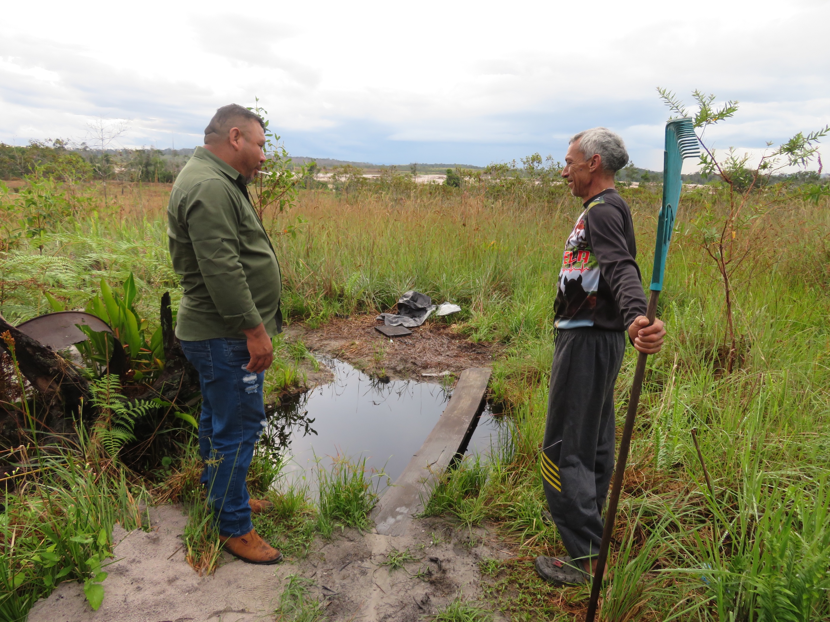
The environmental impact is evident along the route to the Pemón indigenous community and also at its main entrance. There, the soil of a vast morichal – a wetland-type ecosystem dominated by the moriche palm (Mauritia flexuosa), known in other Amazonian countries as buriti – appears to have been disturbed as the vehicle moves forward. There are currently no machines or miners present. Until a few years ago, families would walk to this and other sources in search of water for their daily chores. “They destroyed that morichal in the search for gold,” said an indigenous woman, who asked not to be identified for fear of reprisals.
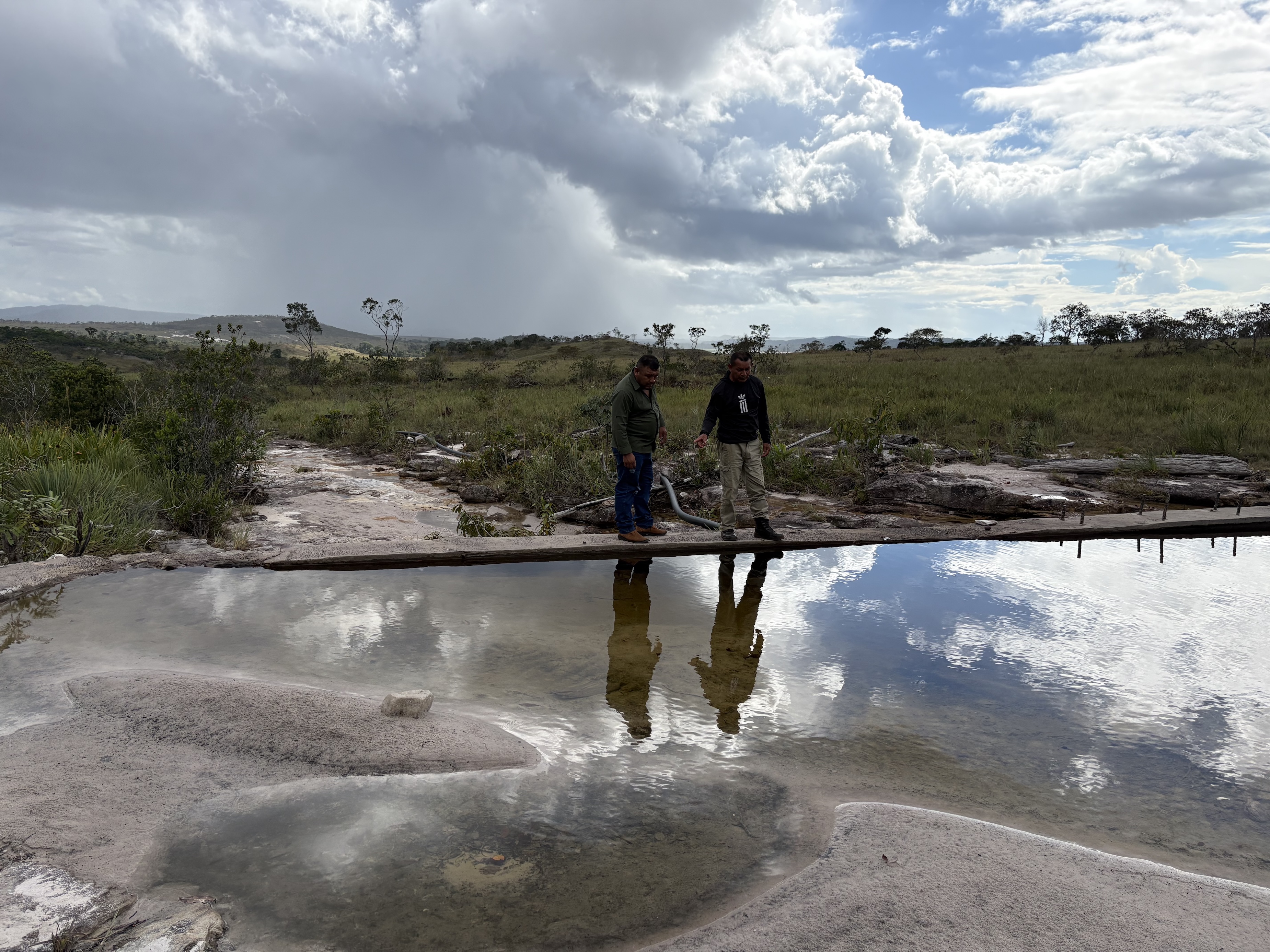
Jhony Pérez, head of the community’s mining committee, recalls that they used to go there with plastic containers to collect water. “The morichal used to be good, but mining had a huge impact,” he says. Gold mining took place around 2006, but it had to be halted due to the damage caused, explains the chairman of the Council of Elders, Eude Piñero.
He recalls that pure water used to flow through the streams, but the miners blocked some of the watercourses. “They were healthy rivers, places for recreation, natural. You used to bathe and fish there; that’s how I remember it. It was lovely; there was no pollution like there is now. By 1994, the companies had brought in heavy machinery,” he explains. “Sections of the streams have disappeared; they still exist at the headwaters, but a stretch – I reckon up to 500 metres – is completely blocked in some streams.”
Piñero, who is also involved in mining, says that if the rivers could speak, they would cry out for help. “It’s a huge concern because we’re witnessing the destruction. As members of the community, we’ve wanted to manage it in a controlled way, but some leaders allowed heavy machinery in. I didn’t allow that when I was captain. Then there was an internal dispute. When I stepped down, disaster struck. But it’s the only source of income.”
Constantino Díaz, the community’s captain, says that to guarantee the supply of drinking water, they decided to build two reservoirs that supply Apoipó by gravity. One was built in 2023 and the other in 2026. There is a clear community rule: mining is prohibited in the upland areas that feed the reservoirs. “By the time I became captain, the area had already been affected, so we also bought engines because, with gold beneath the ground, we have to extract it to support the community (…) The revenue from mining has been invested in public works, education and healthcare,” he says.
Díaz, who is serving his second term as an indigenous leader, is an outspoken advocate of mining and even practises it himself. “Everyone talks about Apoipó, but we bear the brunt of all that pollution because there’s mining further up here too,” says the 45-year-old chief.
The community has a set of general regulations comprising 11 articles on small-scale mining activities, which stipulate that “every member and inhabitant of the community has the right to work that generates an income to support their family and cover household expenses, without any restrictions that would impair the quality of life of each family member”.
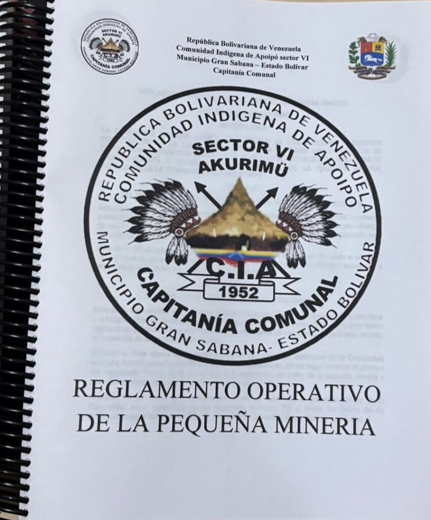 The regulations also state that it is the duty of every owner of hydraulic jacks – mechanical equipment that shoots water at high pressure to break away the walls of the mines – to contribute to community development, in accordance with the plans and projects established by the community. A management report from the local council sets out an extensive list of activities carried out since 2007, in the absence of a response from government authorities, using funds from mining operations.
The technical college was built with funds from the mine. Also the primary healthcare centre, the Adventist church, the community canteen, the multi-purpose hall, the sports stand and two bridges spanning small streams. With the money from gold, they purchased a boat, two generators, medical supplies and sound equipment for the community. They even use the gold to pay the schoolteachers’ salaries.
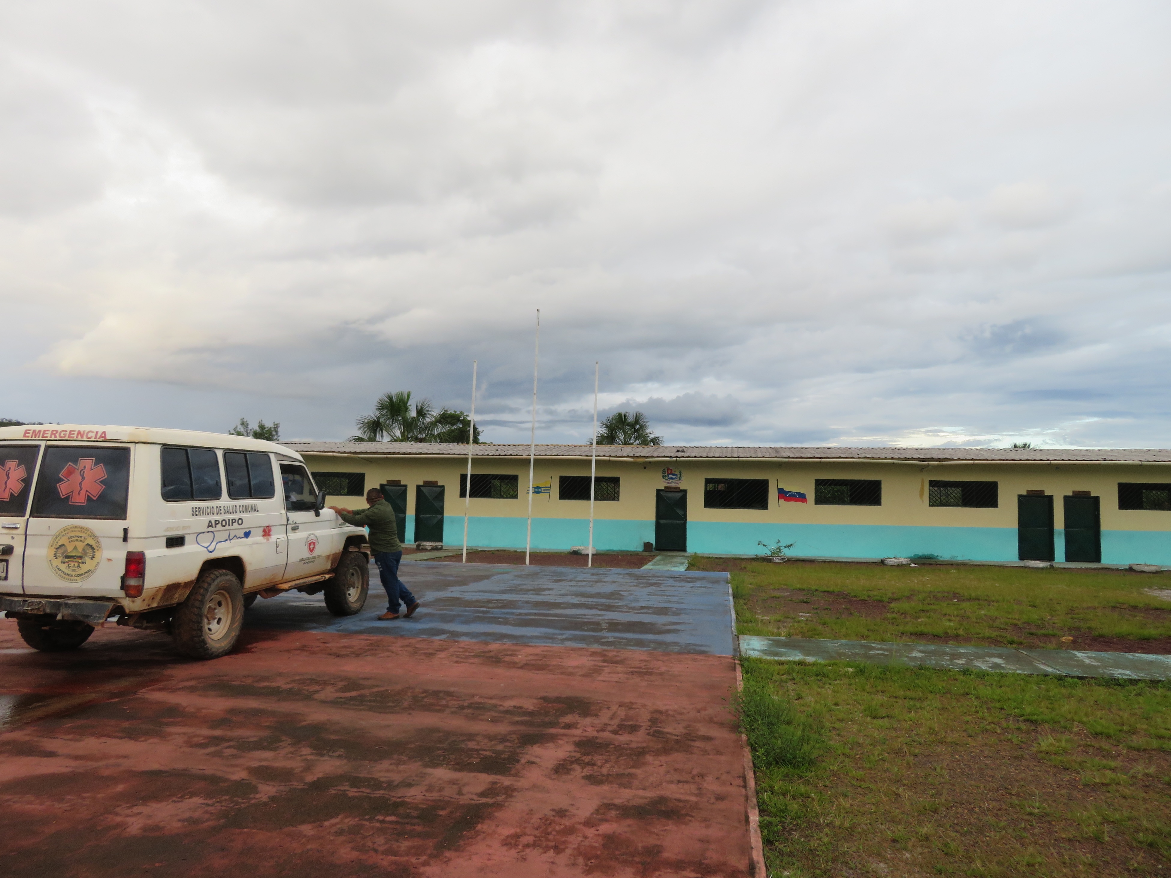
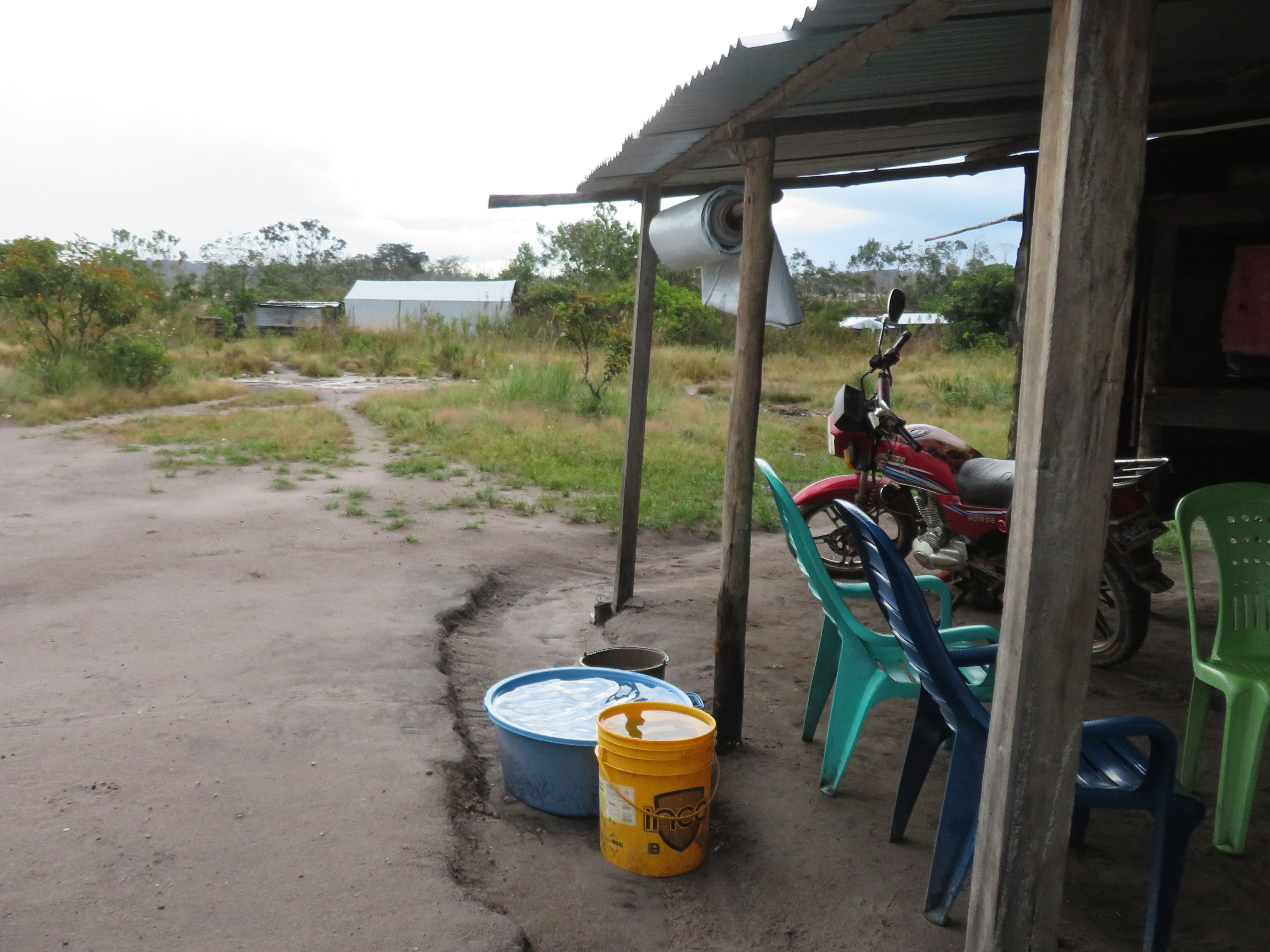
In the camps near the mines, however, water is not supplied via pipes. These are home to non-indigenous miners from various states across the country. Taniuzka Vásquez, a 36-year-old trader originally from the state of Sucre, collects rainwater in buckets and walks for about 20 minutes to a stream to fetch water for washing, cooking and drinking. Although the makeshift homes, made of wood and plastic sheeting, are just a few metres from the River Kukenán, nobody drinks water from the river itself. “How can I drink water from the river? It’s dirty!” says Johannys Lugo, a 25-year-old woman with two children aged eight and nine. “We collect water from the well and the stream and boil it,” she explained.
One of the objectives of Apoipó’s 2025–2028 community management programme is to establish working conditions for mining areas, taking into account the restoration of areas affected by mineral extraction. The chair of the Council of Elders, Eude Piñero, explained that they have a community nursery project with capacity for 10,000 plants of various species, which they hope to use to reforest affected areas.
However, they will need more, as they agree that mining is their only means of subsistence. In May 2026, an unpublicised decision by the indigenous authorities put the community – and others both within and outside Canaima National Park – to a severe test.
The resolution mandated a halt to mining activities during the last two weeks of May, whilst alternatives to the mining industry were sought and assessed – alternatives that did not rely on the exploitation of minerals in this territory inhabited by indigenous peoples and home to a fragile ecosystem that forms a vital part of one of Venezuela’s most important river basins: that of the Caroní River.
“Some suggested three months, but it was only two weeks. Even the local businesses were worried because everyone makes a living from mining. That’s the reality,” said Captain Díaz.
After decades of mining, which has left deep scars on the land and their own traditions, there is one view on which the indigenous authorities agree. As José Bolívar puts it, “mining will come to an end when the Venezuelan state properly provides the community with services, roads, education and healthcare. Until that happens, we will continue to work in the mine; there is no other source of income”.

This project is the result of a collaboration between Latin American journalists and scientists, spearheaded by Brazil’s Serrapilheira Institute and the Latin American Center for Investigative Journalism (CLIP), to explore the Atlantic-Amazon-Andes water pathway and the disruptions to the ecosystem services it provides to the continent.


