

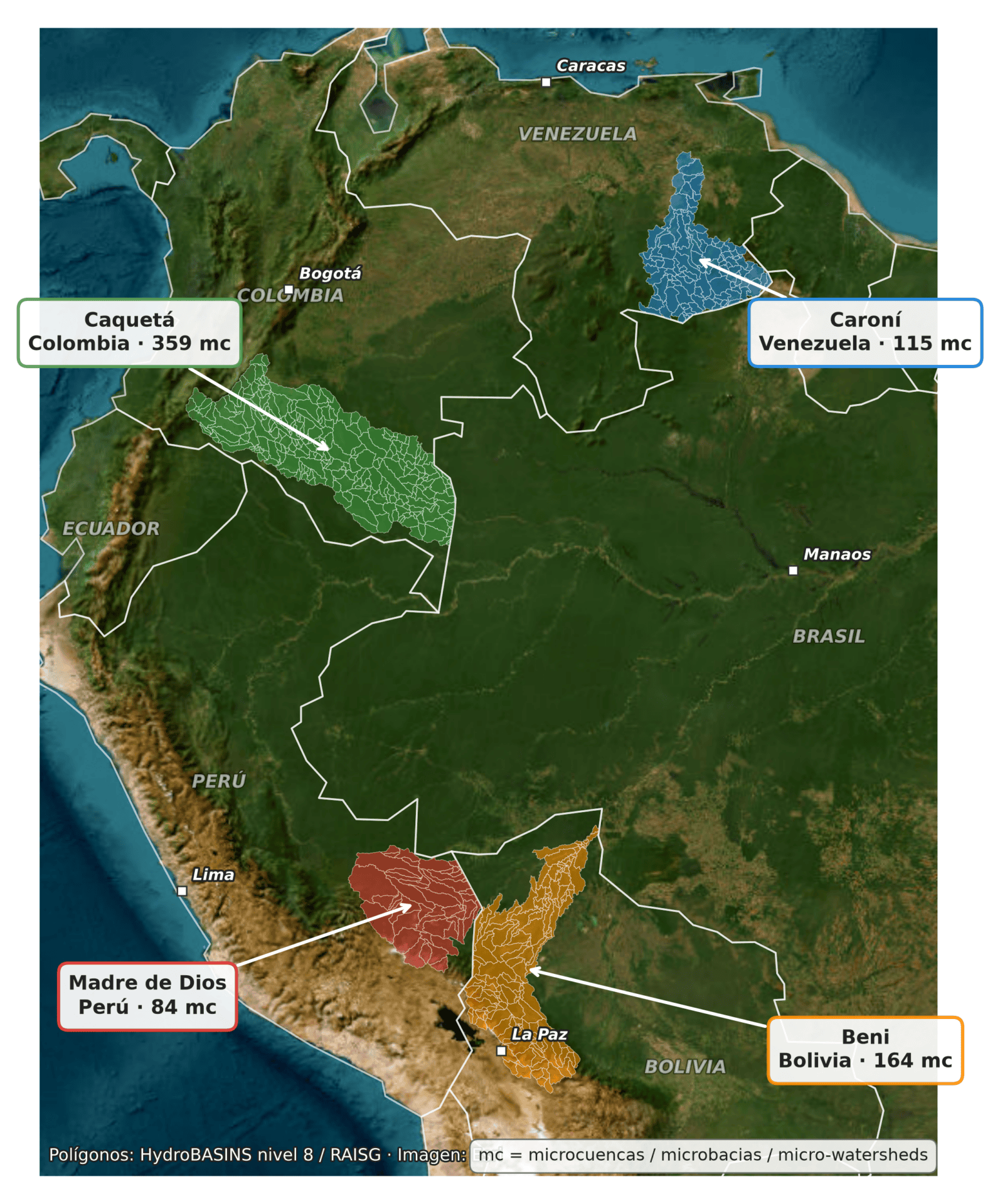
Four media partners involved in the ‘Divided Waters’ investigation, together with the Serrapilheira Institute, analysed 722 micro-watersheds that feed the river basins of the Beni in Bolivia, the Caquetá in Colombia, the Madre de Dios in Peru and the Caroní in Venezuela. These areas are home to 74 indigenous groups spread across 202 territories.
In all four river basins, natural water resources are under pressure. Mining activity leaves behind huge pools of artificial or anthropogenic (man-made) water, and wherever livestock farming takes hold, the water disappears.
Over the 25 years analysed for this research, the four catchment areas lost nearly 33,000 hectares of natural water, an area equivalent to more than twice the size of Colombia’s Tayrona National Park. The greatest loss was recorded in the Colombian Caquetá catchment area, which crosses a department where extensive livestock farming has been the main economic activity for years.
In the three basins with mining activity – Madre de Dios, Beni and Caroní – artificial water sources appeared: of every five hectares of these water sources, more than four are on indigenous territory. Furthermore, in the Caquetá basin, livestock farming is drying up the rivers, and this is the basin that has lost the most natural water.
Vanessa Romo (Mongabay Latam)
“People think that because we live in the jungle we have plenty of water, but this is the reality,” says Erick Tijé, a Harakmbut indigenous resident of the southern Peruvian Amazon, with disappointment, as he points to the murky water flowing down the Inambari River. That river is not the same as it was five years ago, when fishing and life along the river were very different for the residents of the Arazaire indigenous community. Illegal mining stole their water, only to return it to them polluted. Today, they have to buy the water they drink.
On the other side of the Peruvian border, in the Colombian Amazon, Major Lázaro Ibañez, from the Coreguaje people who live in the Jácome indigenous reserve, laments how cattle farming and climate change may be reducing the availability of water around their territory in the department of Caquetá. “The cattle have been destroying everything and now all you can see is pastureland; there are hardly any trees left,” he says, having witnessed how deforestation to create pastureland for cattle has gone hand in hand with the drying up of their water sources.
How can we make sense of the paradox of a community that lives surrounded by water but cannot use it? What does it mean for an indigenous people to see the spirits that guarded their water sources driven away by the advance of logging and cattle farming?
A team of journalists from Mongabay Latam, El Espectador and El Correo del Caroní, in partnership with scientists from Brazil’s Serrapilheira Institute, analysed more than two decades of satellite data to understand the changes that have been affecting four Amazonian river basins in Bolivia (the Beni River), Colombia (the Caquetá), Peru (the Madre de Dios) and Venezuela (the Caroní). The results of this investigation, coordinated by Mongabay Latam and forming part of the ‘Divided Waters’ project led by the Latin American Centre for Investigative Journalism (CLIP), show that in all four catchments analysed, natural water resources are being lost due to external pressures such as illegal mining, deforestation, livestock farming and the presence of hydroelectric power stations.
To reach this conclusion, 722 micro-basins — which drain into the four rivers analysed — were examined over a 25-year period (2000 to 2024). The result is that more than half of the sections reviewed — 393 in total — recorded a loss of natural water. At the same time, the maps revealed how available water has been distributed across open pits created by illegal mining or dam reservoirs, giving the misleading impression that water levels have risen. Scientists define these water sources, which have emerged or been transformed, as ‘artificial or anthropogenic waters’ – that is, of human origin.
“Anthropogenic water is, in fact, water associated with a specific use: it may be from aquaculture, mining, or dams and reservoirs. Sometimes it is a body of water created where there was previously nothing. At other times, it is a naturally occurring lake which, once put to a specific use, becomes anthropogenic,” explains environmental engineer Eva Mollinedo, technical coordinator of MapBiomas Agua Bolivia, who also advised on this research.
This journalistic partnership, working closely with scientists, compared satellite imagery spanning more than two decades to see how water bodies were changing and cross-referenced this data with rainfall records to identify the most critical sections. The historical data was provided by the Amazonian Network for Georeferenced Socio-Environmental Information (RAISG) and by MapBiomas Agua, a platform created by environmental and social organisations in the Amazon to map changes to land and water in the biome.
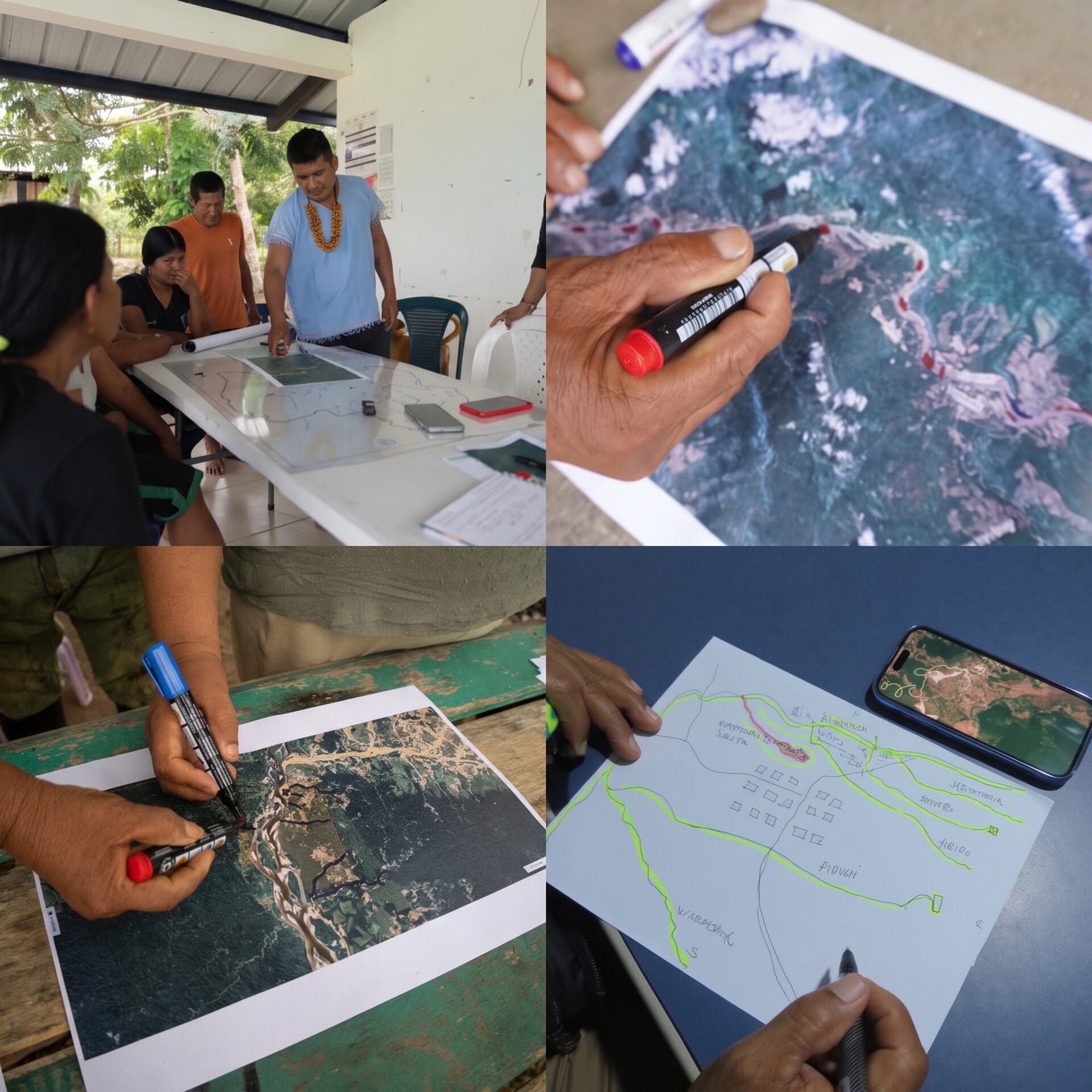
The journalists then travelled to the areas to experience the reality at these critical points first-hand, meet the local people and hear their stories about how they have lived through these changes in freshwater ecosystems. They took printed maps with them so that members of the Harakmbut, Coreguaje, Leco and Pemón indigenous communities could help identify and reconstruct the changes to their water sources. The places where they play, drink, fish, bathe and pay tribute – or, in some cases, where they used to do so.
In Peru, the team visited the Harakmbut community of Arazaire on the banks of the River Inambari. In Colombia, they visited the Coreguaje reservation of Jácome, which depends on the waters of the Orteguaza. Another team of journalists travelled to the Leco community of Tomachi, situated a few metres from the Kaká River, a tributary of the Beni in Bolivia. And in Venezuela, they visited the Pemón community of Apoipó, which depends on the waters of the Kukenán.
The indigenous residents of Arazaire marked on the map the streams to which they can no longer return. The Coreguaje people of Colombia pointed out the areas where cattle ranches are expanding, which could be reducing their water sources. The Pemón people of Venezuela recalled the exact location of the lagoon on which they had so heavily depended and which has now disappeared. And, in Bolivia, the Leco people identified the two streams they still use and which they are defending against the advance of mining.
A broken sponge
A study published by a team of Dutch scientists in 2019, which analysed rivers in tropical forests around the world, describes the rainforest as a giant sponge that stores water and also releases it.
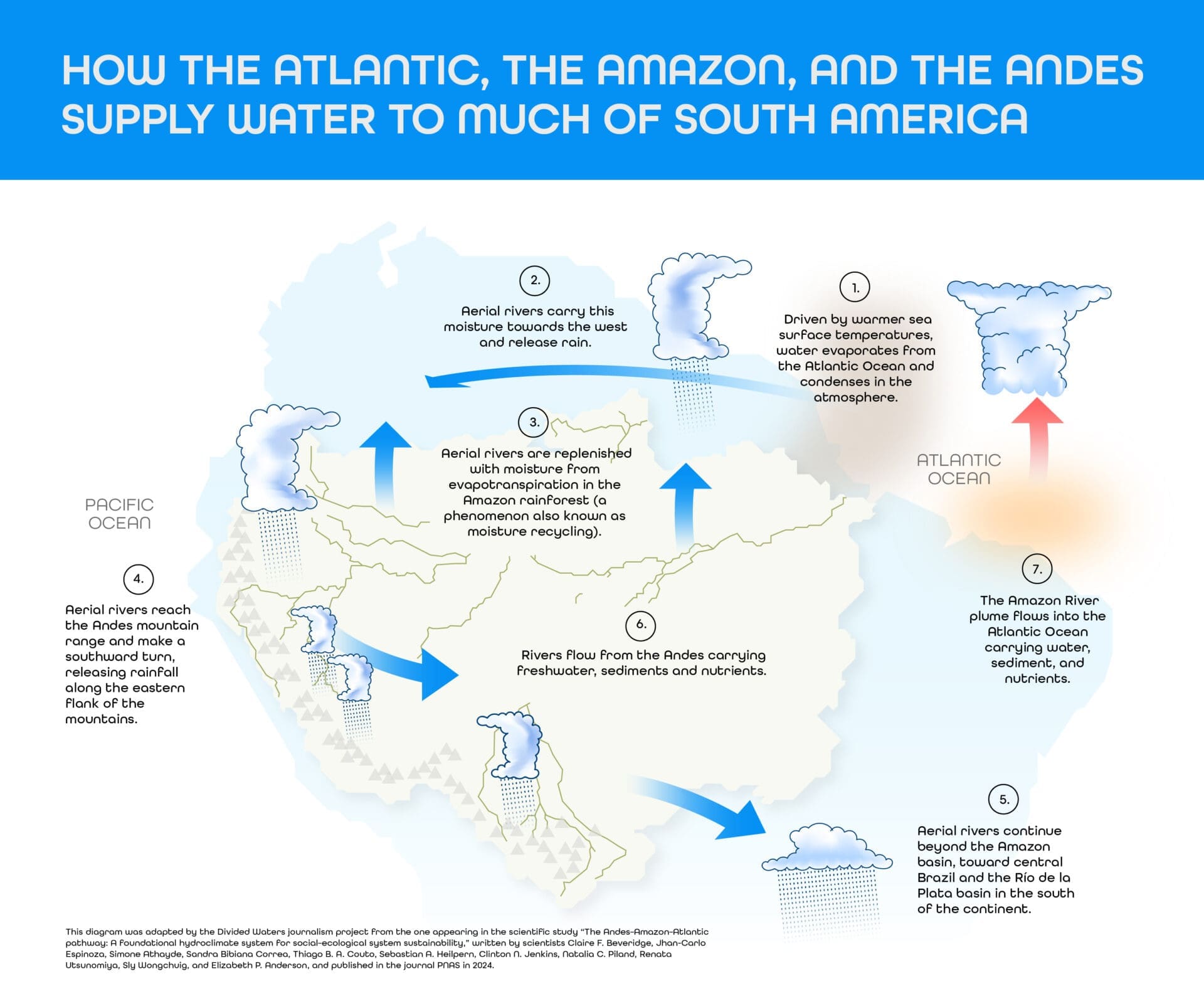
When it rains, the tree canopies catch the water, which then flows down until it is absorbed by the soil; at the same time, the leaf litter stores water to release it during the dry season. There is another function that is less visible but equally important in this process: almost half of the water that falls in the Amazon does not remain on the ground.
According to a study by the Brazilian climatologist Enéas Salati, published in 1979 and which has since become a benchmark for understanding the Amazonian water cycle, half of that rainfall returns to the atmosphere because the trees absorb it through their roots and release it as vapour through their leaves. This vapour forms clouds that carry the moisture into the interior of the basin, where it falls again. The forest therefore not only stores water, but also distributes it.
However, there are external factors that could be helping to disrupt this cycle, such as deforestation.
No one explains it more simply than Lázaro Ibáñez, a wise man (spiritual and intellectual authority) from the Coreguaje indigenous reserve in Jácome, in the Caquetá region of Colombia: “Where the trees are felled, the lakes and headwaters dry up, and that is where the water comes from.”
When the forest is felled, the sponge breaks. For every percentage point of tropical forest lost, regional rainfall falls by an average of 2.4 millimetres per year, according to another study published in February 2026, in which the Brazilian meteorologist José A. P. Veiga participated, reviewing the global relationship between tropical forest loss and regional precipitation. In other words, deforestation not only dries out the area where it occurs, but also alters the climate of the entire region.
Communities are the first to feel these changes in their territories. Leaders of the Jácome reservation in Caquetá, Colombia, say that the seasons are no longer predictable. In Tomachi, Bolivia, Roxana Pizza Tupa, president of the Leco indigenous people, observes the same phenomenon from another corner of the Amazon. “The heat is increasing and that is affecting our water sources,” she asserts.
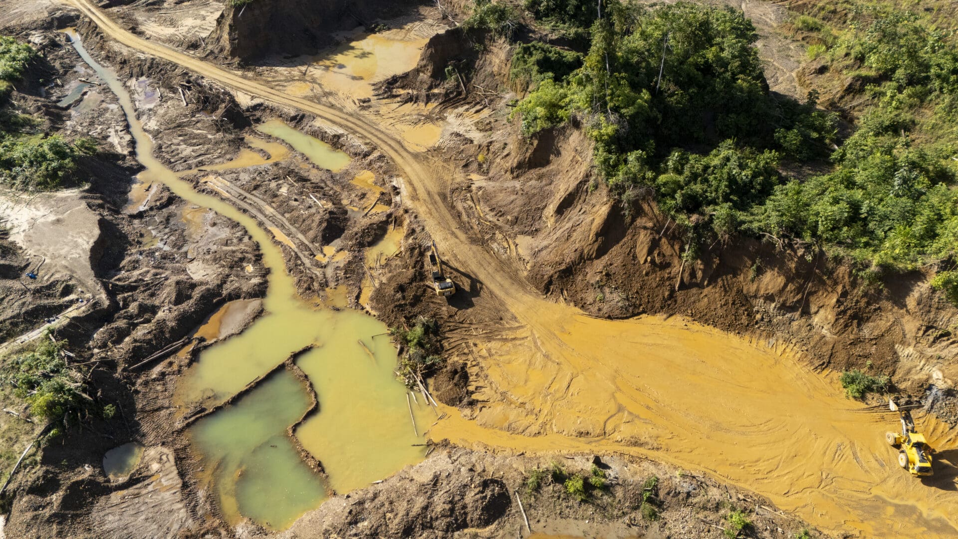
The problem is only exacerbated by the arrival of new pressures. Deforestation opens the door, but we must pay attention to what replaces the felled forest. If livestock farming arrives, as in Caquetá, natural water sources can dry up and disappear without anything to replace them. If mining moves in – as in Madre de Dios, Beni or Caroní – the machinery destroys the riverbed and leaves behind artificial pools of water, stagnant and polluted.
Jaime Cuéllar, a Bolivian expert on the impacts of mining, sums it up. “Mining alters the riverbed, the banks and the sediments. An affected river is not just an environmental liability; it represents a territorial vulnerability,” he says. “It may seem as though there is no shortage of water, or that there is plenty, but the key is to consider what sort of water it is,” adds Waldo Lavado-Casimiro, deputy director of applied hydrology at Peru’s National Meteorological and Hydrological Service.

The water that is disappearing
The information gathered on the ground provides context for the analysis in this investigation. In the Bolivian department of Beni, for example, whilst there has been no increase in rainfall to account for greater water availability, maps show the emergence of new sources: pools created by illegal mining. This is stagnant water contaminated with mercury, as identified by the indigenous communities living alongside it. In livestock-farming areas, the situation is different. The natural water that is lost disappears forever. This is what the inhabitants of the Coreguaje village in Caquetá – the most deforested of the four basins analysed – showed the team of journalists.
As for artificial water, its source can vary. Ana Lía Gonzáles, manager of the Amazon Water Vulnerability Project run by RAISG and the Friends of Nature Foundation (FAN) in Bolivia, explains that mining operations first draw on the most readily available water, such as that from the river itself, but later turn to groundwater. “It’s always easier to locate operations where water is readily available,” she points out. When they dig, groundwater surfaces easily: “You dig a hole in the ground and water appears, because the water table is very close to the surface.” But there is no single answer: “It depends on the extraction site and where those artificial ponds are formed,” she notes.
What the scientists from the quantitative ecology training programme at Brazil’s Serrapilheira Institute – who supported this cross-border investigative journalism project – found is that deforestation is also the pressure most closely associated with the emergence of artificial water sources. It could be responsible for at least 30 per cent of the variation in the artificial water sources analysed. It must also be borne in mind that when a forest is cleared, it attracts other activities, and it is this combination of pressures – coupled with the characteristics of each river, such as its size or flow rate – that drives the transformation.
“The most important aspect of this type of analysis is that it allows different pressures and environmental indicators to be integrated on a single scale. Rather than looking at deforestation, mining or changes in water separately, it reveals where these pressures overlap and which regions are most exposed to multiple impacts,” explains Anthony Barbosa, a forestry engineer and researcher at the Federal University of Pará. Barbosa was one of the scientists who, alongside biologist Kathleen Sena from the Federal University of Rio de Janeiro and architect Julia Cansado from the National Institute for Space Research (INPE), contributed to this study.

Over the 25-year period analysed for this study, the four catchment areas lost around 33,000 hectares of natural water, or 330 square kilometres – an area equivalent to more than twice the size of Colombia’s Tayrona National Park. The greatest loss was recorded in the Caquetá catchment area, where the main impact stems from livestock farming.
In the remaining three catchments, where ‘new water’ was identified — more than 17,000 hectares in total, an area slightly larger than that of the Bolivian capital, La Paz — it was almost always artificial and linked to mining. This is the case in the Madre de Dios, Beni and Caroní rivers, where at least one in six of the micro-basins analysed — 121 out of 722 — is losing natural water and gaining artificial water as a result of mining activity.
One further fact: 64 of the micro-basins or river sections analysed that have gained mining ponds are located within indigenous territories. In other words, there are communities that are not only witnessing the replacement of natural water, but are also the hardest hit because they have been left without drinking water.
Rivers under pressure from mining
In Tomachi, a Leco village in the Bolivian Amazon, José Cartagena has fond memories of the River Kaka. Thirty years ago, he says, he could fish, drink the water and even navigate the river without any problems. “The Kaka River used to have clear water; today it is polluted by all the companies operating in the mining area,” says the current chair of the community’s Water Committee. Lucas Solara, who arrived in Tomachi 35 years ago, looks out at the Kaka and says, “These are no longer the crystal-clear streams that used to flow down from the melting Andean glaciers.”
Gold mining operations began using dredgers around 2010, and Eva Mollinedo, technical coordinator at MapBiomas Agua, tracked their progress using satellite imagery. “With the platform, we can see how this is expanding over time (…) By 2001, we were already beginning to see more mining activity, and it has only been growing every year,” notes the scientist.
In the Beni basin, where Tomachi is located, the figures confirm what can be seen: almost 14,000 hectares of natural water bodies have been lost, and in their place some 3,000 hectares of mining pits have appeared. This scenario gives the misleading impression that there is more water.
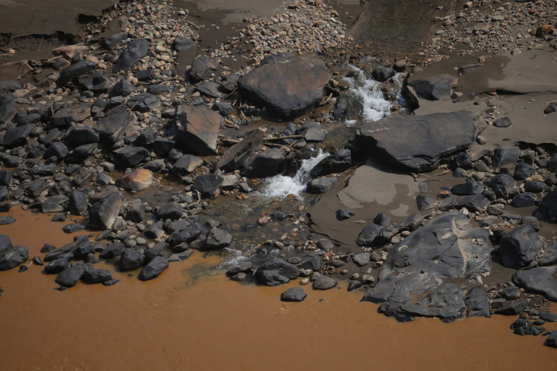
Óscar Campanini, director of the Bolivian Documentation and Information Centre (CEDIB), who has closely followed the issue of legal and illegal gold mining, explains that ultimately it is the indigenous communities who are most affected. “Not only do the communities consume this water, but the rivers are part of their territories, their culture and their livelihoods (…) It is not just their right to water that is affected, but also their right to life,” he says. That is why Pizza Tupa, a Leco leader, insists that they will not allow mining to touch the two streams they have left. “We will not allow them to touch our springs,” she declares.
In Madre de Dios, the transformation is also evident in the images. Between 2000 and 2023, the area of artificial water bodies in the catchment increased almost twelvefold: from 1,224 to 14,418 hectares, an area equivalent to more than twice the size of the city of Cusco. When compared with the sections of the catchment where there is no mining, the difference is stark. In the 39 sections with no mining activity, the total area of artificial water bodies is just 38 hectares.
Joaquín Romualdo, a geographer specialising in remote sensing at the Instituto del Bien Común and head of water analysis for MapBiomas in Peru, explains that “water suffers the most; it is the element that ultimately suffers the most, alongside the forest”.
In Peru, unlike Bolivia, the areas affected by mining receive more rainfall, so an additional climate-related benefit must be taken into account. That is why, over 25 years, the land has been observed to dry out whilst the pools have grown considerably. The problem is that the water that appears is undrinkable.
The Native Federation of the Madre de Dios River and its Tributaries (Fenamad), which brings together 38 communities from seven indigenous peoples, confirmed to Mongabay Latam that 60 per cent of these communities pay for the water they consume. “It won’t be long before water costs more than oil,” says Eusebio Ríos, vice-president of Fenamad and a Harakmbut leader. Carlos Álvarez, an indigenous guardian from Arazaire, sums up the situation as follows: “And what’s in that water now? Just mud. There’s no life left, there’s nothing.”
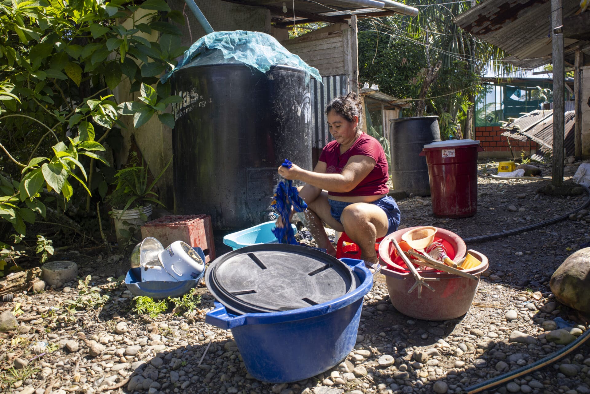
In Apoipó, a Pemón community situated on the banks of the River Kukenán — the upper reaches of Venezuela’s Caroní River — José Bolívar recalls a lagoon surrounded by Mauritia or buriti palm trees that they called Morompo Deuta, where, according to Pemón belief, an anaconda with a wax-like head lived. The community used to fish in its waters. Mining operations crept closer year after year until the lagoon dried up completely. “That no longer exists; now everything is polluted,” laments Bolívar.
Carlos Maytín, a researcher at the National Experimental University of Guayana, confirms that drainage flows from the mines carry “not only sediment but also pollutants, particularly heavy metals and mercury [into the Caroní]”. He notes that natural water levels in the Apoipó area have fallen, despite the fact that cumulative rainfall began to rise from 2015 onwards. The Caroní follows the same pattern as Peru and Bolivia: almost all the new artificial water has appeared where there is mining.
There is another detail that sets the Caroní apart. The total water surface area of its 98 tributaries and reservoirs fell by 5.8 per cent, according to data from MapBiomas Venezuela. Given that more than three-quarters of the Caroní’s water is contained within three large hydroelectric power stations (Guri, Macagua and Caruachi), this figure masks a significantly greater loss of water in the rivers.
Eude Piñero, chair of the Council of Elders who works in mining out of necessity, sums up what he sees in seven words: “If the rivers could speak, they would cry out for help.”
The pressure of deforestation and livestock farming
In the Jácome indigenous reservation, in the Caquetá region of Colombia, the story is different: it is not mining that has transformed the land, but livestock farming and the community’s own history. Adel Iles points out where the Puñuchiara lagoon used to be, the largest in the municipality of Milán. It covered more than 10 hectares of water surface in 1998 and, by 2024, was less than one hectare. They went from catching large fish to witnessing the lagoon’s disappearance. This was not caused solely by external factors: around 40 years ago, according to the Coreguaje indigenous people, the community itself dug an artificial canal to connect it to the River Orteguaza and shorten the journey to the nearest village. Over time, that shortcut ended up draining the lagoon.
The drying up of one of their main water sources was compounded by livestock farming, which in the municipality of Milán has increased by 53.4 per cent over the last decade, according to data from the Colombian Agricultural Institute’s cattle inventory. “Children hardly want to go fishing anymore. There are only tiny sardines left,” says Claudia Patricia Ibáñez, chief of the reserve.
And on top of the local damage is something the community refers to in Spanish because their language has no word for it: climate change. “Before, when it was summer, it really was summer,” says Iles. “Now, after just three days of sunshine, the stream dries up. To see it at the levels it’s at now, we used to have to wait until December.” The Amazonian Institute for Scientific Research (SINCHI) backed up this view in a 2025 study: the Orteguaza river basin faces a “very high climate risk if current trends in climate change and land-use and land-conversion patterns continue”.
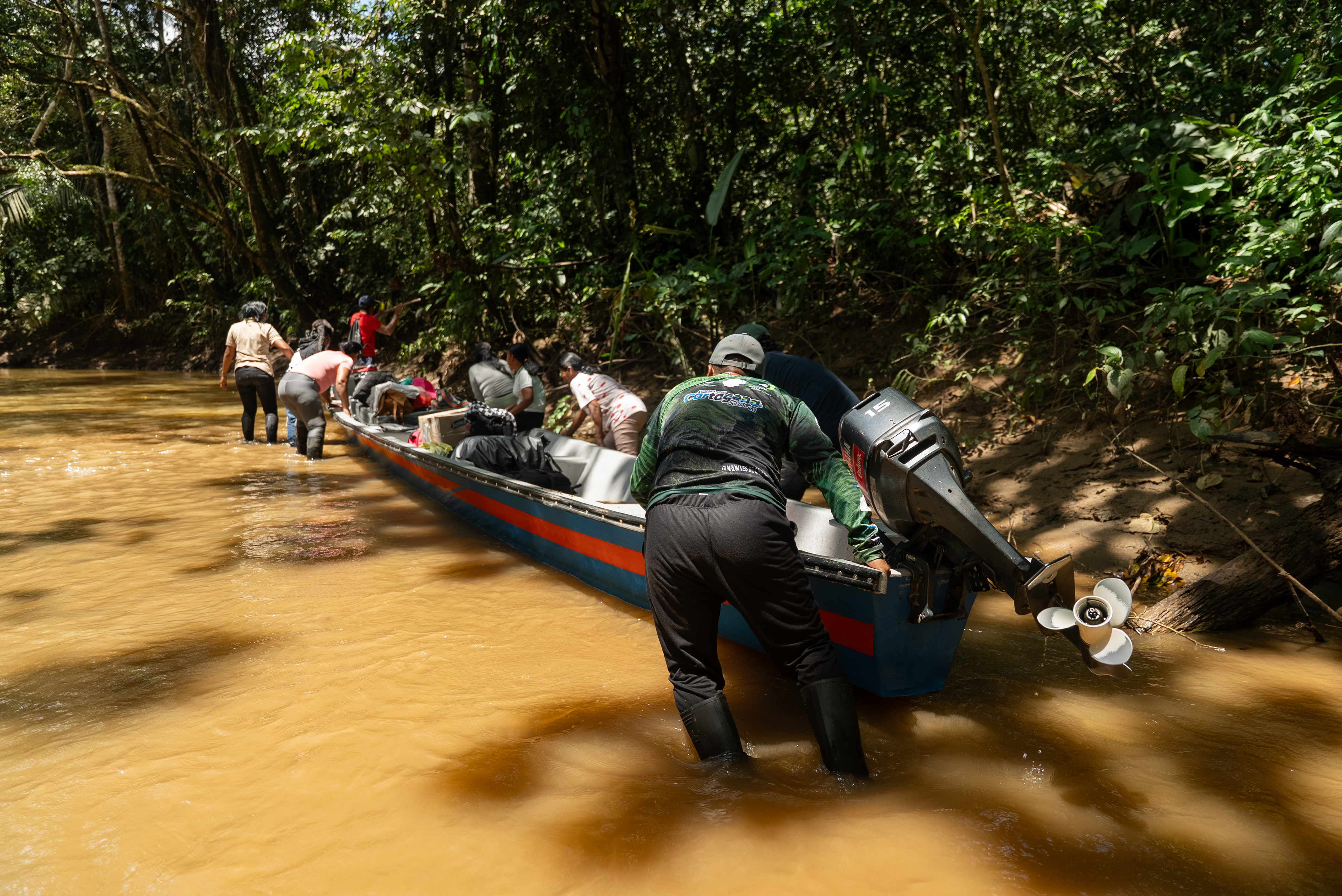
The data from this study confirm that the Colombian Caquetá catchment has the greatest absolute loss of natural water of the four catchments: 21,532 hectares.
A researcher from the Foundation for Conservation and Sustainable Development (FCDS), who asked to remain anonymous for security reasons, describes the institutional backdrop. “Whilst the Colombian state promotes conservation, organisations such as Finagro have allocated at least 466 million dollars to livestock loans in the Amazon between 2018 and 2025,” he says. “This is the contradictory approach the Colombian state has historically taken towards the Amazon.”
But the reservation is not waiting for an institutional response before taking action: it already has more than 40,000 seedlings of native species in a community nursery, including the canangucha or buriti palm tree that acts as a natural water sponge. “What we are seeking, first and foremost, is to establish a forest at least along the banks of the stream. Then, for the true owner of that place – the spirit – to return as well,” says Iles.
What the map doesn’t show
“Statistical analyses are only an approximation of what is really happening. Combining that data with the accounts of the people who live in those places strengthens the findings,” says Kathleen Sena, a researcher at the Federal University of Rio de Janeiro and part of the Serrapilheira training programme.
Because all these figures are correlations, not controlled experiments: they do not prove that mining or deforestation cause the changes, but they do show that for 25 years the data has consistently pointed in the same direction. And there is something that no satellite can measure: quality. Satellites measure water surface area, not volume or whether the water is usable. A micro-watershed can gain surface area without gaining a single drop of drinkable water.
What no satellite can count are the people. Beneath those 722 micro-basins live at least 74 indigenous groups, spread across 202 territories, for whom the river is not a surface that grows or shrinks in an image, but the place from which they draw their water and spend a large part of their lives.
The water that Erick Tijé and little Santiago drink no longer comes from the river that Grandfather José chose more than fifty years ago on the banks of the Inambari. Now it comes from a plastic jerrycan. In Tomachi, they are fighting by hand to protect the two remaining streams; in Apoipó, the lagoon where they used to fish has dried up completely; in Jácome, the children can hardly find anything to catch anymore. These are four territories where the map shows more water than ever before. The water that is actually drinkable, however, now fits into a single bottle.
Bibliographical references
Peña-Arancibia, J. L., Bruijnzeel, L. A., Mulligan, M. and van Dijk, A. I. J. M. (2019). “Forests as ‘sponges’ and ‘pumps’: Assessing the impact of deforestation on dry-season flows across the tropics”. Journal of Hydrology, 574, 946–963. https://www.sciencedirect.com/science/article/abs/pii/S0022169419304032
Salati, E., Dall’Olio, A., Matsui, E. and Gat, J. R. (1979). “Recycling of water in the Amazon Basin: An isotopic study”. Water Resources Research, 15(5), 1250–1258. https://agupubs.onlinelibrary.wiley.com/doi/abs/10.1029/WR015i005p01250
Baker, J. C. A., Smith, C., Veiga, J. A. P., Farnsworth, H. and Spracklen, D. V. (2026). “Quantifying tropical forest rainfall generation”. Communications Earth & Environment. https://www.nature.com/articles/s43247-025-03159-3
Data and methodology for this research
- Aguas Partidas (2026). A journalistic project coordinated by the Latin American Centre for Investigative Journalism (CLIP), in partnership with Mongabay Latam, El Espectador, Correo del Caroní and the Serrapilheira Institute (Brazil). Based on data from MapBiomas Água (Pan-Amazon collection and national collections), RAISG (analysis by micro-basins, indigenous territories, mining and deforestation) and HydroBASINS/HydroATLAS Level 8 (WWF).

This project is the result of a collaboration between Latin American journalists and scientists, spearheaded by the Serrapilheira Institute in Brazil and the Latin American Centre for Investigative Journalism (CLIP), to explore the Atlantic–Amazon–Andes water cycle and the disruptions to the environmental services it provides to the continent.


